Dharamkot (Himachal Pradesh)
| Dharamkot | |
|---|---|
|
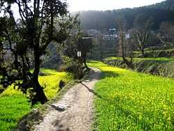
A mustard field at Dharamkot near Dharamshala | |
 Dharamkot Location in Himachal Pradesh, India | |
| Coordinates: 32°14′19″N 76°19′26″E / 32.238602°N 76.323878°ECoordinates: 32°14′19″N 76°19′26″E / 32.238602°N 76.323878°E | |
| Country |
|
| State | Himachal Pradesh |
| District | Kangra |
| Elevation | 2,100 m (6,900 ft) |
| Languages | |
| Time zone | IST (UTC+5:30) |


Dharamkot is a small hill station in Kangra district in the state of Himachal Pradesh, India.

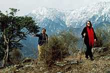
On the crest of a hill above McLeodGanj, Dharamkot is an attractive spot that presents a wide view of the Kangra Valley and the Dhauladhar ranges. There are a couple of small (and interesting) eateries around. Several foreigners have taken residence in the area; all live in village homes and tiny guest houses. Dharamkot also has the Vipassana meditation centre, Dhamma Shikara, as well as the Tushita Meditation Centre which is a centre for the study and practice of Buddhism in the Tibetan Mahayana tradition.
Past Dharamkot, at a distance of 9 km from McLeodGanj, much of which is a steady climb, Triund is at the foot of the Dhauladhar ranges and is at a height of 2,827 m. The snow line, which is considered to be the most easily accessible in the entire Himalayan range starts from Ilaqua, 4 km from Triund. A good walker will take around four hours to reach Triund from McLeodganj and another one and a half to two hours to reach Ilaqua.
After Dharamkot, one crosses the Galu Devi Temple when the climb and the trail become demanding.
