Dettah
| Dettah Detah | |
|---|---|
| Yellowknives Dene First Nation (Dettah) | |
 | |
 Dettah | |
| Coordinates: 62°24′41″N 114°18′27″W / 62.41139°N 114.30750°WCoordinates: 62°24′41″N 114°18′27″W / 62.41139°N 114.30750°W | |
| Country | Canada |
| Territory | Northwest Territories |
| Region | North Slave Region |
| Constituency | Weledeh |
| Census division | Region 6 |
| Government | |
| • Chief | Edward Sangris & Ernest Betsina |
| • Chief Executive Officer | Michael Cheeks |
| • MLA | Bob Bromley |
| Area[1] | |
| • Land | 1.34 km2 (0.52 sq mi) |
| Elevation | 179 m (587 ft) |
| Population (2011)[1] | |
| • Total | 210 |
| • Density | 157.2/km2 (407/sq mi) |
| Time zone | Mountain (MST) (UTC-7) |
| • Summer (DST) | MDT (UTC-6) |
| Canadian Postal code | X1A |
| Area code(s) | 867 |
| Telephone exchanges | 444 445 446 669 765 766 873 920 |
|
Sources: Department of Municipal and Community Affairs,[2] Prince of Wales Northern Heritage Centre,[3] Canada Flight Supplement[4] | |
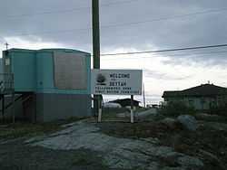
Dettah or Detah is a First Nations[5] community in the North Slave Region of the Northwest Territories, Canada. Located just outside the capital of Yellowknife, it is a 6.5 km (4.0 mi) drive from that town by ice road in winter or a 27 km (17 mi) drive via the Ingraham Trail. The name means 'Burnt Point' in the Tli Cho language and refers to a traditional fishing camp used by the Dene for hundreds of years.
Demographics
According to the 2011 Census, Dettah had a population of 210 people a decrease of 15.0% from the 2006 Census, consisting almost entirely of First Nations.[1][6] In 2012, the Government of the Northwest Territories reported that the population was 260 with an average yearly growth rate of 1.9% from 2001.[6]
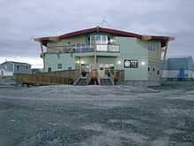
Both it and N'Dilo are the communities of the Yellowknives. Dettah is represented by the Yellowknives Dene First Nation (Dettah) and are part of the Akaitcho Territory Government.[7]
References
- ↑ 1.0 1.1 1.2 Detah, SET Northwest Territories (Census subdivision)
- ↑ "NWT Communities - Dettah". Government of the Northwest Territories: Department of Municipal and Community Affairs. Retrieved 2014-01-29.
- ↑ Prince of Wales Northern Heritage Centre - official names
- ↑ Canada Flight Supplement. Effective 0901Z 24 July 2014 to 0901Z 18 September 2014
- ↑ Differences in Community Government Structures
- ↑ 6.0 6.1 Detah - Statistical Profile
- ↑ Indian and Northern Affairs Canada
Further reading
- Northwest Territories, and BHP Billiton Diamonds Inc. Communities and Diamonds Socio-Economic Impacts in the Communities of Behchoko, Gameti, Whati, Wekweeti, Detah, Ndilo, Lutsel K'e, and Yellowknife: 2005 Annual Report of the Government of the Northwest Territories Under the BHP Billiton, Diavik and De Beers Socio-Economic Agreements. [Yellowknife]: Govt. of the Northwest Territories, 2006.
External links
| Wikimedia Commons has media related to Dettah. |
| ||||||||||||||||||||||||||||||||||||||||||||||||||||||||||||||||||||||||||||||||||||||||||