Derbent
| Derbent (English) Дербент (Russian) | |
|---|---|
| - City[1] - | |
 | |
.svg.png) Location of the Republic of Dagestan in Russia | |
 Derbent | |
|
| |
| Administrative status (as of April 2006) | |
| Country | Russia |
| Federal subject | Republic of Dagestan[1] |
| Administratively subordinated to | City of Derbent[1] |
| Capital of | Republic of Dagestan[1] |
| Administrative center of | City of Derbent,[1] Derbentsky District[1] |
| Municipal status (as of October 2012) | |
| Urban okrug | Derbent Urban Okrug[2] |
| Administrative center of | Derbent Urban Okrug,[2] Derbentsky Municipal District |
| Statistics | |
| Area | 69.63 km2 (26.88 sq mi)[3] |
| Population (2010 Census) | 119,200 inhabitants[4] |
| - Rank in 2010 | 137th |
| Density | 1,712/km2 (4,430/sq mi)[5] |
| Time zone | MSK (UTC+03:00)[6] |
| Founded | 438 |
| City status since | 1840 |
| Postal code(s)[7] | 368600 |
| Dialing code(s) | +7 87240 |
| Derbent on WikiCommons | |
| Citadel, Ancient City and Fortress Buildings of Derbent | |
|---|---|
| Name as inscribed on the World Heritage List | |
 | |
| Type | Cultural |
| Criteria | iii, iv |
| Reference | 1070 |
| UNESCO region | Europe |
| Inscription history | |
| Inscription | 2003 (27th Session) |
Derbent (Persian: دربند; Russian: Дербе́нт; Rutul: Дербéнд; Avar: Дербенд, Derbend; Lezgian: Кьвевар, K′vevar; Azerbaijani: Dərbənd; Lak: Чурул, Churul; Judeo-Tat: Дэрбэнд, דארבּאנד, Dərbənd), formerly romanized as Derbend,[8] is a city in the Republic of Dagestan, Russia, located on the Caspian Sea, north of the Azerbaijani border. It is the southernmost city in Russia, and it is the second-most important city of Dagestan. Population: 119,200 (2010 Census);[4] 101,031 (2002 Census);[9] 78,371 (1989 Census).[10]
Derbent occupies the narrow gateway between the Caspian Sea and the Caucasus Mountains connecting the Eurasian steppes to the north and the Iranian Plateau to the south. Its etymology derives from the Persian Darband (دربند), meaning "locked gate",[11] and it is often identified with the legendary Gates of Alexander, being known in Arabic as Bāb al Abwab ("Gate of Gates") and Turkish as Demirkapı ("Iron Gate"). Derbent claims to be the oldest city in Russia (8th century BCE).[12] Since antiquity, the value of the area as the gate to the Caucasus has been understood, and Derbent has archaeological structures over 5,000 years old. As a result of this geographic particularity, the city developed between two walls, stretching from the mountains to the sea. These fortifications were continuously employed for a millennium and a half, longer than any other extant fortress in the world. Over the years, different nations gave the city different names, but all connected to the word gate; its name in Persian is Darband, which means "closed gates".
History

Derbent's location on a narrow, three-kilometer strip of land between the Caspian Sea and the Caucasus mountains is strategic in the Caucasus. Historically, this position allowed the rulers of Derbent to control land traffic between the Eurasian Steppe and the Middle East. The only other practicable crossing of the Caucasus ridge was over the Darial Gorge.
Antiquity up to the early modern era
The first intensive settlement in the Derbent area dates from the 8th century BCE; the site was intermittently controlled by the Persian monarchs, starting from the 6th century BCE. Until the 4th century CE, it was part of Caucasian Albania which was a satrap of the Achaemenid Persian Empire, and is traditionally identified with Albana, the capital.[13] The modern name is a Persian word (دربند Darband) meaning "gateway", which came into use in the end of the 5th or the beginning of the 6th century CE, when the city was re-established by Kavadh I of the Sassanid dynasty of Persia, however, Derbent was probably already into the Sasanian sphere of influence as a result of the victory over the Parthians and the conquest of Caucasian Albania by Shapur I, the first shah of the Sassanid Persians.[13] In the 5th century Derbent also functioned as a border fortress and the seat of a Sassanid marzban.[13] The 20-meter (66 ft) high walls with thirty north-looking towers are believed to belong to the time of Kavadh's son, Khosrau I. Some say that the level of the Caspian was formerly higher and that the lowering of the water level opened an invasion route that had to be fortified.[14] The chronicler Movses Kagankatvatsi wrote about "the wondrous walls, for whose construction the Persian kings exhausted our country, recruiting architects and collecting building materials with a view of constructing a great edifice stretching between the Caucasus Mountains and the Great Eastern Sea." Derbent became a strong military outpost and harbour of the Sassanid empire. During the 5th and 6th centuries, Derbent also became an important center for spreading the Christian faith in the Caucasus.
During periods when the Sasanians were distracted by war with the Byzantines or protracted battles with the Hephthalites in the eastern provinces, the northern tribes succeeded in advancing into the Caucasus. The first Sasanian attempt to seal off the road along the Caspian seacoast at Darband by means of a mud-brick wall has been dated in the reign of Yazdegerd II (438–457 AD).[13]
The 20-meter (66 ft) high walls with thirty north-looking towers are believed to belong to the time of Kavadh's son, Khosrau I. Some say that the level of the Caspian was formerly higher and that the lowering of the water level opened an invasion route that had to be fortified.[14] The chronicler Movses Kagankatvatsi wrote about "the wondrous walls, for whose construction the Persian kings exhausted our country, recruiting architects and collecting building materials with a view of constructing a great edifice stretching between the Caucasus Mountains and the Great Eastern Sea." Derbent became a strong military outpost and harbour of the Sassanid empire.
Movses Kagankatvatsi left a graphic description of the sack of Derbent by the hordes of Tong Yabghu of the Western Turkic Khaganate in 627. His successor, Böri Shad, proved unable to consolidate Tong Yabghu's conquests, and the city was retaken by the Persians. In 654, Derbent was captured by the Arabs following their attack on Persia, who transformed it into an important administrative center and introduced Islam to the area. The impression of antiquity evoked by these fortifications led many Arab historians to connect them with Khosrow I and to include them among the seven wonders of the world.[13] The Darband fortress was certainly the most prominent Sasanian defensive construction in the Caucasus and could have been erected only by an extremely powerful central government.[13] Because of its strategic position on the northern branch of the Silk Route, the fortress was contested by the Khazars in the course of the Khazar-Arab Wars. The Sassanids had also brought Armenians from Syunik to help protect the pass from invaders; as Arab rule weakened in the region at the end of the ninth century, the Armenians living there were able to establish a kingdom of their own, which lasted until the early years of the thirteenth century.[15][16]

Excavations on the eastern side of the Caspian Sea, opposite to Derbent, revealed the Great Wall of Gorgan, the eastern counterpart to the wall and fortifications of Derbent. Similar Sassanian defensive fortifications there—massive forts, garrison towns, long walls—also run from the sea to the mountains.
The Caliph Harun al-Rashid lived in Derbent and brought it into great repute as a seat of the arts and commerce. According to Arab historians, Derbent, with population exceeding 50,000, was the largest city of the 9th century Caucasus. In the 10th century, with the collapse of the Arab Caliphate, Derbent became the capital of an emirate. This emirate often fought losing wars with the neighboring Christian state of Sarir, allowing Sarir to occasionally manipulate Derbent politics. Despite that, the emirate outlived its rival and continued to flourish at the time of the Mongol invasion in 1239. In the 14th century, Derbent was occupied by Timur's armies. In 1437, it fell under the control of the Shirvanshahs of Shirvan, located in the modern day republic of Azerbaijan.
From Iranian rule to Russian rule
Conquered by Shah Ismail of Iran in the early 16th century as he incorporated all the possessions of the Shirvanshahs, and while occasionally briefly taken by the Ottoman Turks such as in 1583 after the Battle of Torches and the Treaty of Istanbul, Derbent stayed under Persian till the early 19th century.[17]
Being briefly taken by the Russians under Peter the Great during the Persian expedition of (1722-23) by Peter the Great, the 1735 Treaty of Ganja formed by Imperial Russia and Afsharid Persia, forced Russia to return Derbent and it's mighty bastion back to Persia. In 1747, Derbent became the capital of the Derbent Khanate of the same name.
During the Persian Expedition of 1796, Derbent was stormed by Russian forces under Valerian Zubov, but the Russians were foced to retreat due to internal political issues,[18] making it fall under Persian rule again. As a consequence of the Russo-Persian War (1804-1813) and the resulting Treaty of Gulistan of 1813, Derbent and wider Dagestan were forcedly and irrevocably ceded by Iran to the Russian Empire.[19]
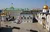
A large portion of the walls and several watchtowers still remain in reasonable shape. The walls, reaching to the sea, date from the 6th century, Sassanid dynasty period. The city has a well-preserved citadel (Narin-kala), enclosing an area of 4.5 hectares (11 acres), enclosed by strong walls. Historical attractions include the baths, the cisterns, the old cemeteries, the caravanserai, the 18th-century Khan's mausoleum, as well as several mosques. The oldest mosque is the Juma Mosque, built over a 6th-century Christian basilica; it has a 15th-century madrassa. Other shrines include the 17th-century Kyrhlyar mosque, the Bala mosque and the 18th-century Chertebe mosque.
Geography
The modern city is built near the western shores of the Caspian Sea, south of the Rubas River, on the slopes of the Tabasaran Mountains (part of the Bigger Caucasus range). Derbent is well served by public transport, with its own harbor, a railway going south to Baku, and the Baku to Rostov-on-Don road.
To the north of the town is the monument of the Kirk-lar, or forty heroes, who fell defending Dagestan against the Arabs in 728. To the south lies the seaward extremity of the Caucasian wall (fifty metres long), otherwise known as Alexander's Wall, blocking the narrow pass of the Iron Gate or Caspian Gates (Portae Athanae or Portae Caspiae). When intact, the wall had a height of 29 ft (9 m) and a thickness of about 10 ft (3 m) and, with its iron gates and numerous watch-towers, defended Persia's frontier.
Climate
| Climate data for Derbent | |||||||||||||
|---|---|---|---|---|---|---|---|---|---|---|---|---|---|
| Month | Jan | Feb | Mar | Apr | May | Jun | Jul | Aug | Sep | Oct | Nov | Dec | Year |
| Record high °C (°F) | 17.0 (62.6) |
25.0 (77) |
18.0 (64.4) |
24.0 (75.2) |
31.0 (87.8) |
41.0 (105.8) |
38.0 (100.4) |
40.0 (104) |
34.0 (93.2) |
27.0 (80.6) |
23.4 (74.1) |
19.0 (66.2) |
41.0 (105.8) |
| Average high °C (°F) | 5.0 (41) |
4.3 (39.7) |
7.5 (45.5) |
13.2 (55.8) |
19.4 (66.9) |
24.6 (76.3) |
27.9 (82.2) |
27.5 (81.5) |
23.3 (73.9) |
16.7 (62.1) |
11.6 (52.9) |
7.7 (45.9) |
16.0 (60.8) |
| Daily mean °C (°F) | 2.7 (36.9) |
2.0 (35.6) |
5.0 (41) |
10.2 (50.4) |
16.1 (61) |
21.4 (70.5) |
24.7 (76.5) |
24.2 (75.6) |
20.0 (68) |
13.8 (56.8) |
9.2 (48.6) |
5.3 (41.5) |
13.2 (55.8) |
| Average low °C (°F) | 0.6 (33.1) |
−0.2 (31.6) |
2.8 (37) |
7.4 (45.3) |
12.7 (54.9) |
17.7 (63.9) |
21.3 (70.3) |
20.7 (69.3) |
16.6 (61.9) |
10.9 (51.6) |
6.7 (44.1) |
3.1 (37.6) |
10.3 (50.5) |
| Record low °C (°F) | −14.0 (6.8) |
−10.9 (12.4) |
−14.0 (6.8) |
0.1 (32.2) |
1.9 (35.4) |
10.0 (50) |
12.9 (55.2) |
9.0 (48.2) |
6.0 (42.8) |
−1.0 (30.2) |
−3.9 (25) |
−12.0 (10.4) |
−14.0 (6.8) |
| Average precipitation mm (inches) | 13.1 (0.516) |
21.2 (0.835) |
19.3 (0.76) |
12.0 (0.472) |
16.0 (0.63) |
17.4 (0.685) |
33.7 (1.327) |
16.2 (0.638) |
26.0 (1.024) |
34.3 (1.35) |
17.9 (0.705) |
29.4 (1.157) |
256.5 (10.099) |
| Avg. precipitation days | 15.3 | 15.3 | 10.2 | 7.6 | 5.8 | 2.8 | 2.9 | 6.6 | 7.7 | 10.1 | 10.6 | 10.0 | 104.9 |
| Source: climatebase.ru[20] | |||||||||||||
Administrative and municipal status
Within the framework of administrative divisions, Derbent serves as the administrative center of Derbentsky District, even though it is not a part of it.[1] As an administrative division, it is incorporated separately as the City of Derbent—an administrative unit with the status equal to that of the districts.[1] As a municipal division, the City of Derbent is incorporated as Derbent Urban Okrug.[2]
Demographics
The main ethnic groups are (2002 Census):[21][22]
- Lezgins (32.6%)
- Azerbaijanis (31.7%)
- Tabasarans (6.4%)
- Dargins (5.5%)
- Russians (5.0%)
- Aghuls (2.9%)
- Rutuls (0.7%)
Jewish community
Jews began to settle in Derbent in ancient times and, during the Khazars' reign, were an important part of the city.[23] Jews living there are mentioned in the 12th century by Benjamin of Tudela, and in the 13th by the Christian traveler Wilhelm of Rubruquis. The first mention of Jews in Derbent in modern times is by the German traveler Adam Olearius in the 17th century. Derbent's Jewry suffered during the wars in the 18th century; Nadir Shah of Persia forced many Jews to adopt Islam. After the Russian conquest, many of the Jewish occupants of rural Dagestan fled to Derbent, which became the spiritual center of the mountain Jews. The Jewish population numbered 2,200 in 1897 (15% of total population) and 3,500 in 1903. In 1989, there were 13,000 Jews in the city, most of whom emigrated after the dissolution of the Soviet Union. In 2002, there were 2,000 Jews living in Derbent along with an active synagogue and community center.[24] The chief rabbi in Derbent is Obadiah Isakov, who became a rabbi in 2004. On July 25, 2013, an assassination attempt on Isakov's life was made by an unknown person near his home, badly injuring him. The incident sparked concerns among the local Jews of further acts against the Jewish community.[25]
Economy and culture
The city is home to machine building, food, textile, fishing and fishery supplies, construction materials and wood industries. It is the center of Russian brandy production. The educational infrastructure includes a university as well as several technical schools. On the cultural front, there is a Lezgin drama theater (named after S. Stalsky). About two kilometers (1.2 miles) from the city is the vacation colony of Chayka (Seagull).
Derbent resembles a huge museum and has magnificent mountains and shore nearby, and therefore possesses much touristic potential, further increased by UNESCO's classification of the citadel, ancient city and fortress as a World Heritage Site in 2003; however, instability in the region has retarded development.
The Soviet novelist Yury Krymov named a fictional motor tanker after the city in his book The Tanker "Derbent".
Notable people
- Michail Dadashev, writer, poet, economist, translator and historian of Mountain Jews language and heritage.
- Sergey Izgiyayev, poet, playwright and translator of Mountain Jewish descent
- Yagutil Mishiev, writer
- Israel Tsvaygenbaum, artist
- Igor Yusufov, politician
- Najmaddin Sadigov, Chief of General Staff of Azerbaijani Armed Forces and Deputy Minister of Defense of Azerbaijan Republic.
- Rustam Khabilov, sambist and UFC fighter
- Bella Nisan, ophthalmologist
Twin towns and sister cities
Derbent is twinned with:
 Ganja, Azerbaijan[26]
 Yakima, Washington, United States
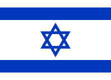 Hadera, Israel
References
Notes
- ↑ 1.0 1.1 1.2 1.3 1.4 1.5 1.6 1.7 Law #16
- ↑ 2.0 2.1 2.2 Law #6
- ↑ Подсчитано по базе данных муниципальных образований РФ на 2008 год
- ↑ 4.0 4.1 Russian Federal State Statistics Service (2011). "Всероссийская перепись населения 2010 года. Том 1" [2010 All-Russian Population Census, vol. 1]. Всероссийская перепись населения 2010 года (2010 All-Russia Population Census) (in Russian). Federal State Statistics Service. Retrieved June 29, 2012.
- ↑ The value of density was calculated automatically by dividing the 2010 Census population by the area specified in the infobox. Please note that this value may not be accurate as the area specified in the infobox does not necessarily correspond to the area of the entity proper or is reported for the same year as the population.
- ↑ Правительство Российской Федерации. Федеральный закон №107-ФЗ от 3 июня 2011 г. «Об исчислении времени», в ред. Федерального закона №248-ФЗ от 21 июля 2014 г. «О внесении изменений в Федеральный закон "Об исчислении времени"». Вступил в силу по истечении шестидесяти дней после дня официального опубликования (6 августа 2011 г.). Опубликован: "Российская газета", №120, 6 июня 2011 г. (Government of the Russian Federation. Federal Law #107-FZ of June 31, 2011 On Calculating Time, as amended by the Federal Law #248-FZ of July 21, 2014 On Amending Federal Law "On Calculating Time". Effective as of after sixty days following the day of the official publication.).
- ↑ Почта России. Информационно-вычислительный центр ОАСУ РПО. (Russian Post). Поиск объектов почтовой связи (Postal Objects Search) (Russian)
- ↑ "Derbend" in the Encyclopædia Britannica, 9th ed., Vol. VII. 1878.
- ↑ Russian Federal State Statistics Service (May 21, 2004). "Численность населения России, субъектов Российской Федерации в составе федеральных округов, районов, городских поселений, сельских населённых пунктов – районных центров и сельских населённых пунктов с населением 3 тысячи и более человек" [Population of Russia, Its Federal Districts, Federal Subjects, Districts, Urban Localities, Rural Localities—Administrative Centers, and Rural Localities with Population of Over 3,000] (XLS). Всероссийская перепись населения 2002 года [All-Russia Population Census of 2002] (in Russian). Retrieved August 9, 2014.
- ↑ Demoscope Weekly (1989). "Всесоюзная перепись населения 1989 г. Численность наличного населения союзных и автономных республик, автономных областей и округов, краёв, областей, районов, городских поселений и сёл-райцентров" [All Union Population Census of 1989: Present Population of Union and Autonomous Republics, Autonomous Oblasts and Okrugs, Krais, Oblasts, Districts, Urban Settlements, and Villages Serving as District Administrative Centers]. Всесоюзная перепись населения 1989 года[All-Union Population Census of 1989] (in Russian). Институт демографии Национального исследовательского университета: Высшая школа экономики [Institute of Demography at the National Research University: Higher School of Economics]. Retrieved August 9, 2014.
- ↑ Zonn, Igor S; Aleksey N Kosarev; Michael Glantz; Andrey G. Kostianoy (2010). The Caspian Sea Encyclopedia. Springer. p. 160.
- ↑ Derbent - Russia’s oldest city: 5,000 and counting
- ↑ 13.0 13.1 13.2 13.3 13.4 13.5 "DARBAND (1)". Retrieved 29 December 2014.
- ↑ 14.0 14.1 Robert H. Hewsen, Armenia: A historical Atlas,2001,page 89
- ↑ See (Armenian) Sedrak Barkhudaryan, “Դերբենդի հայ-աղվանական թագավորությունը” (“The Armenian-Caucasian Albanian Kingdom of Derbend”). Patma-Banasirakan Handes . № 3, 1969, pp. 125-147.
- ↑ (Armenian) Matthew of Edessa. Ժամանակնագրություն (Chronicle). Translated by Hrach Bartikyan. Yerevan: Hayastan Publishing, 1973, pp. 151-152, 332, note 132a.
- ↑ "Citadel, Ancient City and Fortress Buildings of Derbent". Retrieved 29 December 2014.
- ↑ "Alexey Yermolov's Memoirs". Retrieved 29 December 2014.
- ↑ "Russia at War: From the Mongol Conquest to Afghanistan, Chechnya, and Beyond ...". Retrieved 29 December 2014.
- ↑ "Climatebase". Retrieved June 8, 2012.
- ↑ Правительство РД — Дербент — Муниципальные районы и городские округа
- ↑ население дагестана
- ↑ DERBENT - JewishEncyclopedia.com
- ↑ Derbent
- ↑ После покушения на раввина евреи Дагестана живут в страхе
- ↑ "Twin-cities of Azerbaijan". Azerbaijans.com. Retrieved 2013-08-09.
Sources
- Народное Собрание Республики Дагестан. Закон №16 от 10 апреля 2002 г. «Об административно-территориальном устройстве Республики Дагестан», в ред. Закона №106 от 30 декабря 2013 г. «О внесении изменений в некоторые законодательные акты Республики Дагестан». Вступил в силу со дня официального опубликования. Опубликован: "Дагестанская правда", №81, 12 апреля 2002 г. (People's Assembly of the Republic of Dagestan. Law #16 of April 10, 2002 On the Administrative-Territorial Structure of the Republic of Dagestan, as amended by the Law #106 of December 30, 2013 On Amending Various Legislative Acts of the Republic of Dagestan. Effective as of the day of the official publication.).
- Народное Собрание Республики Дагестан. Закон №6 от 13 января 2005 г. «О статусе и границах муниципальных образований Республики Дагестан», в ред. Закона №60 от 5 октября 2012 г. «О внесении изменения в статью 9 Закона Республики Дагестан "О статусе и границах муниципальных образований Республики Дагестан"». Вступил в силу со дня официального опубликования. Опубликован: "Дагестанская правда", №8, 15 февраля 2005 г. (People's Assembly of the Republic of Dagestan. Law #6 of January 13, 2005 On the Status and Borders of the Municipal Formations of the Republic of Dagestan, as amended by the Law #60 of October 5, 2012 On Amending Article 9 of the Law of the Republic of Dagestan "On the Status and Borders of the Municipal Formations of the Republic of Dagestan". Effective as of the day of the official publication.).
 This article incorporates text from a publication now in the public domain: Chisholm, Hugh, ed. (1911). Encyclopædia Britannica (11th ed.). Cambridge University Press.
- Some text used with permission from www.travel-images.com. The original text can be found here.
External links
- Derbent - Russia's oldest city: 5,000 and counting
- History and attractions of Derbent
- A mosque. A prison. And a mosque again. Derbent - the oldest Djuma-mosque in North Caucasus.
- Pictures of Derbent
| ||||||||||||||||||||||||||||||||||||||||
| ||||||||||||||||||||||||||||||||||