Denstroude

Coordinates: 51°18′56″N 1°01′12″E / 51.31557°N 1.020°E
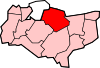
Denstroude is a dispersed hamlet located to the west of the A290 road north of Canterbury in Kent, England. It is a collection of houses and farms, one of which takes its name from the hamlet; the other being Parsonage Farm, although there is no church nearby.
It stretches between the parishes of Blean and Dunkirk, in the districts of Canterbury and Swale respectively.
Edward Hasted in 1799, only mentions 'Denstroud common'.[1]
References
- ↑ Hasted, Edward (1799). "Parishes". The History and Topographical Survey of the County of Kent (Institute of Historical Research) 8: 524–536. Retrieved 20 February 2014.
External links
![]() Media related to Denstroude at Wikimedia Commons
Media related to Denstroude at Wikimedia Commons