Demopolis Municipal Airport
| Demopolis Municipal Airport | |||||||||||
|---|---|---|---|---|---|---|---|---|---|---|---|
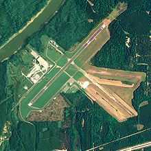 NAIP aerial image, 18 August 2006 | |||||||||||
| IATA: none – ICAO: KDYA – FAA LID: DYA | |||||||||||
| Summary | |||||||||||
| Airport type | Public | ||||||||||
| Owner | City of Demopolis | ||||||||||
| Serves | Demopolis, Alabama | ||||||||||
| Location | Marengo County, Alabama | ||||||||||
| Elevation AMSL | 112 ft / 34 m | ||||||||||
| Coordinates | 32°27′50″N 087°57′15″W / 32.46389°N 87.95417°WCoordinates: 32°27′50″N 087°57′15″W / 32.46389°N 87.95417°W | ||||||||||
| Map | |||||||||||
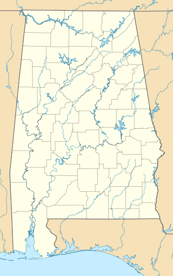 DYA Location of airport in Alabama | |||||||||||
| Runways | |||||||||||
| |||||||||||
| Statistics (2010) | |||||||||||
| |||||||||||
Demopolis Municipal Airport[1][2] (ICAO: KDYA, FAA LID: DYA, formerly 7A2) is a city-owned public-use airport located six nautical miles (7 mi, 11 km) southwest of the central business district of Demopolis, a city in Marengo County, Alabama, United States.[1] It is also known as Demopolis Regional Airport[3] and Julian D. "Buzz" Sawyer Airport.[4]
This airport is included in the FAA's National Plan of Integrated Airport Systems for 2011–2015[5] and 2009–2013,[6] both of which categorized it as a general aviation facility.
Although most U.S. airports use the same three-letter location identifier for the FAA and IATA, this airport is assigned DYA by the FAA but has no designation from the IATA.[7]
History
During World War II the airfield was built by the United States Army Air Forces and opened in October 1943. It was assigned to Third Air Force. It was used to train pilots as an axillary airfield to the group and replacement training center at Key Field, Mississippi. With the end of the war in September 1945, activities at Demopolis Army Airfield were diminished. The airfield was returned to civil control in 1946.[8]
Facilities and aircraft
The airport covers an area of 438 acres (177 ha) at an elevation of 112 feet (34 m) above mean sea level. It has one runway designated 4/22 with an asphalt surface measuring 5,002 by 100 feet (1,525 x 30 m).[1]
For the 12-month period ending September 9, 2010, the airport had 5,250 aircraft operations, an average of 14 per day: 99% general aviation and 1% military. At that time there were 18 aircraft based at this airport: 89% single-engine and 11% multi-engine.[1]
See also
References
- ↑ 1.0 1.1 1.2 1.3 1.4 FAA Airport Master Record for DYA (Form 5010 PDF). Federal Aviation Administration. Effective 25 August 2011.
- ↑ "Demopolis Municipal Airport". City of Demopolis. Retrieved 12 October 2011.
- ↑ "Demopolis’ Sawyer tapped for Aviation Hall of Fame". The Demopolis Times. 7 December 2010.
- ↑ "Airport renamed after Sawyer". The Demopolis Times. 26 April 2011.
- ↑ "2011–2015 NPIAS Report, Appendix A (PDF, 2.03 MB)" (PDF). 2011–2015 National Plan of Integrated Airport Systems. Federal Aviation Administration. 4 October 2010.
- ↑ "2009–2013 NPIAS Report, Appendix A: Part 1 (PDF, 1.33 MB)" (PDF). 2009–2013 National Plan of Integrated Airport Systems. Federal Aviation Administration. 15 October 2008.
- ↑ Great Circle Mapper: KDYA - Demopolis Municipal Airport - Demopolis, Alabama
- ↑
 This article incorporates public domain material from websites or documents of the Air Force Historical Research Agency.
External links
- Aerial image as of 23 January 1993 from USGS The National Map
- FAA Terminal Procedures for DYA, effective April 2, 2015
- Resources for this airport:
- FAA airport information for DYA
- AirNav airport information for DYA
- FlightAware airport information and live flight tracker
- SkyVector aeronautical chart for DYA
| |||||||||||||||||||||||||||||||||||||||||||||||||
.svg.png)