Demidovsky District
| Demidovsky District Демидовский район (Russian) | |
|---|---|
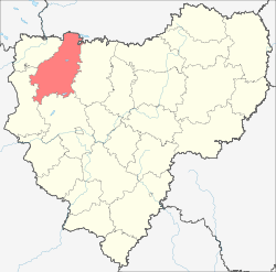 Location of Demidovsky District in Smolensk Oblast | |
| Coordinates: 55°16′N 31°31′E / 55.267°N 31.517°ECoordinates: 55°16′N 31°31′E / 55.267°N 31.517°E | |
.svg.png) | |
|
| |
| Location | |
| Country | Russia |
| Federal subject | Smolensk Oblast[1] |
| Administrative structure (as of February 2013) | |
| Administrative center | town of Demidov[1] |
| Administrative divisions:[1] | |
| Urban settlements (towns) | 1 |
| Urban settlements (urban-type settlements) | 1 |
| Rural settlements | 15 |
| Inhabited localities:[1] | |
| Cities/towns | 1 |
| Urban-type settlements | 1 |
| Rural localities | 231 |
| Municipal structure (as of October 2011) | |
| Municipally incorporated as | Demidovsky Municipal District[2] |
| Municipal divisions:[2] | |
| Urban settlements | 2 |
| Rural settlements | 15 |
| Statistics | |
| Area (administrative district) (February 2013) | 2,514.02 km2 (970.67 sq mi)[1] |
| Population (2010 Census) | 14,039 inhabitants[3] |
| - Urban | 64.2% |
| - Rural | 35.8% |
| Density | 5.58/km2 (14.5/sq mi)[4] |
| Time zone | MSK (UTC+03:00)[5] |
| Official website | |
Demidovsky District (Russian: Деми́довский райо́н) is an administrative[1] and municipal[2] district (raion), one of the twenty-five in Smolensk Oblast, Russia. It is located in the northwest of the oblast and borders with Tver Oblast in the north, Velizhsky District in the northwest, Rudnyansky District in the southwest, Smolensky District in the south, and with Dukhovshchinsky District in the east. The area of the district is 2,514.02 square kilometers (970.67 sq mi).[1] Its administrative center is the town of Demidov.[1] Population: 14,039 (2010 Census);[3] 18,167 (2002 Census);[6] 24,237 (1989 Census).[7] The population of Demidov accounts for 52.2% of the district's total population.[3]
Geography
Major rivers flowing through the district include the Kasplya, the Vyatsha, and the Yelsha. There are many lakes, most significant of which are Lake Sapsho, Lake Dgo, and Lake Baklanovskoye. 58.4% of the district's territory is covered by forests. A portion of Smolenskoye Poozyorye National Park is located in the district.
Economy
The economy of the district is based on agriculture and timber industry; production of building materials is also developed.
References
Notes
- ↑ 1.0 1.1 1.2 1.3 1.4 1.5 1.6 1.7 Resolution #261
- ↑ 2.0 2.1 2.2 Law #131-z
- ↑ 3.0 3.1 3.2 Russian Federal State Statistics Service (2011). "Всероссийская перепись населения 2010 года. Том 1" [2010 All-Russian Population Census, vol. 1]. Всероссийская перепись населения 2010 года (2010 All-Russia Population Census) (in Russian). Federal State Statistics Service. Retrieved June 29, 2012.
- ↑ The value of density was calculated automatically by dividing the 2010 Census population by the area specified in the infobox. Please note that this value may not be accurate as the area specified in the infobox does not necessarily correspond to the area of the entity proper or is reported for the same year as the population.
- ↑ Правительство Российской Федерации. Федеральный закон №107-ФЗ от 3 июня 2011 г. «Об исчислении времени», в ред. Федерального закона №248-ФЗ от 21 июля 2014 г. «О внесении изменений в Федеральный закон "Об исчислении времени"». Вступил в силу по истечении шестидесяти дней после дня официального опубликования (6 августа 2011 г.). Опубликован: "Российская газета", №120, 6 июня 2011 г. (Government of the Russian Federation. Federal Law #107-FZ of June 31, 2011 On Calculating Time, as amended by the Federal Law #248-FZ of July 21, 2014 On Amending Federal Law "On Calculating Time". Effective as of after sixty days following the day of the official publication.).
- ↑ Russian Federal State Statistics Service (May 21, 2004). "Численность населения России, субъектов Российской Федерации в составе федеральных округов, районов, городских поселений, сельских населённых пунктов – районных центров и сельских населённых пунктов с населением 3 тысячи и более человек" [Population of Russia, Its Federal Districts, Federal Subjects, Districts, Urban Localities, Rural Localities—Administrative Centers, and Rural Localities with Population of Over 3,000] (XLS). Всероссийская перепись населения 2002 года [All-Russia Population Census of 2002] (in Russian). Retrieved August 9, 2014.
- ↑ Demoscope Weekly (1989). "Всесоюзная перепись населения 1989 г. Численность наличного населения союзных и автономных республик, автономных областей и округов, краёв, областей, районов, городских поселений и сёл-райцентров" [All Union Population Census of 1989: Present Population of Union and Autonomous Republics, Autonomous Oblasts and Okrugs, Krais, Oblasts, Districts, Urban Settlements, and Villages Serving as District Administrative Centers]. Всесоюзная перепись населения 1989 года[All-Union Population Census of 1989] (in Russian). Институт демографии Национального исследовательского университета: Высшая школа экономики [Institute of Demography at the National Research University: Higher School of Economics]. Retrieved August 9, 2014.
Sources
- Администрация Смоленской области. Постановление №261 от 30 апреля 2008 г. «Об утверждении реестра административно-территориальных единиц и территориальных единиц Смоленской области», в ред. Постановления №464 от 27 июня 2014 г. «О внесении изменений в реестр административно-территориальных единиц и территориальных единиц Смоленской области». Опубликован: База данных "Консультант-плюс". (Administration of Smolensk Oblast. Resolution #261 of April 30, 2008 On the Adoption of the Registry of the Administrative-Territorial Units and Territorial Units of Smolensk Oblast, as amended by the Resolution #464 of June 27, 2014 On Amending the Registry of the Administrative-Territorial Units and Territorial Units of Smolensk Oblast. ).
- Смоленская областная Дума. Закон №131-з от 28 декабря 2004 г. «О наделении статусом муниципального района муниципального образования "Демидовский район" Смоленской области, об установлении границ муниципальных образований, территории которых входят в его состав, и наделении их соответствующим статусом», в ред. Закона №84-з от 31 октября 2011 г. «О внесении изменений в областной Закон "О наделении статусом муниципального района муниципального образования "Демидовский район" Смоленской области, об установлении границ муниципальных образований, территории которых входят в его состав, и наделении их соответствующим статусом"». Вступил в силу со дня официального опубликования. Опубликован: "Вестник Смоленской областной Думы и Администрации Смоленской области", №14, часть II, стр. 6, 30 декабря 2004 г. (Smolensk Oblast Duma. Law #131-z of December 28, 2004 On Granting the Status of the Municipal District to the Municipal Formation of "Demidovsky District" of Smolensk Oblast, on Establishing the Borders of the Municipal Formations the Territories of Which Are Comprising It, and on Granting Them Appropriate Status, as amended by the Law #84-z of October 31, 2011 On Amending the Oblast Law "On Granting the Status of the Municipal District to the Municipal Formation of "Demidovsky District" of Smolensk Oblast, on Establishing the Borders of the Municipal Formations the Territories of Which Are Comprising It, and on Granting Them Appropriate Status". Effective as of the official publication date.).
| ||||||||||||||||||||