Deer, Arkansas
| Deer, Arkansas | |
|---|---|
| Unincorporated community | |
 Deer, Arkansas | |
| Coordinates: 35°49′36″N 93°12′34″W / 35.82667°N 93.20944°WCoordinates: 35°49′36″N 93°12′34″W / 35.82667°N 93.20944°W | |
| Country | United States |
| State | Arkansas |
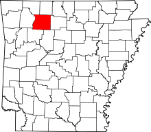
| County | Newton |
| Elevation | 2,339 ft (713 m) |
| Population | |
| • Total | 680[1] |
| Time zone | Central (CST) (UTC-6) |
| • Summer (DST) | CDT (UTC-5) |
| ZIP code | 72628 |
| Area code(s) | 870 |
| GNIS feature ID | 71358[2] |
Deer is an unincorporated community in Newton County, Arkansas, United States. Deer is located on Arkansas Highway 16 12.5 miles (20.1 km) south of Jasper. Deer has a post office with ZIP code 72628.[3]
Climate
| Climate data for Deer, Arkansas (Elevation 2,375ft) | |||||||||||||
|---|---|---|---|---|---|---|---|---|---|---|---|---|---|
| Month | Jan | Feb | Mar | Apr | May | Jun | Jul | Aug | Sep | Oct | Nov | Dec | Year |
| Record high °F (°C) | 69 (21) |
78 (26) |
83 (28) |
88 (31) |
85 (29) |
92 (33) |
102 (39) |
106 (41) |
97 (36) |
86 (30) |
79 (26) |
70 (21) |
106 (41) |
| Average high °F (°C) | 41.3 (5.2) |
46.2 (7.9) |
55.5 (13.1) |
64.6 (18.1) |
70.7 (21.5) |
78.4 (25.8) |
83.1 (28.4) |
83.2 (28.4) |
75.6 (24.2) |
65.3 (18.5) |
54.5 (12.5) |
44.3 (6.8) |
63.6 (17.6) |
| Average low °F (°C) | 23.1 (−4.9) |
27.0 (−2.8) |
35.2 (1.8) |
44.5 (6.9) |
53.6 (12) |
62.3 (16.8) |
66.9 (19.4) |
66.1 (18.9) |
58.4 (14.7) |
47.3 (8.5) |
36.8 (2.7) |
26.6 (−3) |
45.7 (7.6) |
| Record low °F (°C) | −20 (−29) |
−10 (−23) |
1 (−17) |
16 (−9) |
31 (−1) |
44 (7) |
52 (11) |
45 (7) |
33 (1) |
15 (−9) |
4 (−16) |
−13 (−25) |
−20 (−29) |
| Average precipitation inches (mm) | 3.17 (80.5) |
3.70 (94) |
5.57 (141.5) |
5.23 (132.8) |
6.65 (168.9) |
4.58 (116.3) |
3.53 (89.7) |
3.55 (90.2) |
4.49 (114) |
4.51 (114.6) |
5.92 (150.4) |
4.33 (110) |
55.24 (1,403.1) |
| Average snowfall inches (cm) | 4.0 (10.2) |
4.2 (10.7) |
1.8 (4.6) |
0.3 (0.8) |
0 (0) |
0 (0) |
0 (0) |
0 (0) |
0 (0) |
0 (0) |
0.6 (1.5) |
1.7 (4.3) |
12.6 (32) |
| Source: The Western Regional Climate Center[4] | |||||||||||||
Education
Public education for elementary and secondary school students is provided by the Deer/Mount Judea School District, which includes:
- Deer Elementary School
- Deer High School
- Deer Community College of Agricultural Science
References
- ↑ http://www.bestplaces.net/people/zip-code/arkansas/deer/72628
- ↑ U.S. Geological Survey Geographic Names Information System: Deer, Arkansas
- ↑ ZIP Code Lookup
- ↑ "Seasonal Temperature and Precipitation Information". Western Regional Climate Center. Retrieved November 18, 2013.
External links
| |||||||||||||||||||||||||