Dean Island (Antarctica)
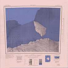
1:250,000 scale topographic map of Dean Island.
Dean Island in the Antarctic is an ice-covered island, 20 nautical miles (37 km; 23 mi) long and 10 nautical miles (19 km; 12 mi) wide, lying within the Getz Ice Shelf and midway between Grant Island and Siple Island, off the coast of Marie Byrd Land. It was first sighted from a distance of 20 nautical miles (37 km; 23 mi) from the USS Glacier on February 5, 1962, and was named for Chief Warrant Officer S.L. Dean, U.S. Navy, Electrical Officer on the Glacier at the time of discovery.
References
-
 This article incorporates public domain material from the United States Geological Survey document "Dean Island (Antarctica)" (content from the Geographic Names Information System).