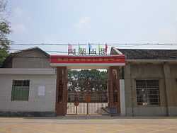
Datunying, Ningxiang
| Datunying Township | |
|---|---|
| Township | |
| Chinese transcription(s) | |
| • Simplified | 大屯营乡 |
| • Traditional | 大屯營鄉 |
| • Pinyin | Datunying Xiang |
 | |
 Datunying Township Location in Hunan | |
| Coordinates: 27°58′30″N 112°39′28″E / 27.97500°N 112.65778°ECoordinates: 27°58′30″N 112°39′28″E / 27.97500°N 112.65778°E | |
| Country | People's Republic of China |
| Province | Hunan |
| City | Changsha |
| County-level city | Ningxiang County |
| Area | |
| • Total | 106.2 km2 (41.0 sq mi) |
| Population | 43,000 |
| Time zone | China Standard (UTC+8) |
| Area code(s) | 0731 |
Datunying Township (simplified Chinese: 大屯营乡; traditional Chinese: 大屯營鄉; pinyin: Dàtúnyíng Xiāng) is a rural township in Ningxiang County, Changsha City, Hunan Province, China. It is surrounded by Huaminglou Town on the north, Daolin Town on the east, and Shaoshan City on the southwest. As of the 2000 census it had a population of 39,819 and an area of 106.2 square kilometres (41.0 sq mi).
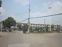
Cityscape

The township is divided into thirteen villages: Xinmin Village (新民村), Baiyang Village (白洋村), Shaoguang Village (韶光村), Zongyi Village (宗一村), Meihu Village (梅湖村), Sanxianao Village (三仙坳村), Shaohe Village (韶河村), Datunying Village (大屯营村), Tianli Village (天里村), Hexi Village (河西村), Shibei Village (狮北村), Jinxing Village (靳兴村) and Shijiawan Village (石家湾村).
Geography
The Jin River, a tributary of the Xiang River, flows through the town.[1]
Economy
Tea and tobacco are important to the economy.[1]
Education
There is one senior high school located with the town limits: Ningxiang County Ninth Senior High School (宁乡九中).
Culture
Huaguxi is the most influence local theater.
Celebrity

- Ouyang Qin (simplified Chinese: 欧阳钦; traditional Chinese: 歐陽欽; pinyin: Oūyáng Qīn,1900–1978), politician.[1]
- Zhou Dawu (simplified Chinese: 周达武; traditional Chinese: 周達武; pinyin: Zhōu Dáwǔ), general.
- Zhu Jianfan (simplified Chinese: 朱剑凡; traditional Chinese: 朱劍凡; pinyin: Zhū Jiànfán,1883–1932), educator.[1]
References
External links
| |||||||||||||||||
| Wikimedia Commons has media related to Datunying, Ningxiang. |
