Datu Hoffer Ampatuan, Maguindanao
| Datu Hoffer Ampatuan | |
|---|---|
| Municipality | |
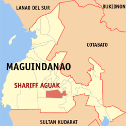 Map of Maguindanao showing the location of Datu Hoffer Ampatuan | |
.svg.png) Datu Hoffer Ampatuan Location within the Philippines | |
| Coordinates: 6°52′0.01″N 124°27′0″E / 6.8666694°N 124.45000°ECoordinates: 6°52′0.01″N 124°27′0″E / 6.8666694°N 124.45000°E | |
| Country |
|
| Region | Autonomous Region in Muslim Mindanao (ARMM) |
| Province | Maguindanao |
| Barangays | 11 |
| Government[1] | |
| • Mayor | Bongbong M. Ampatuan |
| Area | |
| • Total | 461.10 km2 (178.03 sq mi) |
| Population (2010) | |
| • Total | 16,295 |
| • Density | 35/km2 (92/sq mi) |
| Time zone | PST (UTC+8) |
| ZIP code | 9608 |
| Dialing code | 64 |
| Income class | 6th |
| Population census of Datu Hoffer Ampatuan, Maguindanao | ||
|---|---|---|
| Year | Pop. | ±% p.a. |
| 2010 | 16,295 | — |
| Source: National Statistics Office[2] | ||
Datu Hoffer Ampatuan is a 6th class municipality in the province of Maguindanao, Philippines. According to the 2010 census, it has a population of 16,295 people in 7,000 households.
It was created out of 9 barangays from the municipality of Shariff Aguak, and portions of 2 barangays from Datu Unsay, by virtue of Muslim Mindanao Autonomy Act No. 220, which was subsequently ratified in a plebiscite held on July 30, 2009.
Barangays
Datu Hoffer Ampatuan is politically subdivided into 11 barangays.
- Kubentong
- Labu-labu I
- Labu-labu II
- Limpongo
- Sayap
- Taib
- Talibadok
- Tuayan
- Tuayan I
- Macalag
- Tuntungan
References
- ↑ "Official City/Municipal 2013 Election Results". Intramuros, Manila, Philippines: Commission on Elections (COMELEC). 1 July 2013. Retrieved 5 September 2013.
- ↑ "Total Population by Province, City, Municipality and Barangay: as of May 1, 2010". 2010 Census of Population and Housing. National Statistics Office. Retrieved 6 October 2013.
External links
- MMA Act No. 220 : An Act Creating the Municipality of Datu Hoffer Ampatuan in the Province of Maguindanao
- Philippine Standard Geographic Code
- 2007 Census Population Figures for Maguindanao
- COMELEC - Plebiscite results for 3 new Maguindanao towns
- COMELEC Resolution No. 8169
| ||||||||||||||