Datu Abdullah Sangki, Maguindanao
| Datu Abdullah Sangki | |
|---|---|
| Municipality | |
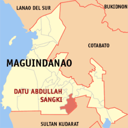 Map of Maguindanao showing the location of Datu Abdullah Sangki | |
.svg.png) Datu Abdullah Sangki Location within the Philippines | |
| Coordinates: 6°49′52″N 124°30′26″E / 6.83111°N 124.50722°ECoordinates: 6°49′52″N 124°30′26″E / 6.83111°N 124.50722°E | |
| Country |
|
| Region | Autonomous Region in Muslim Mindanao (ARMM) |
| Province | Maguindanao |
| Barangays | 10 |
| Government[1] | |
| • Mayor | Mariam Magudadatu |
| Area | |
| • Total | 220.00 km2 (84.94 sq mi) |
| Population (2010) | |
| • Total | 17,079 |
| • Density | 78/km2 (200/sq mi) |
| Time zone | PST (UTC+8) |
| ZIP code | 9609 |
| Dialing code | 64 |
| Income class | 6th |
Datu Abdullah Sangki is a 6th class municipality in the province of Maguindanao, Philippines. According to the 2010 census, it has a population of 17,079 people in 5,544 households.
The municipality was created under Muslim Mindanao Autonomy Act No. 153 dated August 20, 2003, ratified in the plebiscite held on January 3, 2004.[2] It was carved out of the municipality of Ampatuan.
Barangays
Datu Abdullah Sangki is politically subdivided into 10 barangays.[3]
- Banaba
- Dimampao
- Guinibon
- Kaya-kaya
- Maganoy
- Mao
- Maranding
- Sugadol
- Talisawa
- Tukanalugong
Demographics
| Population census of Datu Abdullah Sangki | ||
|---|---|---|
| Year | Pop. | ±% p.a. |
| 2007 | 33,259 | — |
| 2010 | 17,079 | −21.54% |
| Source: National Statistics Office[4] | ||
References
- ↑ "Official City/Municipal 2013 Election Results". Intramuros, Manila, Philippines: Commission on Elections (COMELEC). 1 July 2013. Retrieved 5 September 2013.
- ↑ National Statistical Coordination Board (2004-08-22). "2004 Factsheet (January to July 2004)". Retrieved 2006-06-24.
- ↑ National Statistical Coordination Board. "PSGC Interactive: Municipality/City: DATU ABDULLAH SANGKI". Retrieved 2008-05-19.
- ↑ "Total Population by Province, City, Municipality and Barangay: as of May 1, 2010". 2010 Census of Population and Housing. National Statistics Office. Retrieved 6 October 2013.
External links
- MMA Act No. 153 : An Act Creating the Municipality of Datu Abdullah Sangki in the Province of Maguindanao
- Philippine Standard Geographic Code
- Philippine Census Information
- Local Governance Performance Management System
 |
Mamasapano | Rajah Buayan | | |
| Ampatuan | |
Lambayong, Sultan Kudarat | ||
| ||||
| | ||||
| Esperanza, Sultan Kudarat |
| ||||||||||||||