Dashmina Upazila
| Dashmina দশমিনা | |
|---|---|
| Upazila | |
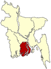
 Dashmina Location in Bangladesh | |
| Coordinates: 22°17′N 90°35.4′E / 22.283°N 90.5900°ECoordinates: 22°17′N 90°35.4′E / 22.283°N 90.5900°E | |
| Country |
|
| Division | Barisal Division |
| District | Patuakhali District |
| Area | |
| • Total | 351.74 km2 (135.81 sq mi) |
| Population (1991) | |
| • Total | 106,539 |
| • Density | 303/km2 (780/sq mi) |
| Time zone | BST (UTC+6) |
| Website | Official Map of the Dashmina Upazila |
Dashmina (Bengali: দশমিনা ) is an Upazila of Patuakhali District in the Division of Barisal, Bangladesh.[1]
Geography
Dashmina is located at 22°17′00″N 90°35′25″E / 22.2833°N 90.5903°E . It has 19,863 households and a total area of 351.74 km².
Demographics
According to the 1991 Bangladesh census, Dashmina had a population of 106,539. Males constituted 49.5% of the population, and females 50.5%. The population aged 18 or older was 52,137. Dashmina had an average literacy rate of 29.5% (7+ years), compared to the national average of 32.4%.
Administration
Dashmina has 6 Unions/Wards, 51 Mauzas/Mahallas, and 55 villages. The names of the Unions are Dashmina, Alipura, Banshbaria, Rono Gopaldi, Bohorampur and Betagi Shankipur. The Upazila Headquarters is situated in Dashmina Sadar. It is situated on the Bank of the river Tetulia. At present it holds three colleges, three Boys' high schools, two girls' schools, an Alia Madrasa and a number of government and non government primary schools.
See also
References
- ↑ Masud Hasan Chowdhury and Md Mahbub MurshedGazi Shahidul Islam (2012). "Dashmina Upazila". In Sirajul Islam and Ahmed A. Jamal. Banglapedia: National Encyclopedia of Bangladesh (Second ed.). Asiatic Society of Bangladesh.
| |||||||||||||||||||||||||||||||||