Darr, Nebraska
| Darr, Nebraska | |
|---|---|
| Unincorporated community | |
 | |
 Darr, Nebraska | |
| Coordinates: 40°49′15″N 99°53′01″W / 40.82083°N 99.88361°WCoordinates: 40°49′15″N 99°53′01″W / 40.82083°N 99.88361°W | |
| Country | United States |
| State | Nebraska |
| County | Dawson |
| Elevation | 2,451 ft (747 m) |
| Time zone | Central (CST) (UTC-6) |
| • Summer (DST) | CDT (UTC-5) |
| Area code(s) | 308 |
| GNIS feature ID | 828579[1] |
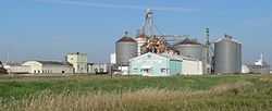
Darr (also Cayote, Coyote)[1] is an unincorporated community in Dawson County, Nebraska, United States.[1] Darr is located on U.S. Route 30 and Nebraska Highway 21 between Cozad and Lexington. Its elevation is 2,451 feet (747 m). Darr appears on the Cozad U.S. Geological Survey map.[1]
History
Darr was named for George B. Darr, the original owner of the town site.[2] A post office was established at Darr in 1902, and remained in operation until it was discontinued in 1923.[3]
References
- ↑ 1.0 1.1 1.2 1.3 "Darr". Geographic Names Information System. United States Geological Survey.
- ↑ Fitzpatrick, Lillian L. (1960). Nebraska Place-Names. University of Nebraska Press. p. 51. A 1925 edition is available for download at University of Nebraska—Lincoln Digital Commons.
- ↑ "Dawson County". Jim Forte Postal History. Retrieved 25 August 2014.
| |||||||||||||||||||||||||