Danube
| Danube | |
| River | |
| Countries | Germany, Austria, Slovakia, Hungary, Croatia, Serbia, Bulgaria, Romania |
|---|---|
| Cities | Ulm, Ingolstadt, Regensburg, Linz, Vienna, Bratislava, Győr, Budapest, Dunaújváros, Vukovar, Novi Sad, Zemun, Pančevo, Belgrade, Drobeta Turnu-Severin, Vidin |
| Primary source | Breg |
| - location | Martinskapelle, Black Forest, Germany |
| - elevation | 1,078 m (3,537 ft) |
| - length | 2,860 km (1,777 mi) |
| - coordinates | 48°05′44″N 08°09′18″E / 48.09556°N 8.15500°E |
| Secondary source | Brigach |
| - location | St. Georgen, Black Forest, Germany |
| - elevation | 940 m (3,084 ft) |
| - length | 2,860 km (1,777 mi) |
| - coordinates | 48°06′24″N 08°16′51″E / 48.10667°N 8.28083°E |
| Source confluence | |
| - location | Donaueschingen |
| - coordinates | 47°57′03″N 08°31′13″E / 47.95083°N 8.52028°E |
| Mouth | Danube Delta |
| - coordinates | 45°13′3″N 29°45′41″E / 45.21750°N 29.76139°ECoordinates: 45°13′3″N 29°45′41″E / 45.21750°N 29.76139°E |
| Length | 2,860 km (1,777 mi) |
| Basin | 817,000 km2 (315,445 sq mi) |
| Discharge | for before delta |
| - average | 7,000 m3/s (247,203 cu ft/s) |
| colspan="2" style=""text-align: left"" | Discharge elsewhere (average) | |
| - Passau | 580 m3/s (20,483 cu ft/s) 30km before town |
| - Vienna | 1,900 m3/s (67,098 cu ft/s) |
| - Budapest | 2,350 m3/s (82,989 cu ft/s) |
| - Belgrade | 4,000 m3/s (141,259 cu ft/s) |
The Danube (/ˈdænjuːb/ DAN-ewb, also known by other names) is Europe's second-longest river, located in Central and Eastern Europe.
Names and etymology
The name Dānuvius is presumably a loan from a Scythian language, or possibly Gaulish. It is one of a number of river names derived from a Proto-Indo-European language word *dānu, apparently a term for "river", but possibly also of a primeval cosmic river, and of a Vedic river goddess (see Danu), perhaps from a root *dā "to flow/swift, rapid, violent, undisciplined." Other river names with the same etymology include Don, Donets, Dnieper and Dniestr. Dniepr (pre-Slavic Danapir by Gothic historian Jordanes) and Dniestr, from Danapris and Danastius, are presumed from Scythian Iranian *Dānu apara "river afar" and *Dānu nazdya- "river near", respectively.
The Danube was known in Latin as Danubius, Danuvius, Ister, in Ancient Greek as Ἴστρος (Istros). The Dacian/Thracian name was Donaris/Donaris (Τάναις in Greek, upper Danube) and Istros (lower Danube).[1] Its Thraco-Phrygian name was Matoas,[2] "the bringer of luck".[3] The Ancient Greek Istros was a borrowing from Thracian/Dacian meaning "strong, swift", akin to Sanskrit iṣiras "swift".[1]
Since the Norman conquest of England, the English language has used the Latin-derived word Danube.
In the languages of the modern countries through which the river flows, it is:
- Bulgarian: Дунав, pronounced [ˈdunɐf] (transliterated: Dunav)
- German: Donau, pronounced [ˈdoːnaʊ̯]
- Hungarian: Duna, pronounced [ˈdunɒ]
- Romanian: Dunărea, pronounced [ˈdunəre̯a]
- Serbo-Croatian: Dunav / Дунав, pronounced [dǔnaʋ] or [dǔnaːʋ]
- Slovak: Dunaj, pronounced [ˈdunaj]
- Ukrainian: Дунай, pronounced [duˈnɑj] (transliterated: Dunai)
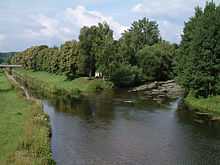
Geography
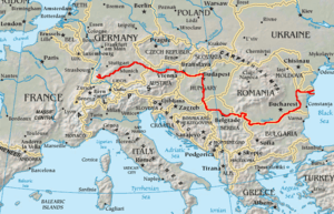
Classified as an international waterway, it originates in the town of Donaueschingen—which is in the Black Forest of Germany—at the confluence of the rivers Brigach and Breg. The Danube then flows southeast for 1,914 km (1,189 mi), passing through four capital cities before emptying into the Black Sea via the Danube Delta in Romania and Ukraine.
Once a long-standing frontier of the Roman Empire, the river passes through or touches the borders of ten countries: Romania (29.0% of basin area), Hungary (11.6%), Serbia (10.2%), Austria (10.0%), Germany (7.0%), Bulgaria (5.9%), Slovakia (5.9%), Croatia (4.4%), Ukraine (3.8%), and Moldova (1.6%).[4] Its drainage basin extends into nine more.
There are also some parcels of unclaimed land (terrae nullius) along the Danube's western coastline, due to a technicality in the Croatia–Serbia border dispute. Activist Vít Jedlička from the Czech Party of Free Citizens has proclaimed the micronation Liberland on the largest of these land masses.
Drainage basin
In addition to the bordering countries (see above), the drainage basin includes parts of nine more countries: Bosnia and Herzegovina (4.6%), the Czech Republic (2.9%), Slovenia (2.0%), Montenegro (0.9%), Switzerland (0.2%), Italy (<0.1%), Poland (<0.1%), the Republic of Macedonia (<0.1%) and Albania (<0.1%).[4] The highest point of the drainage basin is the summit of Piz Bernina at the Italy–Switzerland border, 4,049 metres (13,284 ft).[5]
Tributaries
The Danube's watershed extends into many other countries. Many Danubian tributaries are important rivers in their own right, navigable by barges and other shallow-draught boats. From its source to its outlet into the Black Sea, its main tributaries are (in order that they enter):
|
17. Tisza |
Cities and towns


The Danube flows through many cities, including four national capitals (shown below in bold), more than any other river in the world. Ordered from the source to the mouth they are:
 Germany
- Donaueschingen in the State of Baden-Württemberg – Brigach and Breg rivers join to form the Danube river
- Möhringen an der Donau in Baden-Württemberg
- Tuttlingen in Baden-Württemberg
- Sigmaringen in Baden-Württemberg
- Riedlingen in Baden-Württemberg
- Munderkingen in Baden-Württemberg
- Ehingen in Baden-Württemberg
- Ulm in Baden-Württemberg
- Neu-Ulm in Bavaria
- Günzburg in Bavaria
- Dillingen an der Donau in Bavaria
- Donauwörth in Bavaria
- Neuburg an der Donau in Bavaria
- Ingolstadt in Bavaria
- Kelheim in Bavaria
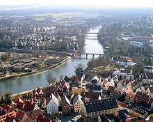
- Regensburg in Bavaria
- Straubing in Bavaria
- Deggendorf in Bavaria
- Passau in Bavaria
 Austria
- Linz, capital of Upper Austria
- Krems in Lower Austria
- Tulln in Lower Austria
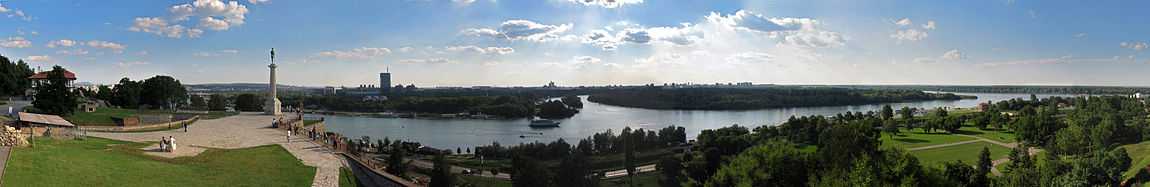
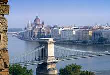
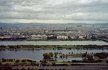
- Vienna – capital of Austria and the largest city on the Danube, where the Danube floodplain is called the Lobau, though the Innere Stadt is situated away from the main flow of the Danube (it is bounded by the Donaukanal – 'Danube canal').
 Slovakia
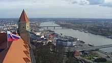
- Bratislava – capital of Slovakia
- Komárno
- Štúrovo
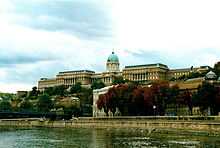
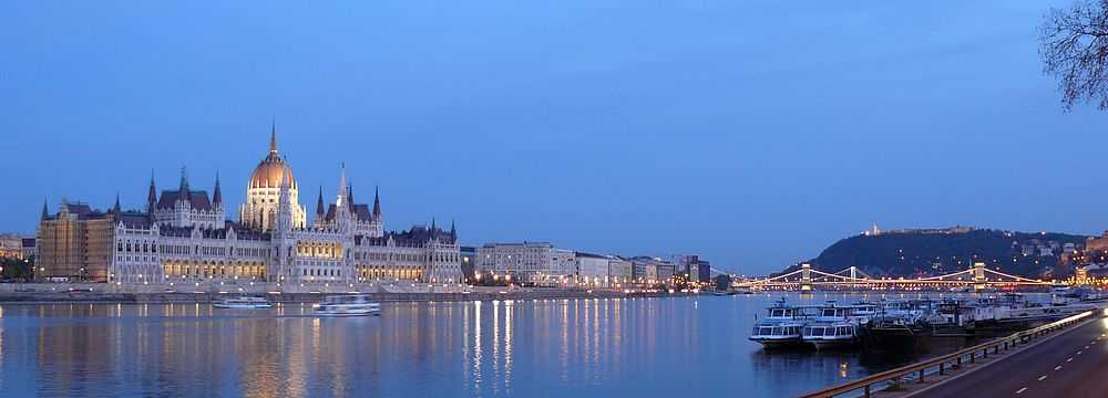
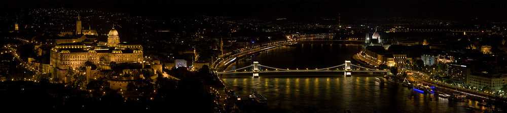
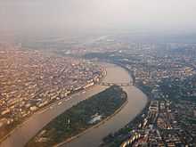
 Hungary
 Croatia
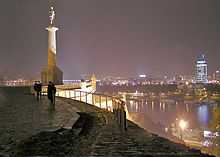
 Serbia
 Bulgaria
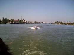
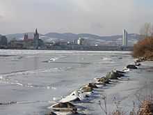
 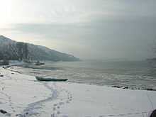 Danube at Nikopol, Bulgaria in winter
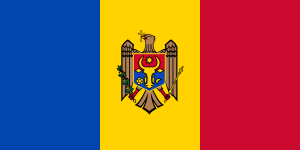 Moldova
 Ukraine
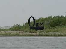 0 km, Danube Delta (Ukraine)
 Romania
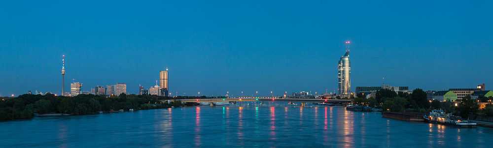
_River_Panorama_near_Vienna.jpg)
Islands
- Adakale Island
- Ostrovul Mare, Gogoşu
- Balta Ialomiţei
- Belene Island
- Csepel Island
- Donauinsel
- Great Brăila Island
- Great War Island
- Island of Vukovar
- Island of Šarengrad
- Žitný Island
- Szigetköz
- Island of Szentendre
- Margaret Island
- Csepel Island
- Island of Mohács
- Ostrovul Ciocăneşti
- Ostrovul Mare, Islaz
- Ostrvo (Kostolac)
- Kozloduy Island
- Ribarsko Ostrvo, Novi Sad
- Vardim Island
Sectioning
- Upper Section: From spring to Devín Gate. Danube remains a characteristic mountain river until Passau, with average bottom gradient 0.0012% (12 ppm), from Passau to Devín Gate the gradient lessens to 0.0006% (6 ppm).
- Middle Section: From Devín Gate to Iron Gate. The riverbed widens and the average bottom gradient becomes only 0.00006% (0.6 ppm).
- Lower Section: From Iron Gate to Sulina, with average gradient as little as 0.00003% (0.3 ppm).
Modern navigation

The Danube is navigable by ocean ships from the Black Sea to Brăila in Romania and by river ships to Kelheim, Bavaria, Germany; smaller craft can navigate further upstream to Ulm, Württemberg, Germany. About 60 of its tributaries are also navigable.
Since the completion of the German Rhine–Main–Danube Canal in 1992, the river has been part of a trans-European waterway from Rotterdam on the North Sea to Sulina on the Black Sea, a distance of 3,500 km (2,200 mi). In 1994 the Danube was declared one of ten Pan-European transport corridors, routes in Central and Eastern Europe that required major investment over the following ten to fifteen years. The amount of goods transported on the Danube increased to about 100 million tons in 1987. In 1999, transport on the river was made difficult by the NATO bombing of three bridges in Serbia during the Kosovo War. Clearance of the resulting debris was completed in 2002, and a temporary pontoon bridge that hampered navigation was removed in 2005.
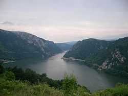
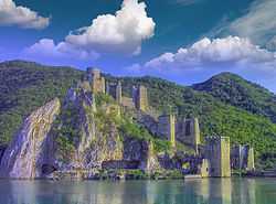
At the Iron Gate, the Danube flows through a gorge that forms part of the boundary between Serbia and Romania; it contains the Iron Gate I Hydroelectric Power Station dam, followed at about 60 km (37 mi) downstream (outside the gorge) by the Iron Gate II Hydroelectric Power Station. On 13 April 2006, a record peak discharge at Iron Gate Dam reached 15,400 m3/s (540,000 cu ft/s).
There are three artificial waterways built on the Danube: the Danube-Tisa-Danube Canal (DTD) in the Banat and Bačka regions (Vojvodina, northern province of Serbia); the 64 km (40 mi) Danube-Black Sea Canal, between Cernavodă and Constanţa (Romania) finished in 1984, shortens the distance to the Black Sea by 400 km (250 mi); the Rhine–Main–Danube Canal is about 171 km (106 mi), finished in 1992, linking the North Sea to the Black Sea.
Piracy
In 2010–12, shipping companies (especially from Ukraine) claimed that their vessels suffered from "regular pirate attacks", on the Serbian and Romanian stretches of the Danube (i.e. inside the European Union's territory).[8][9][10] However, these transgressions may not be considered acts of piracy, as defined according to the United Nations Convention on the Law of the Sea, but rather instances of "river robbery".[11]
On the other hand, media reports say the crews on transport ships often steal and sell their own cargo and then blame the plundering on “pirates”, and the alleged attacks are not piracy but small-time contraband theft that is taking place along the river.[12]
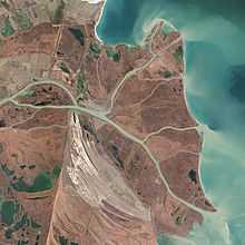
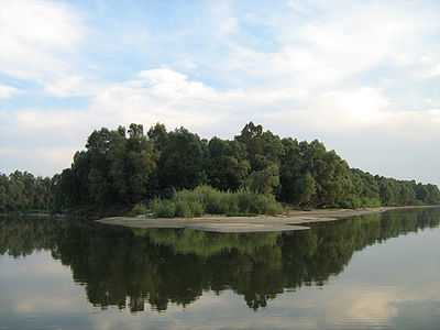
Danube delta
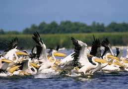
The Danube Delta has been a UNESCO World Heritage Site since 1991. Its wetlands (on the Ramsar list of wetlands of international importance) support vast flocks of migratory birds, including the endangered Pygmy Cormorant (Phalacrocorax pygmaeus). Rival canalization and drainage schemes threaten the delta: see Bystroye Canal.
The Danube Delta (Romanian: Delta Dunării pronounced [ˈdelta ˈdunərij]; Ukrainian: Дельта Дунаю, Del'ta Dunaju) is the largest river delta in the European Union, and is the most preserved on the continent. The greater part of the Danube Delta lies in Romania (Tulcea county), while its northern part, on the left bank of the Chilia arm, is situated in Ukraine (Odessa Oblast). The approximate surface is 4,152 km2 (1,603 sq mi), of which 3,446 km2 (1,331 sq mi) are in Romania. If one includes the lagoons of Razim-Sinoe (1,015 km2 (392 sq mi) of which 865 km2 (334 sq mi) water surface), which are located south of the delta proper, but are related to it geologically and ecologically (their combined territory is part of the World Heritage Site), the total area of the Danube Delta reaches 5,165 km2 (1,994 sq mi).
The waters of the Danube, which flow into the Black Sea, form the largest and best preserved of Europe's deltas. The Danube delta hosts over 300 species of birds as well as 45 freshwater fish species in its numerous lakes and marshes.
International cooperation
Ecology and environment
The International Commission for the Protection of the Danube River (ICPDR) is an organization consisting of 14 member states (Germany, Austria, the Czech Republic, Slovakia, Slovenia, Hungary, Croatia, Bosnia and Herzegovina, Serbia, Bulgaria, Romania, Moldova, Montenegro and Ukraine) and the European Union. The commission, established in 1998, deals with the whole Danube River Basin, which includes tributaries and the groundwater resources. Its goal is to implement the Danube River Protection Convention by promoting and coordinating sustainable and equitable water management, including conservation, improvement and rational use of waters and the implementation of the EU Water Framework Directive.
Navigation
The Danube Commission is concerned with the maintenance and improvement of the river's navigation conditions. It was established in 1948 by seven countries bordering the river. Members include representatives from Austria, Bulgaria, Croatia, Germany, Hungary, Moldova, Slovakia, Romania, Russia, Ukraine, and Serbia, It meets regularly twice a year. It also convenes groups of experts to consider items provided for in the commission's working plans.
The commission dates to the Paris Conferences of 1856 and 1921, which established for the first time an international regime to safeguard free navigation on the Danube. Today the Commission include riparian and non-riparian states.
Geology


Although the headwaters of the Danube are relatively small today, geologically, the Danube is much older than the Rhine, with which its catchment area competes in today's southern Germany. This has a few interesting geological complications. Since the Rhine is the only river rising in the Alps mountains which flows north towards the North Sea, an invisible line beginning at Piz Lunghin divides large parts of southern Germany, which is sometimes referred to as the European Watershed.
Before the last ice age in the Pleistocene, the Rhine started at the southwestern tip of the Black Forest, while the waters from the Alps that today feed the Rhine were carried east by the so-called Urdonau (original Danube). Parts of this ancient river's bed, which was much larger than today's Danube, can still be seen in (now waterless) canyons in today's landscape of the Swabian Alb. After the Upper Rhine valley had been eroded, most waters from the Alps changed their direction and began feeding the Rhine. Today's upper Danube is but a meek reflection of the ancient one.
Since the Swabian Alb is largely shaped of porous limestone, and since the Rhine's level is much lower than the Danube's, today subsurface rivers carry much water from the Danube to the Rhine. On many days in the summer, when the Danube carries little water, it completely oozes away noisily into these underground channels at two locations in the Swabian Alp, which are referred to as the Donauversickerung (Danube Sink). Most of this water resurfaces only 12 kilometres (7 mi) south at the Aachtopf, Germany's wellspring with the highest flow, an average of 8,500 litres per second (300 cu ft/s), north of Lake Constance—thus feeding the Rhine. The European Water Divide applies only for those waters that pass beyond this point, and only during the days of the year when the Danube carries enough water to survive the sink holes in the Donauversickerung.
Since such large volumes of underground water erode much of the surrounding limestone, it is estimated that the Danube upper course will one day disappear entirely in favor of the Rhine, an event called stream capturing.
The hydrological parameters of Danube are regularly monitored in Croatia at Batina, Dalj, Vukovar and Ilok.[13]
History

The Danube basin was the site of some of the earliest human cultures. The Danubian Neolithic cultures include the Linear Pottery cultures of the mid-Danube basin. Many sites of the sixth-to-third millennium BC Vinča culture, (Vinča, Serbia) are sited along the Danube. The third millennium BC Vučedol culture (from the Vučedol site near Vukovar, Croatia) is famous for its ceramics.
Alexander the Great defeated the Triballian king Syrmus and the northern barbarian Thracian and Illyrian tribes by advancing from Macedonia as far as the Danube in 336 BC.
The river was one of the Roman Empire's Limes Germanicus. The Romans often used the Danube as a northern border for their empire.
Avars used the river as their southeastern border in the sixth century.
Ancient cultural perspectives of the lower Danube
Part of the Danubius or Istros river was also known as (together with the Black Sea) the Okeanos in ancient times, being called the Okeanos Potamos (Okeanos River). The lower Danube was also called the Keras Okeanoio (Gulf or Horn of Okeanos) in the Argonautica by Apollonius Rhodos (Argon. IV. 282).
At the end of the Okeanos Potamos, is the holy island of Alba (Leuke, Pytho Nisi, Isle of Snakes), sacred to the Pelasgian (and later, Greek) Apollo, greeting the sun rising in the east. Hecateus Abderitas refers to Apollo's island from the region of the Hyperboreans, in the Okeanos. It was on Leuke, in one version of his legend, that the hero Achilles was buried (to this day, one of the mouths of the Danube is called Chilia). Old Romanian folk songs recount a white monastery on a white island with nine priests.[14]
Ottoman–Hungarian and Ottoman–Habsburg rivalry along the Danube
Between the late 14th and late 19th centuries, the Ottoman Empire competed first with the Kingdom of Hungary and later with the Austrian Habsburgs for controlling the Danube, which formed the northern border of the Ottoman Empire for centuries. Many of the Ottoman–Hungarian Wars (1366–1526) and Ottoman–Habsburg wars (1526–1791) were fought along the river.
The most important wars of the Ottoman Empire along the Danube include the Battle of Nicopolis (1396), the Battle of Mohács (1526), the first Turkish Siege of Vienna (1529), the Siege of Esztergom (1543), the Long War (1591–1606), the Battle of Vienna (1683), the Great Turkish War (1683–1699), the Crimean War (1853–1856) and the Russo-Turkish War (1877–1878).
Economics
Drinking water
Along its course, the Danube is a source of drinking water for about twenty million people. In Baden-Württemberg, Germany, almost thirty percent (as of 2004) of the water for the area between Stuttgart, Bad Mergentheim, Aalen and Alb-Donau (district) comes from purified water of the Danube. Other cities such as Ulm and Passau also use some water from the Danube.
In Austria and Hungary, most water is drawn from ground and spring sources, and only in rare cases is water from the Danube used. Most states also find it too difficult to clean the water because of extensive pollution; only parts of Romania where the water is cleaner still obtain drinking water from the Danube on a regular basis.[15]
Navigation and transport
In the 19th century, the Danube was an important waterway but was, as The Times of London put it, "annually swept by ice that will lift a large ship out of the water or cut her in two as if she were a carrot."[16]
Today, as "Corridor VII" of the European Union, the Danube is an important transport route. Since the opening of the Rhine–Main–Danube Canal, the river connects the Port of Rotterdam and the industrial centres of Western Europe with the Black Sea and, also, through the Danube – Black Sea Canal, with the Port of Constanţa.
The waterway is designed for large-scale inland vessels (110×11.45 m) but it can carry much larger vessels on most of its course. The Danube has been partly canalized in Germany (5 locks) and Austria (10 locks). Proposals to build a number of new locks to improve navigation have not progressed, due in part to environmental concerns.
Downstream from the Freudenau locks in Vienna, canalization of the Danube was limited to the Gabčíkovo dam and locks near Bratislava and the two double Iron Gate locks in the border stretch of the Danube between Serbia and Romania. These locks have larger dimensions. Downstream of the Iron Gate, the river is free flowing all the way to the Black Sea, a distance of more than 860 kilometres (530 mi).
The Danube connects with the Rhine–Main–Danube Canal at Kelheim, with the Donaukanal in Vienna, and with the Danube–Black Sea Canal at Cernavodă.
Apart from a couple of secondary navigable branches, the only major navigable rivers linked to the Danube are the Drava, Sava and Tisa. In Serbia, a canal network also connects to the river; the network, known as the Danube–Tisa–Danube Canals, links sections downstream.
Fishing
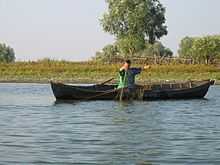
The importance of fishing on the Danube, which was critical in the Middle Ages, has declined dramatically. Some fishermen are still active at certain points on the river, and the Danube Delta still has an important industry.
The Upper Danube ecoregion alone has about 60 fish species and the Lower Danube–Dniester ecoregion has about twice as many.[17] Among these are an exceptionally high diversity of sturgeon, a total of six species (beluga, Russian sturgeon, bastard sturgeon, sterlet, starry sturgeon and European sea sturgeon), but these are all threatened and have largely–or entirely in the case of the European sea sturgeon–disappeared from the river.[17] The huchen, one of the largest species of salmon, is endemic to the Danube basin, but has been introduced elsewhere by humans.[18]
Tourism
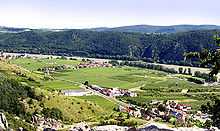
Important tourist and natural spots along the Danube include the Wachau Valley, the Nationalpark Donau-Auen in Austria, Gemenc in Hungary, the Naturpark Obere Donau in Germany, Kopački rit in Croatia, Iron Gate in Serbia and Romania, the Danube Delta in Romania, and the Srebarna Nature Reserve in Bulgaria.
Also, leisure and travel cruises on the river are of significance. Besides the often frequented route between Vienna and Budapest, some ships even go from Passau in Germany to the Danube Delta and back. During the peak season, more than 70 cruise liners are in use on the river, while the traffic-free upper parts can only be discovered with canoes or boats. The Danube region is not only culturally and historically of importance, but also due to its fascinating landmarks and sights important for the regional tourism industry. With its well established infrastructure regarding cycling, hiking and travel possibilities, the region along the Danube attracts every year an international clientele. In Austria alone, there are more than 14 million overnight stays and about 6.5 million arrivals per year.[19]
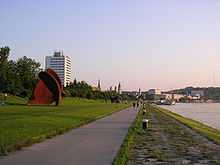
The Danube Banks in Budapest are a part of Unesco World Heritage sites, they can be viewed from a number of sightseeing cruises offered in the city.
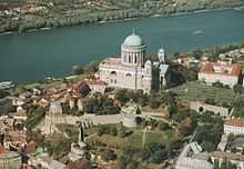
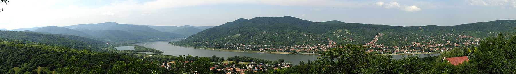
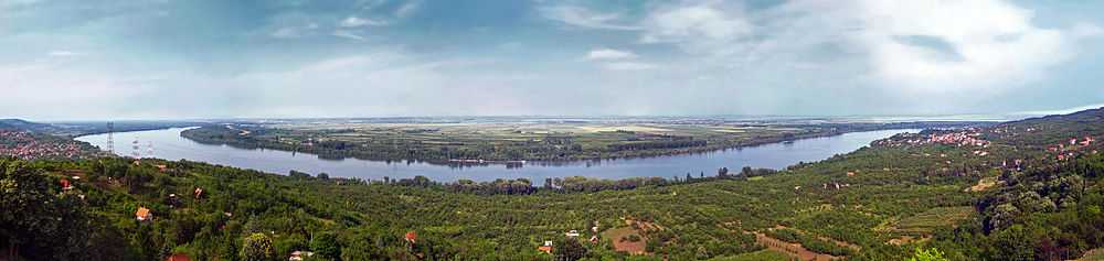
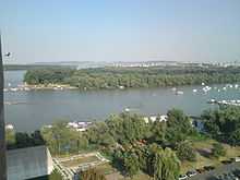
The Danube Bend is also a popular tourist destination.
Danube Bike Trail
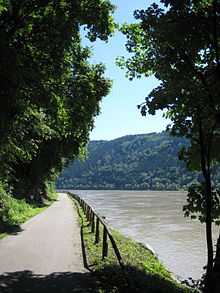
The Danube Bike Trail (also called Danube Cycle Path or the Donauradweg) is a bicycle trail along the river. Especially the parts through Germany and Austria are very popular, which makes it one of the 10 most popular bike trails in Germany.[20]
The Danube Bike Trail starts at the origin of the Danube and ends where the river flows into the Black Sea. It is divided into four sections:
- Donaueschingen-Passau (559 km)
- Passau-Vienna (340 km)
- Vienna-Budapest (306 km)
- Budapest-Black Sea (1670 km)
Sultans Trail
The Sultans Trail is a hiking trail that runs along the river between Vienna and Smederevo in Serbia. From there the Sultans Trail leaves the Danube, terminating in Istanbul. Sections along the river are as follows.
Donausteig
In 2010 the Donausteig, a hiking trail from Passau to Grein, was opened. It is 450 kilometres (280 mi) long and it is divided into 23 stages. The route passes five Bavarian and 40 Austrian communities. An impressive landscape and beautiful viewpoints, which are along the river, are the highlights of the Donausteig.[21]
The Route of Emperors and Kings
The Route of Emperors and Kings is an international touristic route leading from Regensburg to Budapest, calling in Passau, Linz and Vienna. The international consortium ARGE Die Donau-Straße der Kaiser und Könige, comprising ten tourism organisations, shipping companies, and cities, strives for the conservation and touristic development of the Danube region.[19]
In medieval Regensburg, with its maintained old town, stone bridge and cathedral, the Route of Emperors and Kings begins. It continues to Engelhartszell, with the only Trappist monastery in Austria. Further highlight-stops along the Danube include the “Schlögener Schlinge”, the city of Linz, which was European Capital of Culture in 2009 with its contemporary art richness, the Melk Abbey, the university city of Krems and the cosmopolitan city of Vienna. Before the Route of Emperors and Kings ends, you pass Bratislava and Budapest, the latter which was seen as the twin town of Vienna during the times of the Austro-Hungarian Empire.
Since ancient Roman times, famous emperors and their retinue travelled on and along the Danube and used the river for travel and transportation. While travelling on the mainland was quite exhausting, most people preferred to travel by ship on the Danube. So the Route of Emperors and Kings was the setting for many important historical events, which characterize the Danube up until today.
The route got its name from the Holy Roman Emperor Frederick I of Barbarossa and the crusaders as well as from Richard I of England who had been jailed in the Dürnstein Castle, which is situated above the Danube. The most imperial journeys throughout time were those of the Habsburg family. Once crowned in Frankfurt, the emperors ruled from Vienna and also held in Regensburg the Perpetual Diet of Regensburg. Many famous castles, palaces, residences and state-run convents where built by the Habsburger along the river. Nowadays they still remind us of the bold architecture of the “Donaubarock”.
Today, people can not only travel by boat on the Danube, but also by train, by bike on the Danube Bike Trail or walk on the “Donausteig” and visit the UNESCO World Heritage cities of Regensburg, Wachau and Vienna.[22]
Important national parks
- Naturpark Obere Donau (Germany)
- Donauauen zwischen Neuburg und Ingolstadt (Germany) - map
- Nature protection area Donauleiten (Germany)
- Nationalpark Donau Auen (Austria) - map
- Chránená krajinná oblasť Dunajské luhy (Slovakia) - map
- Danube-Ipoly National Park (Hungary) - map
- Danube-Drava National Park (Hungary) - map
- Naturalpark Kopački Rit (Croatia) - map
- Gornje Podunavlje Nature Reserve (Serbia) - map
- Fruška Gora National park (Serbia)
- Koviljsko-petrovaradinski rit Nature Reserve (Serbia)
- Great War Island Nature Reserve (Serbia)
- Đerdap National park (Serbia)
- Iron Gates Natural Park (Romania)
- Persina Nature Park (Bulgaria) - map
- Kalimok-Brushlen Protected Site (Bulgaria) - map
- Srebarna Nature Reserve (Bulgaria) - map
- Natural Park Măcin Mountains (Romania)
- Natural Park Small Island of Brăila (Romania)
- Biosphere Reserve Danube Delta (Romania) - map
- Danube Biosphere Reserve in Ukraine
Cultural significance
- The Danube is mentioned in the title of a famous waltz by Austrian composer Johann Strauss, An der schönen, blauen Donau (On the Beautiful Blue Danube). This piece is well known across the world and is also used widely as a lullaby. The Waves of the Danube (Romanian: Valurile Dunării) is a waltz by the Romanian composer Ion Ivanovici (1845–1902). Joe Zawinul wrote a symphony about the Danube called Stories of the Danube. It was performed for the first time at the 1993 Bruckner festival, at Linz.
- In 2008, the Finnish indie rock band Wiidakko released a song called Tonava (Danube in Finnish) on their second album Asiat joita et voi koskaan saavuttaa.[24]
- The Danube figures prominently in the Bulgarian National Anthem, as a symbolic representation of the country's natural beauty. In Lithuanian folklore songs appearance of Danube (Dunojus, Dunojėlis) is more common than the appearance of the longest Lithuanian river Neman.
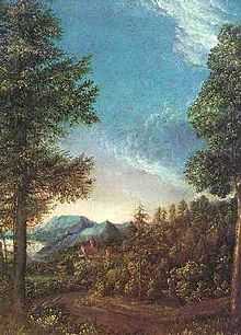
- The German tradition of landscape painting, the Danube school, was developed in the Danube valley in the 16th century.
- One of Claudio Magris's masterpiece is called Danube (ISBN 1-86046-823-3). The book, published in 1986, is a large cultural-historical essay, in which Magris travels the Danube from the very first sources to the delta, tracing the rich European ethnic and cultural heritage, literary and ideological past and present along the way.
- Jules Verne's The Danube Pilot (1908) ("Le Pilote du Danube") depicts the adventures of fisherman Serge Ladko as he travels down the river. Algernon Blackwood's The Willows, about a boat excursion on the river, is considered one of the greatest stories in the literature of the supernatural.
- The river is the subject of the film The Ister (2004) (official site here ). Parts of the German road movie Im Juli take place along the Danube. In Nicolas Roeg's 1980 film Bad Timing, the border crossing over the Danube between Bratislava and Vienna is a recurring site in which the romance between Milena (Teresa Russell), Alex (Art Garfunkel) and Milena's husband Stefan (Denholm Elliot) is played out.
- In the Star Trek universe, the Danube-class runabout is a type of starship used by the Federation Starfleet, most notably in the Deep Space Nine series.
- The river is mentioned a great number of times throughout the Earth's Children Saga by Jean M. Auel, especially in the book The Plains of Passage, when the main characters Ayla and Jondalar travel west along this river, which they call the Great Mother River, due to its big size.
- Miklós Jancsó's film the Blue Danube Waltz (1992)
- The Hungarian sweet speciality, Duna kavics ("Danube Pebbles") is named after the river.
- A Hungarian folk ensemble, the Danube Folk Ensemble (Duna Művészegyüttes) is named after the river. The group is made up of 30 dancers and musicians. During their performances they show the Hungarian folk music, dance and costumes.
- There are Hasidic (Chabad Nigunnim) songs called "dunai", dating from around 1800. They are often lullabys and are named after the Dunay river. Farmers around the river used to come to it and sing spiritual songs to thank their god for the great beauty which they saw every day.
See also
- 2006 European floods
- Between the Woods and the Water, a travel book telling of a Danubian journey in 1934
- The Ister, 2004 film
- List of crossings of the Danube
- Steamboats on the Danube
References
- ↑ 1.0 1.1 Katičić, Radoslav. Ancient Languages of the Balkans, Part One. Paris: Mouton, 1976: 144.
- ↑ Dyer, Robert (1974). "Matoas, the Thraco-Phrygian name for the Danube, and the IE root *madų". Glotta (Vandenhoeck & Ruprecht (GmbH & Co. KG)) 52 (1/2): 91.
- ↑ Šašel Kos, Marjeta (2009). "Reka kot božanstvo — Sava v antiki" [River as a Deity – The Sava in Antiquity]. In Barachini, Jožef. Ukročena lepotica: Sava in njene zgodbe [The Tamed Beauty: The Sava and Its Stories] (PDF) (in Slovene and abstract in English). Sevnica: Javni zavod za kulturo, šport, turizem in mladinske dejavnosti. pp. 42–50. ISBN 978-961-92735-0-0.
- ↑ 4.0 4.1 "Countries of the Danube River Basin". International Commission for the protection of the Danube River. Retrieved 2010-11-13.
- ↑ http://www.unece.org/fileadmin/DAM/env/water/blanks/assessment/black.pdf
- ↑ Treaty of Peace with Turkey signed at Lausanne, Lausanne, Switzerland, 24 July 1923, retrieved 6 December 2014
- ↑ Adakale Island in River Danube
- ↑ Riječni gusari u Srbiji pljačkaju hrvatske brodove (Serbian)
- ↑ "Ukrainian Danube Shipping Company Says Its Ships Are Being Attacked Frequently In Romanian Part Of River Danube". Un.ua. Retrieved 2012-06-11.
- ↑ Romanian Pirats Attack Ukrainian Ships More Frequently (Ukrainian)
- ↑ Pirates on the lower Danube at rivercruiseinfo.com
- ↑ Reports Of 'Pirates Of The Danube' Get The Old Heave-Ho at Radio Free Europe
- ↑ "Daily hydrological report". State Hydrometeorological Bureau of the Republic of Croatia. Retrieved 2010-09-09.
- ↑ Dacia Preistorica, Nicolae Densusianu (1913).
- ↑ "The Danube". International Association of Water Supply Companies in the Danube River Catchement Area. Retrieved 2012-07-28.
- ↑ "The Danube," The Times, February 13, 1883, page 12
- ↑ 17.0 17.1 Hales, J. (2013). Upper Danube. Freshwater Ecoregions of the World. Retrieved 25 February 2013.
- ↑ Froese, Rainer and Pauly, Daniel, eds. (2013). "Hucho hucho" in FishBase. February 2013 version.
- ↑ 19.0 19.1 "Press release of the "ARGE Donau Österreich"" (PDF) (in German). Retrieved 2014-04-01.
- ↑ "Die ADFC-Radreiseanalyse 2013 – Zahlen, Daten und Fakten" (in German). Retrieved 12 March 2014.
- ↑ "Donausteig". Retrieved 1 April 2014.
- ↑ "The Route of Emperors and Kings". Retrieved 29 March 2014.
- ↑ Žmuc, Irena (2010). "Sustained Interest". In Županek, Bernarda. Emona: Myth and Reality (PDF). Museum and Galleries of Ljubljana; City Museum of Ljubljana. p. 63. ISBN 978-961-6509-20-6.
- ↑ https://www.youtube.com/watch?v=20ES9xlnZTM
External links
| Wikimedia Commons has media related to Danube. |
-
 Geographic data related to Danube at OpenStreetMap
 - Danube watershed map and information from the World Resources Institute
- Danube Panorama Project
- сайт о Дунае (Russian)
- Danube and the sport of rowing
- Danube river image pool on Flickr
- Danube Tourist Commission (German)
- danubemap.eu - The Tourist Map of the Danube
- International Commission for the Protection of the Danube River
- Bridges of Budapest over the Danube
- Description of the Danube estuary in June 1877, The Times of London
| |||||||||||||||||||||||||
| ||||||||||||||||||