Dante, Virginia
| Dante | |
|---|---|
| CDP | |
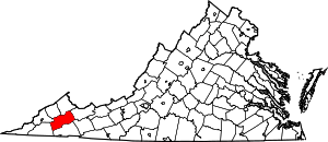
 Dante Location within the Commonwealth of Virginia | |
| Coordinates: 36°58′44″N 82°17′29″W / 36.97889°N 82.29139°WCoordinates: 36°58′44″N 82°17′29″W / 36.97889°N 82.29139°W | |
| Country | United States |
| State | Virginia |
| County | Russell |
| Time zone | Eastern (EST) (UTC-5) |
| • Summer (DST) | EDT (UTC-4) |
| ZIP codes | 24237 |
| FIPS code | 51-21312 |
| GNIS feature ID | 2630763 |
Dante is a census-designated place in Russell County, Virginia. The population as of the 2010 Census was 649.[1]
History
Dante (originally called "Turkeyfoot" due to the confluence of hollows) was originally settled in the late 1700s and early 1800s by western frontiersmen. Explosive growth occurred in the early 1900s with the discovery and exploitation of numerous bituminous coal seams. Southern industrialist George L. Carter made it the northern terminus of the Clinchfield Railroad and made it the headquarters of the Clinchfield Coal Company, which began to mine the nearby hollows (mainly Bear Wallow and Straight Hollow) during the early part of the 20th century. As a result, immigrants from Germany, Hungary, Greece, Poland and other central European countries flocked to the area. In 1912 Sandy Ridge, which lies immediately to the north of Dante, was punctured by the Sandy Ridge Tunnel and allowed the Clinchfield Railroad to extend all the way to Elkhorn City, Kentucky. The coal seams surrounding the town were largely exhausted by the mid 1960s and were closed in favor of new mines such as Moss #3 (A,B,C and D mines) in Duty, Virginia, which began in the late 1950s and was finally closed in the late 1970s after mining the combined Jawbone and Tiller seams to a height in excess of 30 feet of clean, refinable coal. Today, Dante is mostly a decaying coal town. CSX Transportation still operates the Dante Yard, and the Clinchfield Coal Company offices are now apartments.
Climate
The climate in this area is characterized by hot, humid summers and generally mild to cool winters. According to the Köppen Climate Classification system, Dante has a humid subtropical climate, abbreviated "Cfa" on climate maps.[2]
References
- ↑ Virginia Trend Report 2: State and Complete Places (Sub-state 2010 Census Data). Missouri Census Data Center. Accessed 2011-06-08.
- ↑ Climate Summary for Dante, Virginia
External links
| |||||||||||||||||||||||||