Dagupan
| Dagupan | ||
|---|---|---|
| Independent component city | ||
|
Welcome arch | ||
| ||
| Nickname(s): Milk Fish Capital of the Philippines; The "Melting Pot" of Pangasinan | ||
 Map of Pangasinan showing the location of Dagupan | ||
.svg.png) Dagupan Location within the Philippines | ||
| Coordinates: 16°02′N 120°20′E / 16.033°N 120.333°ECoordinates: 16°02′N 120°20′E / 16.033°N 120.333°E | ||
| Country | Philippines | |
| Region | Ilocos (Region I) | |
| Province | Pangasinan | |
| District | 4th district of Pangasinan | |
| Founded | 1590 | |
| Cityhood | June 20, 1947 | |
| Barangays | 31 | |
| Government[1] | ||
| • Mayor | Belen T. Fernandez | |
| Area[2] | ||
| • Total | 37.23 km2 (14.37 sq mi) | |
| Population (2010)[3] | ||
| • Total | 163,676 | |
| • Density | 4,400/km2 (11,000/sq mi) | |
| Demonym | Dagupeño | |
| Time zone | PHT (UTC+8) | |
| ZIP code | 2400 | |
| Dialing code | 75 | |
| Income class | 2nd class[4][5] | |
| Website |
dagupan | |


Dagupan, officially the City of Dagupan (Pangasinan: Ciudad na Dagupan), is an independent component city in the province of Pangasinan in the Philippines. According to the census of May 1, 2010, Dagupan City has a population of 163,676 people with an income classification of second class.[4][5]
Located on the Lingayen Gulf on the island of Luzon, Dagupan is a major commercial and financial center north of Manila. Also, Dagupan is one of the centers of modern medical services, media and communication in Northern Luzon. Dagupan is located in the fertile Agno River Valley.
Dagupan is among the top producers of milkfish in the province. From 2001-2003, Dagupan's milkfish production totaled to 35,560.1 metric tons (MT), contributing 16.8 percent to the total provincial production. Of its total production in the past three years, 78.5 percent grew in fish pens/cages while the rest grew in brackishwater fishpond.[6]
Etymology
The city's name was derived from the local Pangasinense word pandaragupan, meaning "gathering place" as the city has been a regional market center for centuries.
Demographics
Pangasinenses are the major people in Dagupan City who are known to be Businessmen and traders. Income Classification: 2nd Class Registered Voters (2010): 92,867 Population : (as of May 1, 2010): 163,676 District: 4th [7]
Geography
Dagupan City covers a total land area of 3,723 hectares (9,200 acres),[2] bounded by the Lingayen Gulf in the north, San Fabian in the northeast, Mangaldan in the east, Calasiao in the south and Binmaley in the west. Land use is primarily for agriculture with 35.98% of the total land area, fishpond, cropland, residential with 22.88%; others uses are commercial, industrial, institutional, government private, parks, and roads.
Climate
| Climate data for Dagupan City | |||||||||||||
|---|---|---|---|---|---|---|---|---|---|---|---|---|---|
| Month | Jan | Feb | Mar | Apr | May | Jun | Jul | Aug | Sep | Oct | Nov | Dec | Year |
| Record high °C (°F) | 37 (99) |
37 (99) |
38 (100) |
39 (102) |
42 (108) |
38 (100) |
38 (100) |
38 (100) |
40 (104) |
42 (108) |
34 (93) |
37 (99) |
42 (108) |
| Average high °C (°F) | 30 (86) |
30 (86) |
32 (90) |
33 (91) |
33 (91) |
31 (88) |
31 (88) |
30 (86) |
31 (88) |
31 (88) |
30 (86) |
30 (86) |
31 (87.8) |
| Daily mean °C (°F) | 26 (79) |
26 (79) |
28 (82) |
29 (84) |
29 (84) |
28 (82) |
28 (82) |
27 (81) |
28 (82) |
28 (82) |
27 (81) |
26 (79) |
27.5 (81.4) |
| Average low °C (°F) | 22 (72) |
22 (72) |
23 (73) |
25 (77) |
26 (79) |
25 (77) |
25 (77) |
25 (77) |
25 (77) |
25 (77) |
24 (75) |
22 (72) |
24.1 (75.4) |
| Record low °C (°F) | 13 (55) |
18 (64) |
18 (64) |
17 (63) |
18 (64) |
16 (61) |
22 (72) |
17 (63) |
10 (50) |
20 (68) |
11 (52) |
16 (61) |
10 (50) |
| Average rainfall mm (inches) | 4.3 (0.169) |
19.1 (0.752) |
27.3 (1.075) |
45.2 (1.78) |
153.3 (6.035) |
271.3 (10.681) |
411.1 (16.185) |
532.0 (20.945) |
364.4 (14.346) |
182.5 (7.185) |
56.3 (2.217) |
24.4 (0.961) |
2,091.2 (82.331) |
| Avg. rainy days | 3 | 2 | 3 | 5 | 14 | 17 | 22 | 23 | 21 | 13 | 7 | 4 | 134 |
| Average relative humidity (%) | 85 | 84 | 84 | 84 | 88 | 91 | 92 | 94 | 93 | 92 | 89 | 86 | 88.5 |
| Mean daily sunshine hours | 11.7 | 12 | 12.4 | 12.9 | 13.3 | 13.5 | 13.4 | 13.0 | 12.6 | 12.1 | 11.8 | 11.6 | 12.52 |
| Source #1: World Weather Online[8] | |||||||||||||
| Source #2: Weatherbase [9] | |||||||||||||
History
Spanish occupation
The area that is now known as Dagupan was described as marshland thickly covered with mangrove and nipa palm trees. The natives lived along the shoreline and riverbanks of Calmay, Pantal, and Bonuan. But there were also communities in Malued, Lasip, Pogo, and Bacayao. The natives called the area Bacnotan which would later be incorporated into the encomienda of Lingayen that was established in 1583.
The foreign traders would come to the Lingayen coast to trade gold that was brought down to the area by tribesmen from the Cordillera Mountains. Aside from traders, Filipinos also had experience with pirates from Japan and China. One of the Chinese corsairs was Lim Feng (in Fukienese, Lim A-hong), who would be known in Philippine history as Limahong.
Limahong sailed down the Ilocos coast with 62 ships and attacked Manila on November 30, 1574. The Spanish, however, repulsed Limahong's two attacks. The Chinese corsair repaired to Pangasinan to establish a colony at Bacnotan on December 2, 1574. But the Spanish conquistador Juan de Salcedo laid siege to his fortress for eight months by blocking the river outlets. Limahong purportedly broke through the siege by digging a channel from the Agno River through the Bacnotan marshes to Lingayen Gulf
In 1661 a big fire hit Bacnotan during the Malong Revolt, led by Andres Malong of Binalatongan, against the forced labor and mandatory sale of local goods imposed by the Spanish colonial government. The fire broke out after Malong sent 3,000 supporters, most of whom were Zambal tribesmen, to Ilocos and Cagayan to fight the Spaniards. The people of Bacnotan, many of whom joined the Spanish forces in repelling the Zambal marauders, rebuilt the town and renamed it Nandaragupan, meaning where once stood the commercial center, indicating its early importance as a trade, commercial and political center in the region. In 1720, Nandaragupan was chartered as a town but its name was simplified to Dagupan. Malong was eventually beheaded in the city's Pantal bridge in 1661 by Spanish authorities.
Dagupan was also the birthplace of a ladino named Caragay, who led another uprising in 1719 against the provincial governor (alcalde mayor, in Spanish), who had him flogged for what appeared to be a false accusation of smuggling. Governor Antonio del Valle had Caragay arrested in the village of Nantagalan, northeast of San Jacinto and Mangaldan and flogged. Vowing vengeance, Caragay organized a band of men who hounded the governor until they were able to kill him. Historians view Caragay as a "model" of the revolts of Palaris and Diego Silang. In 1762, Dagupan would be one of the first towns to join the Palaris Revolt against Spain.
In 1780 Pantal, originally named Pantalan (port), became a trading center and docking station for merchant ships. At about the same time, the bangus industry thrived and mangrove swamps were converted into fishponds, starting the land conversions that would later have an impact on flooding and earthquake damage in the province. The opening of the Pantalan dock eased the transportation of goods from Pangasinan to other parts of the country, spurring the cultivation of idle lands in the eastern part and the development of fishponds in the western part of the province. The new dock also eased communications between the colonial government, its soldiers and the missionaries, who were tasked to colonize the natives in the Cordillera Mountains and the Cagayan Valley region and exploit its gold deposits.
In July 1787 the Spaniards began to build a road to connect Pangasinan and the Cagayan Valley, the home of several head-hunting tribesmen who refused to submit to Spanish rule. Although it took several years to complete, the road would play a vital role in the colonization of the Cagayan Valley and the Cordillera Mountains.
The Palaris and Silang revolts, which occurred simultaneously with the British Invasion of the Philippines demonstrated to the Spaniards the importance of ports in Pangasinan and Ilocos to the security of the entire island of Luzon. They thus became centers of Spanish governance and acculturation in the 19th century. When the port of Manila was opened to foreign trade in 1830, tobacco from Pangasinan and Cagayan Valley were shipped to the colonial capital via Dagupan and Lingayen. Foreign trading agents also began to make appearances in the two towns, starting a new era of prosperity, especially for the provincial gentry.
The Filipino scholar Maximo Kalaw found the description of the American writer David Barrows as appropriate:
The Filipino had now become embarked upon a new current of intellectual experience—a course of enlightenment which has been so full of unexpected development. Throughout the islands a class was rapidly growing up to which the new industries had brought wealth. Their means enabled them to build spacious and splendid homes of the fine hardwoods of the Philippines, and to surround themselves with such luxuries as the life of the islands permitted. This class was rapidly gaining education.
This was also true of the Dagupan gentry. Trade enriched many families and allowed them to send their scions to study overseas. These young men returned to the Philippines not only with technical knowledge in their chosen fields but also with the intellectual currents of the time, including constitutional republicanism which swept Spain in 1810.
News from the colonial government in Manila also reached Dagupan at a faster pace with the completion of the Manila-Dagupan Railway in 1891. The railway would play a significant role not only in the economic development of Pangasinan but also in the success of the Philippine Revolution.
Under the First Philippine Republic
Not much is known of Dagupeños involvement in the Katipunan and the first and second parts of the Philippine Revolution. But on March 7, 1898, the Dagupeños began a coordinated attack on Spanish forces that appears to have been planned months in advance. It is now known as the Battle of Dagupan (1898)
The Dagupeño leaders of the attack were Juan Solis Galvan, Teodoro Villamil, Pedro de Venecia, Macario Meneses and Daniel Maramba. They were under the overall command of Francisco Macabulos, who had just liberated the provinces of Pampanga and Tarlac. He was assisted by Ramon Manalang, who was based in Alaminos. Communications between Macabulos and Manalang were coordinated by Macario Meneses of Bonuan.
The Spanish forces were commanded by Federico Caballos, who had troops garrisoned at all the towns of Pangasinan. In Dagupan, he had men at the Colegio de San Alberto Magno, which guarded the western approach to the town; at the foot of Quintos Bridge, which guarded the east; and his main force at the Catholic church.
Although the revolutionary forces were ill-equipped (most of them armed only with bolos and lances), they attacked the Spaniards with an ingenious rolling trench. The "trenches" were made of several banana tree trunks, wrapped in sheets of dried nipa palm leaves. The trenches were seven feet in diameter and the revolutionists would roll them toward Spanish positions so they could fight them in close-quarter combat with their bolos and lances.
Galvan led the back at the Colegio de San Alberto Magno while Villamil and De Venecia swooped down on the enemies at Quintos Bridge. The Tagalog forces from Nueva Ecija, who were better armed, joined the Dagupeños who attacked the Spanish position at the church. The Dagupeños held the Spanish troops at bay in Dagupan while other revolutionists liberated other towns in the province. Maramba later joined the battle after fighting in Sta. Barbara and Mangaldan.
By July 21, after four months and 16 days, Macabulos unleashed a concerted attack. Spanish and Filipino troops exchanged fire for two nights and a day before Caballos surrendered on July 23, 1898, six weeks after the Declaration of Philippine Independence on June 12, 1898.
After the town returned to normal, President Emilio Aguinaldo named Galvan president of the municipal council. Galvan was a ranking officer of the Katipunan. Galvan Street along which the public market was built was named after him.
Japanese Occupation
The Japanese planes bombed in Dagupan on December 1941 and through the occupying the Japanese forces on 1942. The established of the military garrisons of the Imperial Japanese armed forces stationed in Dagupan. The general headquarters of the Philippine Commonwealth Army from 1942 to 1946 and Philippine Constabulary under the 2nd Infantry Regiment from 1944 to 1946 was active and stationed in Dagupan during Japanese Occupation. Pangasinese freedom resistance was invaded on Dagupan from 1942 to 1945 and supporting local soldiers under the Philippine Commonwealth Army units and attacking Japanese and aftermath the three year conflicts by the guerrillas were retreating Japanese troops. Before the liberating American troops under the US Sixth Army was landed and invading Japanese troops at Lingayen Gulf on January 9, 1945. Stated the Battle of Pangasinan on 1945 between the Imperial Japanese and the combined United States-Philippine Commonwealth troops.
Allied liberation
On January 8–January 9, 1945, U.S. General Douglas MacArthur landed his amphibious liberation force in the city's "Blue Beach" section along the Lingayen Gulf. From his beachhead in Dagupan, along with those in neighboring towns Lingayen, Binmaley and San Fabian, MacArthur's forces under General Walter Krueger together with the Philippine Commonwealth troops under the Philippine Army and Philippine Constabulary units were able to penetrate Japanese defenses in Luzon island and liberate Filipino and allied prisoners of war near Cabanatuan in the province of Nueva Ecija, and in Manila's University of Sto. Tomas, among others.
Dagupan's cityhood

Dagupan became a city by virtue of Republic Act No. 170, authored by Speaker Eugenio Pérez. It was signed into law by President Manuel Roxas on June 20, 1947.
On October 15, 1947, President Roxas issued Executive Order No. 96 fixing the city limits to include the towns of Mangaldan, Pangasinan and Calasiao, Pangasinan but the residents of Calasiao rejected inclusion into the new city, causing controversy over the election that was held on November 10, 1947.
The dispute was brought before the Supreme Court of the Philippines which subsequently validated the election and ruled that Dagupan became a city on June 20, 1947, when Roxas signed the charter into law.
Despite the controversy attending Dagupan's rise as a city, the new city mayor, Alipio B. Fernandez Sr., embarked on an infrastructure program that would develop unused swamplands toward the south and west.
In 1948 he built a road from barrio Mayombo to barrio Tapuac, passing through the edge of barrio Pogo Chico. The road, built mostly on reclaimed swampland, was named Perez Boulevard, in honor of Rodrigo D. Perez, Dagupan's first lawyer and Assemblyman. The road was needed because of the increasing number of commercial establishments on Torres Bugallon Avenue and the growing number of residents at the southern limits of the city. In 1946, the Dagupan City High School was transferred from Torres Bugallon Avenue. Perez Boulevard expanded the commercial area south especially after Fernandez built a new public market at the bank of the river.
Later, Fernandez's successor Teofilo Guadiz, who served from 1954–1957 and 1958–1959, would also contribute to the city's expansion by extending Rizal Street, which was only then from Torres Bugallon to Rivera Street, up to the Iglesia ni Cristo compound. Also, he extended Galvan Street, which was then up to Gomez Street only, up to Perez Boulevard. He also secured funds from Senator Cipriano P. Primicias, Sr., a native of Pangasinan, to build a two-story semi-permanent building for the city high school. Guadiz also replaced the Bailey bridge on Perez Boulevard with a concrete one.
The westward expansion of the city went as far as Lucao, which was also swampland. Local historian Restituto Basa surmised that the name Lucao may have been derived from the shellfish called lukan that used to abound in the swampy area.
In June 1962, Dagupan was shaken by a series of strong earthquakes which occurred at irregular intervals for about three weeks. The quakes toppled the belfry of the Roman Catholic Church. The epicenter of the earthquake was in Calmay, where real estate values dropped after the tremors. Many people from Calmay, Carael and island barrios evacuated to other towns.
In 1968, the national government agencies opened offices in Dagupan and other key cities across the country. The daytime population increased substantially, causing congestion in the city that began to see the appearance of public utility tricycles.
On July 16, 1990, a magnitude 7.7 earthquake struck northern Luzon. The worst hit cities were Cabanatuan, Baguio and Dagupan.
Many public and private structures were destroyed or damaged when river banks slid into the Pantal River and dry land into the swampy areas. Streets were ruptured and the ground subsided, causing buildings to sink by as much as two meters. Other buildings tilted severely, especially along Perez Boulevard. One building tilted by as much as 19 degrees, but generally, the magnitude of tilt was within 2 to 5 degrees.
There were sand boils in several areas in the city and drainage systems were clogged by the accumulated sand causing temporary flooding of the city's main thoroughfares. Some houses remained underwater by 30–50 cm. for several months. The whole stretch of Don Jose Calimlim Street and swampy areas and fishpond communities, such as Barangay Lasip Grande, remained underwater even during low tide conditions.
At the height of the earthquake, an eyewitness told experts of the Philippine Institute of Volcanology and Seismology that he saw rolling during the earthquake and a jeep parked along the road vanished from his sight.
Scientists blamed the destruction on the liquefaction of land that was had not compacted enough since it was reclaimed from the swamp or marsh. It was also blamed on the active shifting of Pantal River, which left abandoned meanders on which people built structures. Varying degrees of damage were sustained in the different affected areas of Dagupan City. Phivolcs said a study of the damage during the earthquake indicate that susceptibility to liquefaction in different parts of Dagupan City can be related to the relative ages of the geologic features and the deposits underlying them.
The degree of destruction along A.B. Fernandez Avenue, which largely lies on reclaimed swampland, was generally less than that in the Perez Blvd. area except near its intersection with Rizal Street. The great degree of liquefaction along a 100 m stretch of A.B. Fernandez Ave. can be traced to changes in the channel of Pantal River. Prior to north eastward expansion of Dagupan City, Pantal River used to meander around the area now partly occupied by A.B. Fernandez Ave. and Rizal St. before running parallel to Pantal Road.

Local government

City of Dagupan Official Seal
Old City of Dagupan Seal

The old seal was submitted and approved by the Philippine Heraldry Committee in 1948. Railroad and highway were added to emphasize the city's geographic location and to stress the strategic role it played to establish Dagupan as the trading post of the North.
2012 New official seal and logo
The National Historical Commission of the Philippines' Chair Maria Serena I. Diokno and Paquito Ochoa, Jr.[10] signed the Certificate of the new Dagupan Seal. Mayor Benjamin S. Lim officially received on December 9, 2012, the certificate of registration for this city's new corporate seal from Secretary Mar Roxas (Republic Act 7160) permanently abandoning the 68-year old logo and seal, saying: "Mula sa araw na ito, ito na ang magiging simbolo ng Bangus Capital of the World."
Dr. Carmelo John E. Vidal, of Poblacion Oeste and director of the Center for Integrated Extension Services and National Service Training Program Unit of the University of Luzon designed the approved new Seal, to wit: the word BANGUS, lower portion of the seal, midpart of the 7 waves representing the 7 river tributaries; unique shape of the shield; slogan "Sigue Dagupan"; the highway crisscrossing the railroad track, Pandarugupan or meeting place; the horseshoe magnet, the rising sun, gear wheel, and blazing torch and the gear wheel; the stars represent the city's 31 barangays; 1947 signifies Dagupan, Pangasinan birth by Republic Act No. 170.[11]
Barangays
| Population census of Dagupan City | ||
|---|---|---|
| Year | Pop. | ±% p.a. |
| 1903 | 52,865 | — |
| 1918 | 69,567 | +1.85% |
| 1939 | 87,976 | +1.12% |
| 1948 | 87,864 | −0.01% |
| 1960 | 90,586 | +0.25% |
| 1970 | 97,148 | +0.70% |
| 1975 | 105,237 | +1.62% |
| 1980 | 112,967 | +1.43% |
| 1990 | 122,247 | +0.79% |
| 1995 | 126,214 | +0.60% |
| 2000 | 130,328 | +0.69% |
| 2007 | 149,554 | +1.92% |
| 2010 | 163,676 | +3.34% |
Dagupan City is politically subdivided into 31 barangays.[4]
| Barangay | Population (2010)[3] |
|---|---|
| Bacayao Norte | 3283 |
| Bacayao Sur | 2632 |
| Barangay I (T. Bugallon) | 673 |
| Barangay II (Nueva) | 2824 |
| Barangay IV (Zamora) | 841 |
| Bolosan | 3862 |
| Bonuan Binloc | 8246 |
| Bonuan Boquig | 13686 |
| Bonuan Gueset | 22042 |
| Calmay | 6706 |
| Carael | 4732 |
| Caranglaan | 6459 |
| Herrero | 2428 |
| Lasip Chico | 1370 |
| Lasip Grande | 2622 |
| Lomboy | 1367 |
| Lucao | 9748 |
| Malued | 9406 |
| Mamalingling | 1456 |
| Mangin | 3700 |
| Mayombo | 7937 |
| Pantal | 17174 |
| Poblacion Oeste | 4523 |
| Pogo Chico | 4603 |
| Pogo Grande | 2112 |
| Pugaro Suit | 4757 |
| Salapingao | 2890 |
| Salisay | 2134 |
| Tambac | 2328 |
| Tapuac | 4391 |
| Tebeng | 2744 |
Economy

Dagupan has a high concentration of 57 banks and 44 financial institutions that support its status as the major trading and commercial center in North Luzon. It has several malls, supermarkets and multi-national food chains.
Dagupan was identified in 2008 as one of the country's most competitive small-sized cities for doing business in an annual survey conducted by the Asian Institute of Management (AIM) Policy Center. It was ranked based on its respective costs of doing business; the dynamism of the local economies; human resources and training; infrastructure; the responsiveness of the local government units to business’ needs; and the quality of life of its inhabitants. The annual survey is a research undertaking of the AIM Policy Center that seeks to identify the best cities in the country in which to live, work and operate a business.
Dagupan has been named one of the most competitive cities outside Metro Manila in the Philippine Cities Competitiveness Ranking Project 2009 (PCCRP) of the Asian Institute of Management Policy Center. The study used six criteria in ranking the 29 cities: dynamism of local economy, responsiveness of the LGUs to business, infrastructure, quality of life, and cost of doing business and human resource and training. Dagupan City is the most competitive among the emerging cities. It bested the cities of Angeles, Butuan, Cotabato, Lucena, Naga, Legaspi, Pagadian, Puerto Princesa, Ormoc, Iligan, Tagum, and San Fernando in La Union, Surigao, Tuguegarao, Tacloban and Santiago.
Education
Since the Spanish time, Dagupan has always been the center of education in Ilocos Region (Region 1). The private sector-driven centers of education University of Pangasinan, University of Luzon and Lyceum-Northwestern University lead, 14 colleges and 18 vocational schools and 3 technical learning centers, 19 secondary schools and 53 elementary schools both in public and private.
Colleges and Universities
Public Secondary Schools
|
Private Primary and Secondary Schools
|
Health services
Medical and health service centers abound in Dagupan. Out of 51 hospitals in Pangasinan, 12 are located in the city. The largest of these is the Region I Medical Center with hospital bed capacity of 300.
Hospitals and medical centers
- Cuison Family Clinic and Hospital
- Dagupan Doctors Villaflor Memorial Hospital
- Dagupan Orthopedic Center
- Decena Hospital
- Luzon Medical Center
- Medical Centrum Dagupan
- Nazareth General Hospital
- Pangasinan Center for Family Medicine
- Region I Medical Center
- Specialist Group Hospital & Trauma Center
- University of Pangasinan Medical Center
Tourism and culture


Dagupan's interesting points, attractions, events and heritage sites include:
- Sanctuario de San Juan Evangelista - altar where Leonor Rivera, Dr. José Rizal's lost love, married Henry Kipping, a British engineer who set up the first Dagupan railway system.
- Metropolitan Cathedral of St. John the Evangelist - the Katipuneros defeated the Spaniards within these 2 church grounds on July 21, 1898.
- Dagupan railway station - Spanish Railroad Station (Las Estaciones Ferrocarril Manila-Dagupan)
- Dawel River Cruise *Bonuan Blue Beach or Tondaligan Beach
- MacArthur's Landing Site Marker, Bonuan Blue Beach
- Tondaligan People's Park, 72 hectare foreshore
- Gen. Arthur Macarthur's Dagupan Headquarters in Dagupan - Home Economics Building of the West Central Elementary School 1909, the Gabaldon Building.
- Ruins of Franklin Bridge
- Century-old Water Tower
- City Museum has the masterpieces of National Artist Victorio Edades
- Senior Citizen's Park, José Rizal, Children's Park and Andrés Bonifacio monument
- Region I Medical Center[12]
Dining
The city contains a variety of restaurants and fast foods outlets. In Bonuan-Tondaligan area alone, there are about 30 seafood diners, which serve Dagupan Bangus any way one wants it: inihaw (roasted/broiled), sinigang, kilawen and daing. For those with adventurous palate, they can try the local favorites pigar-pigar in Galvan Street, kaleskes in Herrero-Perez. Dagupan's other delicacies and foods include sunflower seeds brittle, cassava cake, buko pastillas, bocayo, rice cakes such as puto.
Nightlife
The city's disco houses, clubs, music bars, video lounge and concert halls offer diverse recreation.
Bangus Festival
The longest barbecue measured 1,007.56 metres (3,305.6 ft). It was created by the people of Dagupan City on May 3, 2003, as part of the city's Bangus Festival. Dagupan City broke Canchia's (Peru) 613 metres (2,011 ft) long record set in November 1999. Dagupeños grilled Bonuan bangus at the "Kalutan ed Dagupan" street party.[13] (Dagupan City Fiesta 2012 - "Bayanihan Sa Liwanag" LIGHTS).
Communication and mass media
Dagupan City is home to regional television stations of GMA Network, Solar News Channel, TV5 and ABS-CBN, sixteen radio broadcasting stations, at least seventeen local newspapers and three cable television companies. There are also four internet service providers and more than 30 cyber cafes now operating in the city.
The city government of Dagupan is the first local government unit (LGU) in the country to apply the Electronic Commerce Law. Thus, business transactions with the city hall can be made via internet.
Television networks
- DZRH News Television: Channel 3
- PTV: Channel 5
- IBC: Channel 8
- GMA-7: Channel 10 (Dagupan)
- GROVE TV: Channel 12
- 9TV: Channel 13
- ETC: Channel 22
- 3ABN International & Hope Channel Philippines: Channel 24
- Net 25: Channel 26
- TV5: Channel 28
- UNTV 37: Channel 30
- ABS-CBN: Channel 32 (Dagupan)
- AksyonTV: Channel 34
- ABS-CBN Sports+Action: Channel 36 (Dagupan)
- GMA News TV-11: Channel 38 (Dagupan)
- BEAM: Channel 40
- 2nd Avenue: Channel 42
- Brigada News TV: Channel 46
- Global News Network: Channel 48 (Dagupan)
- Sonshine Media Network International: Channel 50
- MYX Channel Dagupan: Channel 66
AM Radio stations
- DZMQ-AM: Radyo ng Bayan 756 (Philippine Broadcasting Service)
- DZRD-AM: Sonshine Radio 981 (Sonshine Media Network International)
- DWDC-AM: Radyo Budyong 1017 (Intercontinental Broadcasting Corporation)
- DWIN-AM: Radyo Agila 1080 (Relay Station) (Eagle Broadcasting Corporation)
- DZWN-AM: Bombo Radyo Dagupan 1125 (Consolidated Broadcasting System)
- DWCM-AM: Aksyon Radyo Dagupan 1161 (Pacific Broadcasting System)
- DZDG-AM: Life Radio Dagupan 1224 (End-Time Mission Broadcasting System)
- DWPR-AM: PoweRadio 1296 (Multipoint)
- DWDH-AM: DZRH Dagupan 1440 (Relay Station) (Manila Broadcasting Company)
- DZSD-AM: Super Radyo Dagupan 1548 (Relay Station) (GMA Network Inc.)
FM Radio Stations
- DWIZ-FM: DWIZ 89.3 Music and News Radio (formerly Home Radio) (Aliw Broadcasting Corporation)
- DWKT-FM: Energy FM 90.3 (Ultraonic Broadcasting System Inc.)
- DWTL-FM: Barangay 93.5 (formerly Campus Radio Dagupan) (GMA Network Inc.)
- DWEC-FM: MOR 94.3 (ABS-CBN Broadcasting Corporation)
- DWID-FM: Love Radio 98.3 (Manila Broadcasting Company)
- DWHY-FM: Star FM 100.7 (People's Broadcasting Service)
- DWON-FM: iFM 104.7 (Radio Mindanao Network Inc.)
- DWHR-FM: Yes FM 106.3 Dagupan (Pacific Broadcasting System)
News Programs
- TV Patrol North Central Luzon (ABS-CBN TV-32 Dagupan, Tarlac and Cabanatuan, ABS-CBN TV-12 Olongapo and TV-13 Zambales, TV-22 Baler)
- 24 Oras North Central Luzon (GMA TV-10 Dagupan, GMA TV-10 Olongapo, GMA TV-5 Baler, GMA TV10 Pampanga, GMA TV-10 Baguio and GMA TV-5 Mountain Province)
- Aksyon Northern Luzon (TV5 TV-28 Baguio, TV5 TV-28 Dagupan, TV5 TV-32 Tuguegarao, TV5 TV-11 Isabela)
Sister cities
Local
 Santiago City, Philippines
- Zamboanga City, Philippines
International
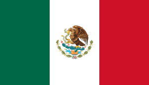 Guadalajara, Mexico[14]
 Iwata, Shizuoka, Japan[15]
 Milpitas, California, United States
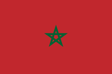 Tangier, Morocco
References
- ↑ "Cities". Quezon City, Philippines: Department of the Interior and Local Government. Retrieved 26 November 2012.
- ↑ 2.0 2.1 "Province: Pangasinan". PSGC Interactive. Retrieved on 2012-05-29.
- ↑ 3.0 3.1 "Total Population by Province, City, Municipality and Barangay: as of May 1, 2010" (PDF). 2010 Census of Population and Housing. National Statistics Office. Retrieved 5 September 2013.
- ↑ 4.0 4.1 4.2 "Municipality/City: Dagupan City". PSGC Interactive. Retrieved on 2012-05-29.
- ↑ 5.0 5.1 "LGU Profile Dagupan City". Local Governance Performance Management Systems. Retrieved on 2012-05-29.
- ↑ "Dagupan City: The Home of the World’s Longest Barbecue". National Statistical Coordination Board Profile. Retrieved on 2012-05-30.
- ↑ http://www.nscb.gov.ph/activestats/psgc/municipality.asp?muncode=015518000®code=01&provcode=55
- ↑ "Dagupan, Philippines: Average Temperatures and Rainfall". World Weather Online. Retrieved 15 September 2014.
- ↑ "Dagupan, Philippines Travel Weather Averages (Weatherbase)". Weatherbase. Retrieved 15 September 2014.
- ↑ http://www.pia.gov.ph/news/index.php?article=411355391039
- ↑ http://www.luzonsundayreport.com/dagupans-new-corporate-seal-a-symbol-of-citys-sovereignty-bsl/
- ↑ http://www.dagupantourism.com/
- ↑ sunstar.com.ph, Sto. Tomas gets world's longest barbecue title
- ↑ "Sister Cities, Public Relations". Guadalajara municipal government. Archived from the original on March 2, 2012. Retrieved March 12, 2013.
- ↑ "30th year of Dagupan-Iwata sisterhood pact celebrated". Sunday Punch Line. Retrieved December 4, 2013.
Further reading
- Basa, Restituto (1972). Story of Dagupan. Manaois Press.
External links
| Wikimedia Commons has media related to Dagupan. |
 |
Lingayen Gulf | San Fabian | | |
| Binmaley | |
Mangaldan | ||
| ||||
| | ||||
| Calasiao |
