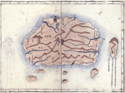
Daedongyeojido

Daedongyeojido (also Daedong yeojido, Korean: 대동여지도, 大東輿地圖, lit. "The Great Map of the East Land") is a large scale map of Korea produced by Chosun Dynasty cartographer and geologist Kim Jeong-ho in 1861.[1] A second edition was printed in 1864.[1] One source describes it as the "oldest map in Korea".[2] Daedongyeojido is considered very advanced for its time, and marks the zenith of pre-modern Korean cartography.[1]
Description

The map consists of 22 separate, foldable booklets, each covering approximately 47 kilometres (29 mi) (north-south) by 31.5 kilometres (19.6 mi) (east-west). Combined, they form an map of Korea that is 6.7 metres (22 ft) wide and 3.8 metres (12 ft) long.[1] The scale of the map is 1:162,000.[3] The map was printed from 70 basswood woodblocks, engraved on both sides.[1] The techniques to create the map have been described as a hybrid of Korean and Western methods.[4]
The map is praised for precise delineations of mountain ridges, waterways, and transportation routes. It also has markings for settlements, including villages, as well as notable administrative and cultural areas and sites, such as past and present government offices and military sites, public warehouses, government horse ranches, beacon fire mounds, and royal tombs.[1][5]
Several versions of the map exist, with some variations (such as the number of booklets, either 21 or 22). The map was accompanied by a preface explaining the methodology, and a legend, as well as additional statistics, and a separate map for the Korean capital of Seoul.[5]
100,000-won banknote controversy
In 2008 the map was considered as an image for one of the 100,000-won banknotes, which would have been the highest-denomination South Korean banknote to date. However, the map of Daedongyeojido did not portray the internationally disputed Liancourt Rocks (known as Dokdo islands in Korea), and the ensuing public debate in Korea over whether the map on a banknote should be changed to include them made the image too controversial for such a high-visibility placement.[6][7][8] Eventually, the 100,000-won banknote was cancelled due to the controversy stirred by the issue.[9][10][11]
See also
References
- ↑ 1.0 1.1 1.2 1.3 1.4 1.5 "Detail Map of Korea (Daedongyeojido), Woodblock". National Museum of Korea. Retrieved 2014-02-09.
- ↑ The Review of Korean Studies. Academy of Korean Studies. 2005. p. 34.
Daedongyeojido (Map of the Great East) was made by Kim Jeong-ho and is the oldest map in Korea.
- ↑ "Territorial map of the Great East 1861 :: American Geographical Society Library Digital Map Collection". Collections.lib.uwm.edu. 2009-11-20. Retrieved 2014-02-09.
- ↑ John Rennie Short (2 April 2012). Korea: A Cartographic History. University of Chicago Press. p. 12. ISBN 978-0-226-75366-9.
- ↑ 5.0 5.1 "Daedongyeojido( Map of Korea by Kim Jeongho ) | kdata.kr". Data.kdata.kr. 1999-02-22. Retrieved 2014-02-09.
- ↑ "Arirang News :: BOK to Put Dokdo on New 100,000 Won Bill". Arirang.co.kr. 2008-07-22. Retrieved 2014-02-09.
- ↑ "The Chosun Ilbo (English Edition): Daily News from Korea - Dokdo Issue Delays New W100,000 Notes". English.chosun.com. Retrieved 2014-02-09.
- ↑ Koehler, Robert (2008-10-08). "No Banknote Would Be Complete Without Dokdo". Rjkoehler.com. Retrieved 2014-02-13.
- ↑ "50,000-Won Banknote to Be Issued in May". Koreatimes.co.kr. 2009-01-27. Retrieved 2014-02-09.
- ↑ "Debut of W100,000 Note Delayed Indefinitely". English.donga.com. 2009-01-01. Retrieved 2014-02-13.
- ↑ "SKorea shelves new banknote". News.asiaone.com. 2008-12-18. Retrieved 2014-02-13.
External links
| Wikimedia Commons has media related to Daedongyeojido. |