D22 road (Croatia)
| |
|---|---|
| Route information | |
| Length: | 42.7 km (26.5 mi) |
| Major junctions | |
| From: |
|
|
| |
| To: |
|
| Location | |
| Counties: | Varaždin, Koprivnica-Križevci |
| Major cities: | Novi Marof, Križevci, Sveti Ivan Žabno |
| Highway system | |
| State roads in Croatia | |


Novi Marof, at the western terminus of the D22 road
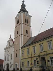
Križevci, on the D22 road route
D22 is a state road in the central Croatia connecting Novi Marof on the D3 state road to the A4 motorway Novi Marof interchange, Križevci on the D41 state road and Sveti Ivan Žabno on the D28 state road.[1] The road is 42.7 km (26.5 mi) long.[2][maps 1]
The road, as well as all other state roads in Croatia, is managed and maintained by Hrvatske ceste, state owned company.[3]
Traffic volume
Traffic is regularly counted and reported by Hrvatske ceste, operator of the road.[4]
| D22 traffic volume | ||||
| Road | Counting site | AADT | ASDT | Notes |
| |
1233 Možđenec | 2,748 | 2,841 | Between the D3 and D24 junction. |
| |
1228 Vukovec | 1,147 | 1,325 | Adjacent to the L26003 junction. |
| |
2101 Križevci - south | 4,543 | 4,602 | Adjacent to the L26069 junction. |
Road junctions and populated areas
| D22 junctions/populated areas | |||||
| Type | Slip roads/Notes | ||||
| |
Novi Marof The western terminus of the road. | ||||
| |
The D22 and D24 are concurrent to the west. | ||||
| |
Možđenec Ž2135 to Grana. | ||||
| |
Sudovec Ž2175 to Visoko. | ||||
| |
Gornja Rijeka | ||||
| |
Dropkovec | ||||
| |
Vukovec | ||||
| |
Finčevec | ||||
| |
Sveti Petar Orehovec Ž2176 to Miholec. Ž2177 to Selanec. | ||||
| |
Ž2138 to Selanec and Kalnik. | ||||
| |
Guščerovec Ž2178 to Bočkovec. | ||||
| |
Križevci Ž2089 to Apatovec and Ludbreg. Ž2179 to Sveta Helena. Ž2209 within the city. Ž2210 to Veliki Potočec. | ||||
| |
Križevci interchange Under construction. | ||||
| |
Cubinec Ž2211 to Poljana Križevačka and Dubrava (D26). | ||||
| |
Bukovje Križevačko | ||||
| |
Ž2228 to Trema. | ||||
| |
Sveti Ivan Žabno The eastern terminus of the road. | ||||
| |||||
Maps
- ↑ Overview map of the D22 (Map). OpenStreetMap. Retrieved July 21, 2014.
Sources
- ↑ 1.0 1.1 "Regulation on motorway markings, chainage, interchange/exit/rest area numbers and names". Narodne novine (in Croatian). April 24, 2003.
- ↑ Ministry of Sea, Transport and Infrastructure (Croatia) (June 4, 2013). "Decision on categorization of public roads as state roads, county roads and local roads" (in Croatian). Narodne novine. Retrieved July 21, 2014.
- ↑ "Public Roads Act". Narodne novine (in Croatian). December 14, 2004.
- ↑ "Traffic counting on the roadways of Croatia in 2013 - digest". Hrvatske ceste. May 2014. Retrieved 2014-07-19.
| ||||||||||||||||||||||||||||||||||