D'Aguilar, Queensland
| D'Aguilar Queensland | |
|---|---|
|
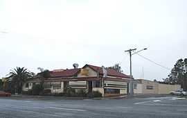
D'Aguilar Hotel | |
| Population | 1,094 (2006)[1] |
| Postcode(s) | 4514 |
| Location |
|
| LGA(s) | Moreton Bay Region |
| State electorate(s) | Glass House |
| Federal Division(s) | Longman |
D'Aguilar is a rural township and locality in the Moreton Bay Region, Queensland, Australia.[2][3] It is located northwest of the larger centre of Caboolture. At the 2006 census, the locality recorded a population of 1,094 persons, living in 373 inhabited dwellings, all of which were detached houses.[1]
D'Aguilar lies on the D'Aguilar Highway between Wamuran and Woodford. It is also the northern endpoint of Mount Mee Road, which leads south through Delaneys Creek and Mount Mee to Dayboro.
The town is named for George Charles D'Aguilar, a military officer who wrote Regulations and Punishments of the British Army, the army textbook in use at the time of the town's establishment.[4] As time passed, the mountain range that the town is situated in came to be named after the town.
References
- ↑ 1.0 1.1 Australian Bureau of Statistics (25 October 2007). "D'Aguilar (Urban Centre/Locality)". 2006 Census QuickStats. Retrieved 2008-05-06.
- ↑ "D'Aguilar (town) (entry 9157)". Queensland Place Names. Queensland Government. Retrieved 30 May 2014.
- ↑ "D'Aguilar (locality) (entry 45386)". Queensland Place Names. Queensland Government. Retrieved 30 May 2014.
- ↑ "Caboolture Town History". Retrieved 2008-05-06.
External links
| Wikimedia Commons has media related to D'Aguilar, Queensland. |
Coordinates: 26°58′40″S 152°48′07″E / 26.9778°S 152.8020°E