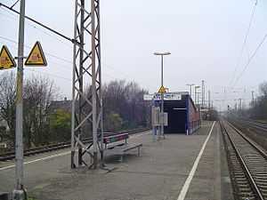
Düsseldorf-Eller Süd station
Düsseldorf-Eller Süd station | |
|---|---|
| Through station | |
 | |
| Location |
Düsseldorf, North Rhine-Westphalia Germany |
| Coordinates | 51°11′52.5″N 6°50′10.8″E / 51.197917°N 6.836333°ECoordinates: 51°11′52.5″N 6°50′10.8″E / 51.197917°N 6.836333°E |
| Line(s) | |
| Platforms | 2 |
| Other information | |
| Station code | 1409 |
| DS100 code | KDES |
| Category | 5 [1] |
| History | |
| Opened | 1967[2] |
Düsseldorf-Eller Süd station is located approximately 5 kilometres south of Düsseldorf Hauptbahnhof in the district of Eller in the city of Düsseldorf in the German state of North Rhine-Westphalia. It is on the Cologne–Duisburg line and is classified by Deutsche Bahn as a category 5 station.[1] It is served by Rhine-Ruhr S-Bahn lines S 6 every 20 minutes and by a few services of S 68 in the peak hour.
Location
The station is located between the districts of Düsseldorf-Wersten, Düsseldorf-Eller, and Dusseldorf-Oberbilk. It has a central island platform and is elevated above the Karlsruher Straße, on which its entrance is located. A second entrance is located on the underpass between the streets of Sturmstraße and Konradstraße.
Services
Currently, the station is served by two S-Bahn lines and four bus lines.
| Preceding station | Rhine-Ruhr S-Bahn | Following station | ||
|---|---|---|---|---|
toward Köln-Nippes | S 6 | toward Essen Hbf |
||
toward Langenfeld | S 68 | toward Wuppertal-Vohwinkel |
Notes
- ↑ 1.0 1.1 "Stationspreisliste 2015" [Station price list 2015] (PDF) (in German). DB Station&Service. 15 December 2014. Retrieved 1 January 2015.
- ↑ "Düsseldorf-Eller Süd operations". NRW Rail Archive (in German). André Joost. Retrieved 1 October 2011.
References
- Amt für Verkehrsmanagement - Landeshauptstadt Düsseldorf (2003). Nahverkehrsplan 2002–2007 (in German). Düsseldorf: Landeshauptstadt Düsseldorf.
- Verkehrsverbund Rhein-Ruhr (1999). Argumente für den ÖPNV (in German). 9, Zielnetz 2015. VRR GmbH.