Cuney, Texas
| Cuney, Texas | |
|---|---|
| Town | |
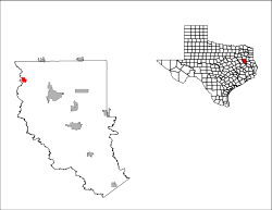
 Location of Cuney, Texas | |
 | |
| Coordinates: 32°2′3″N 95°25′4″W / 32.03417°N 95.41778°WCoordinates: 32°2′3″N 95°25′4″W / 32.03417°N 95.41778°W | |
| Country | United States |
| State | Texas |
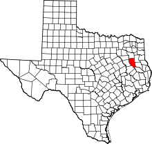
| County | Cherokee |
| Area | |
| • Total | 1.6 sq mi (4.2 km2) |
| • Land | 1.6 sq mi (4.2 km2) |
| • Water | 0.0 sq mi (0.0 km2) |
| Elevation | 374 ft (114 m) |
| Population (2000) | |
| • Total | 145 |
| • Density | 88.6/sq mi (34.2/km2) |
| Time zone | Central (CST) (UTC-6) |
| • Summer (DST) | CDT (UTC-5) |
| ZIP code | 75759 |
| Area code(s) | 430, 903 |
| FIPS code | 48-18152[1] |
| GNIS feature ID | 1333813[2] |
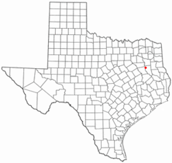
Cuney is a town in Cherokee County, Texas, United States. Cuney is located in the northwestern portion of the county along U.S. Highway 175. The population was 145 at the 2000 census. A July 1, 2008 U.S. Census Bureau estimate placed the population at 147.[3]
Cuney was the only "wet" town in Cherokee County, between the mid-1980s and 2009, then voters in Rusk came out in favor of beer/wine sales. Cuney is still the only town in the county selling liquor.
Geography
Cuney is located at 32°2′3″N 95°25′4″W / 32.03417°N 95.41778°W (32.034127, -95.417769).[4] It is situated just west of the junction of U.S. Highway 175 and FM 855 in northwestern Cherokee County, approximately 10 miles (16 km) northwest of Jacksonville and 22 miles (35 km) northwest of Rusk.[5]
According to the United States Census Bureau, the town has a total area of 1.6 square miles (4.1 km2), all of it land.
History
The site was first settled by freed slaves just after the Civil War. The settlement was initially known as Andy, after Andrew "Andy" Bragg, one of the area's first black homeowners. He arrived in 1870.[6] A community didn't develop until 1902, when the site became a flag stop on the Texas and New Orleans Railroad, which became part of the Southern Pacific system in 1961. Around 1914, Palestine cashier H.L. Price and several local investors formed a company and platted a town site. They named the town Cuney, after Price's son, Cuney Price – who in turn had been named for Norris Wright Cuney, a prominent black politician and head of the state's Republican Party.[7] A post office was established in 1917 and a number of businesses were operating in the community by the early 1920s. With the paving of U.S. Highway 175 in 1929, most of the businesses moved a mile north of the railroad to take advantage of the increased traffic. The population was estimated at 100 in 1929, but declined to only 25 by the mid-1930s. A number of businesses closed after World War II as agricultural prices decreased and residents moved to other cities with greater employment opportunities. Cuney had a population of 75 in the early 1950s. From that period, the community steadily grew, and Cuney was incorporated in November 1983.[5][7] In the 1990 census, the town had 170 residents. That number had fallen to 145 by 2000.
Demographics
As of the census[1] of 2000, there were 145 people, 59 households, and 36 families residing in the town. The population density was 88.6 people per square mile (34.1/km²). There were 78 housing units at an average density of 47.7 per square mile (18.4/km²). The racial makeup of the town was 11.03% White, 83.45% African American, 0.69% Native American, 0.69% Asian, 0.69% from other races, and 3.45% from two or more races. Hispanic or Latino of any race were 0.69% of the population.
There were 59 households out of which 27.1% had children under the age of 18 living with them, 28.8% were married couples living together, 23.7% had a female householder with no husband present, and 37.3% were non-families. 27.1% of all households were made up of individuals and 11.9% had someone living alone who was 65 years of age or older. The average household size was 2.46 and the average family size was 3.11.
In the town the population was spread out with 32.4% under the age of 18, 2.1% from 18 to 24, 26.2% from 25 to 44, 24.8% from 45 to 64, and 14.5% who were 65 years of age or older. The median age was 38 years. For every 100 females there were 98.6 males. For every 100 females age 18 and over, there were 88.5 males.
The median income for a household in the town was $18,333, and the median income for a family was $17,500. Males had a median income of $18,438 versus $22,083 for females. The per capita income for the town was $7,612. There were 35.0% of families and 37.1% of the population living below the poverty line, including 43.4% of under eighteens and 44.8% of those over 64.
Education
The Town of Cuney is served by the Jacksonville Independent School District.
References
- ↑ 1.0 1.1 "American FactFinder". United States Census Bureau. Retrieved 2008-01-31.
- ↑ "US Board on Geographic Names". United States Geological Survey. 2007-10-25. Retrieved 2008-01-31.
- ↑ "Table 4: Annual Estimates of the Resident Population for Incorporated Places in Texas, Listed Alphabetically: April 1, 2000 to July 1, 2008" (CSV). United States Census Bureau, Population Division. 2009-07-01. Retrieved 2009-08-19.
- ↑ "US Gazetteer files: 2010, 2000, and 1990". United States Census Bureau. 2011-02-12. Retrieved 2011-04-23.
- ↑ 5.0 5.1 "Cuney, Texas". Texas Escapes Online Magazine. Retrieved 2009-08-19.
- ↑ "Cuney, Texas". Cherokee County, TXGenWeb. Retrieved 2009-08-19.
- ↑ 7.0 7.1 "Cuney, Texas". The Handbook of Texas online. Retrieved 2009-08-19.
External links
- Cuney, TX from the Handbook of Texas Online
| |||||||||||||||||||||||||||||||||