Cumberland Parkway
| |
|---|---|
| Route information | |
| Length: | 88.547 mi[1] (142.503 km) |
| Major junctions | |
| West end: |
|
| |
| East end: |
|
| Location | |
| Counties: | Barren, Metcalfe, Adair, Russell, Pulaski |
| Highway system | |

The Louie B. Nunn Cumberland Parkway is an 88-mile-long (142 km) east–west controlled-access highway in the U.S. state of Kentucky, extending from Barren County in the west to Somerset in the east. It is one of nine highways that are part of Kentucky's parkway system.
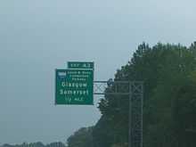
The parkway begins at an interchange with Interstate 65 (exit 43) between Smiths Grove and Park City. It travels east through rolling farmland to its eastern terminus at U.S. Route 27 in north of Somerset. The road parallels Kentucky Route 80 for its entire length. The parkway passes the cities of Glasgow, Edmonton, Columbia, and Russell Springs. It passes near two popular state parks: Lake Cumberland State Resort Park and Barren River Lake State Resort Park. The length of the parkway is designated unsigned Kentucky Route 9008 (LN 9008).
The road is named after Louie B. Nunn, a former Kentucky governor from Barren County who was instrumental in the road's creation. Originally called the Cumberland Parkway from its opening in 1972-1973, it was renamed for Nunn in 2000.
Presumably, the Nunn Parkway was built to Interstate Highway standards at its time of construction aside from some at-grade intersections and traffic signals near its east end, which were eliminated in 2010 by constructing a northwestern bypass around Somerset. The east end of the parkway is currently a partial cloverleaf at U.S. 27. An extension to complete the northern bypass is in the works.
History
The Nunn Parkway, as with all nine parkways, was originally a toll road. By Kentucky state law, toll collection ceases when enough toll has been collected or funds received from other sources, such as a legislative appropriation, to pay off the construction bonds for the parkway. In the case of the Nunn, toll booths were removed in 2003 because of a bill in the United States Congress sponsored by Hal Rogers (R-KY), which included an appropriation to pay off the bonds on the parkway as well as the Daniel Boone Parkway in eastern Kentucky. The state legislature then renamed the Boone Parkway for Rogers, which sparked a controversy among residents of the region and the offspring of Boone. Nunn tried to calm the controversy by suggesting the state rename the Nunn Parkway for Rogers instead, restoring the Boone name, saying that the Cumberland Parkway had been named for Nunn without his consent anyway.
The road had three toll plazas:
- Mile Marker 3 — Bon Ayr (in Barren County)
- Exit 27 (Edmonton)
- Exit 62 (Russell Springs)
Future
Interstate 66
The parkway has been designated a part of the "Future Interstate 66 Corridor," a proposed four-lane Interstate utilizing the existing Cumberland and Hal Rogers Parkway, among other routes, across the southern tier of Kentucky. It cannot be signed as an Interstate until it has permanent connections to the east and west, both of which have not been determined due to the King Coal Highway in West Virginia being demoted to a corridor-standard roadway for US 52. As part of the upgrade of the Cumberland Parkway to interstate standards for I-66, two new exits have been proposed by the Kentucky Transportation Cabinet (KYTC). The first new exit (which has been completed) is at KY 61 (Exit 46) making a second connection to Columbia and a connection to Burkesville and Dale Hollow Lake. The second proposed exit is yet to be under construction or completed by early to late 2012 at KY 910 (Exit 70) connecting the small towns of Salem and Windsor. Currently, the LCADD (Lake Cumberland Area Development District) and the Kentucky Transportation Cabinet are considering proposal to upgrade KY80 from Nancy Exit and KY 910 near future KY910 exit, to form a connector type road into Casey County, intersecting with US 127 between Phil KY and Dunnville KY. If funds are authorized down the road this may extend KY910 further west as well, crossing the Green River, and connecting to KY206/KY70 near Cresten KY. Eventual plans call for an upgraded KY 70 from Liberty to Campbellsville, making this a major regional highway from future Interstate 66, to the future Heartland Parkway.
New interchange in Glasgow
Sometime in late 2014 or in 2015, The Louie B. Nunn Cumberland Parkway is expected to have a new interchange in the Glasgow area to serve the western extension of the Veterans Outer Loop. The eastern extension of that road has been opened in early 2012, complete with the opening of exit 15, which serves the eastern extension of Veterans Outer Loop, designated at KY 1519. The designation for the western extension will be announced upon completion of the new western extension of the Veterans Outer Loop which will include the new on- and off-ramps of the Cumberland Parkway, and a new at-grade intersection with Kentucky Route 1297[2] [3] [4]
Exit list
| County | Location | mi[1] | km | Exit | Destinations | Notes |
|---|---|---|---|---|---|---|
| Barren | 0.000 | 0.000 | 0 | Westbound only; signed as exits 0B (south) and 0A (north) | ||
| Glasgow | 11.467 | 18.454 | 11 | |||
| 14.027 | 22.574 | 14 | ||||
| 15.374 | 24.742 | 15 | ||||
| Metcalfe | Edmonton | 27.400 | 44.096 | 27 | ||
| Adair | Columbia | 46.000 | 74.030 | 46 | ||
| 48.886 | 78.674 | 49 | ||||
| Russell | Russell Springs | 62.419 | 100.454 | 62 | ||
| Pulaski | 78.349 | 126.090 | 78 | |||
| Somerset | 86.104 | 138.571 | 86 | |||
| 88.258 | 142.037 | 88 | Partial cloverleaf interchange: only westbound ramps open | |||
| 1.000 mi = 1.609 km; 1.000 km = 0.621 mi | ||||||
References
- ↑ 1.0 1.1 "Kentucky Transportation Cabinet - Division of Planning - Highway Information System Official Milepoint Route Log Extract". Retrieved 2007-04-08.
- ↑ http://www.wbko.com/home/headlines/Glasgow-Outer-Loop-to-be-Completed-Next-Year-187898311.html Glasgow Outer Loop to be completed Next Year (from WBKO.com January 22, 2013)]
- ↑ http://www.bgdailynews.com/news/multiple-road-projects-on-tap/article_b78405b6-6470-565d-97b2-185456c03c33.html
- ↑ Expect lane closures this week on Happy Valley Road - Glasgow Daily Times (Sept. 18, 2014)
External links
Route map: Bing