Crowchild Trail
|
Crowchild Trail, just north of 5 Ave NW looking South | |
| Location | Calgary, Alberta |
|---|---|

Crowchild Trail is an expressway located on the west side of Calgary, Alberta, Canada.
Part of this road was the Old Banff Coach Road when it was an actual coach road. It was first paved in the 1930s. It then became the main highway to Banff. It was the home of the famous Eamon's Bungalow Camp and service station. When the Trans-Canada Highway was created it dropped in importance.[1][2]
The road was originally signed as 24th Street SW from North Glenmore Park to the Bow River, 24th Street NW from the Bow to the intersection with 16th Avenue NW (the Trans-Canada Highway, Highway 1), and Highway 1A from 16th Ave NW to the city limits. It was renamed Crowchild Trail in March, 1971 in honour of David Crowchild, Chief of the Tsuu T'ina Nation from 1946 to 1953.
Crowchild Trail's south terminus is located at North Glenmore Park as a minor arterial road. Exiting northbound from the park the road intersects several residential streets within the communities of Lakeview and North Glenmore Park, and several residential dwellings are located on the Trail itself. Continuing northward, its first major intersection is with Glenmore Trail at an interchange that was built in 1981, which is the point at which Crowchild becomes an freeway. After an interchange was completed at 50th Avenue SW in 2003, Crowchild Trail became a true freeway from Glenmore Trail to Kensington Road NW, with overpasses at Flanders Avenue SW, 33rd Avenue SW and 17th Avenue SW and interchange intersections with 10th Avenue SW, Bow Trail and Memorial Drive. The speed limit on the freeway sections are 80 km/h (50 mph).
Traffic slows immediately north of the Bow River (dropping to a principal arterial with a 60 km/h (40 mph) limit), with signal-controlled intersections at Kensington Road NW and 5th Avenue NW, and heavy use by football fans and transit users at McMahon Stadium and students of the University of Calgary. After 24th Avenue NW the road veers northwest, and once again becomes an uninterrupted freeway until the Stoney Trail ring road. As of 2012, the interchange was completed at Stoney Trail, which makes Crowchild Trail a freeway nearly to the city limits, at which point (following a signalized intersection with Twelve Mile Coulee Road), Crowchild Trail continues as Highway 1A, eventually linking to the towns of Cochrane and Canmore.
Major intersections
From south to north, the following intersections[3] are observed along Crowchild Trail:
| Crowchild Trail Exit list | |||||||||||||||||||||||||||||||||||||||||||||||||||||||||||||||||||||||||||||||||||||||||||||||||||||||||||||||||||||||||||||||||||||||||||||||||||||||||||||||||||||||||||||||||||||||||||||||||||||||||||||||||||||||||||||||||||||||||||||||||||||||||||||||||||||||||||||||||||||||||||||||
|---|---|---|---|---|---|---|---|---|---|---|---|---|---|---|---|---|---|---|---|---|---|---|---|---|---|---|---|---|---|---|---|---|---|---|---|---|---|---|---|---|---|---|---|---|---|---|---|---|---|---|---|---|---|---|---|---|---|---|---|---|---|---|---|---|---|---|---|---|---|---|---|---|---|---|---|---|---|---|---|---|---|---|---|---|---|---|---|---|---|---|---|---|---|---|---|---|---|---|---|---|---|---|---|---|---|---|---|---|---|---|---|---|---|---|---|---|---|---|---|---|---|---|---|---|---|---|---|---|---|---|---|---|---|---|---|---|---|---|---|---|---|---|---|---|---|---|---|---|---|---|---|---|---|---|---|---|---|---|---|---|---|---|---|---|---|---|---|---|---|---|---|---|---|---|---|---|---|---|---|---|---|---|---|---|---|---|---|---|---|---|---|---|---|---|---|---|---|---|---|---|---|---|---|---|---|---|---|---|---|---|---|---|---|---|---|---|---|---|---|---|---|---|---|---|---|---|---|---|---|---|---|---|---|---|---|---|---|---|---|---|---|---|---|---|---|---|---|---|---|---|---|---|---|---|---|---|---|---|---|---|---|---|---|---|---|---|---|---|---|---|---|---|---|---|---|---|---|---|---|---|---|---|---|---|---|---|---|
Note: | |||||||||||||||||||||||||||||||||||||||||||||||||||||||||||||||||||||||||||||||||||||||||||||||||||||||||||||||||||||||||||||||||||||||||||||||||||||||||||||||||||||||||||||||||||||||||||||||||||||||||||||||||||||||||||||||||||||||||||||||||||||||||||||||||||||||||||||||||||||||||||||||
Gallery
-
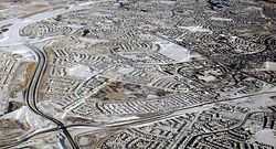
Crowchild Trail at the interchange with Stoney Trail
-
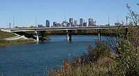
Bridge over Bow River
-

C-Train tracks along Crowchild Trail
See also
References
- ↑ http://calgary.openfile.ca/blog/curator-blog/curated-news/2012/will-corey-hart-save-calgary-heritage-site
- ↑ http://www.cbc.ca/news/canada/calgary/story/2012/05/07/calgary-eamons-plan.html
- ↑ "Crowchild Trail on Alberta Roads". Photographed August 2003. Retrieved 7 September 2009. Check date values in:
|date=(help)
| ||||||||||||||