Créchy
| Créchy | ||
|---|---|---|
|
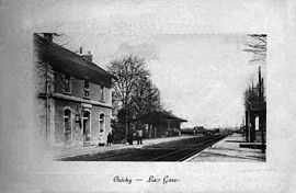
The railway station in the early 20th century | ||
| ||
 Créchy | ||
|
Location within Auvergne region  Créchy | ||
| Coordinates: 46°15′44″N 3°25′27″E / 46.2622°N 3.4242°ECoordinates: 46°15′44″N 3°25′27″E / 46.2622°N 3.4242°E | ||
| Country | France | |
| Region | Auvergne | |
| Department | Allier | |
| Arrondissement | Vichy | |
| Canton | Varennes-sur-Allier | |
| Intercommunality | Varennes Forterre | |
| Government | ||
| • Mayor (2008–2014) | Luce Billet | |
| Area1 | 11.61 km2 (4.48 sq mi) | |
| Population (2008)2 | 473 | |
| • Density | 41/km2 (110/sq mi) | |
| INSEE/Postal code | 03091 / 03150 | |
| Elevation |
233–344 m (764–1,129 ft) (avg. 232 m or 761 ft) | |
|
1 French Land Register data, which excludes lakes, ponds, glaciers > 1 km² (0.386 sq mi or 247 acres) and river estuaries. 2 Population without double counting: residents of multiple communes (e.g., students and military personnel) only counted once. | ||
.svg.png)
Créchy is a commune in the Allier department in central France.
Between this village and nearby Billy, lagerstätten have yielded a rich assemblage of fossils from the Oligocene-Miocene boundary (c. 24-23 million years ago).[1]
Population
| Historical population | ||
|---|---|---|
| Year | Pop. | ±% |
| 1962 | 356 | — |
| 1968 | 440 | +23.6% |
| 1975 | 331 | −24.8% |
| 1982 | 425 | +28.4% |
| 1990 | 481 | +13.2% |
| 1999 | 442 | −8.1% |
| 2008 | 473 | +7.0% |
See also
References
- ↑ Hugueney et al. (2003)
- Hugueney, Marguerite; Berthet, Didier; Bodergat, Anne-Marie; Escuillié, François; Mourer-Chauviré, Cécile & Wattinne, Aurélia (2003): La limite Oligocène-Miocène en Limagne: changements fauniques chez les mammifères, oiseaux et ostracodes des différents niveaux de Billy-Créchy (Allier, France) [The Oligocene-Miocene boundary in Limagne: faunal changes in the mammals, birds and ostracods from the different levels of Billy-Créchy (Allier, France)] [French with English abstract]. Geobios 36(6): 719–731. doi:10.1016/j.geobios.2003.01.002 (HTML abstract)
| Wikimedia Commons has media related to Créchy. |