Coverdale (dale)
Coordinates: 54°15′04″N 1°54′07″W / 54.251°N 1.902°W

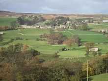
View of Coverdale looking towards Melmerby
Coverdale is a dale in the far east of the Yorkshire Dales, North Yorkshire, England. It takes its name from the River Cover, a tributary of the River Ure. The dale runs south-west from the eastern end of Wensleydale to the dale head at a pass, known as Park Rash Pass,[1] between Great Whernside to the south and Buckden Pike to the north. It is accessible by a single track road, which runs the length of the dale and over the pass to Kettlewell in Wharfedale.
Settlements
- Agglethorpe
- Braidley
- Caldbergh
- Carlton
- Coverham
- East Scrafton
- Horsehouse
- Melmerby
- Middleham
- West Scrafton
References
External links
![]() Media related to Coverdale at Wikimedia Commons
Media related to Coverdale at Wikimedia Commons