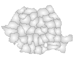
Covasna County
| Covasna County Județul Covasna Kovászna megye | ||
|---|---|---|
| County | ||
|
Landscape in the northern part of Covasna County | ||
| ||
 | ||
| Coordinates: 45°54′N 26°02′E / 45.9°N 26.03°ECoordinates: 45°54′N 26°02′E / 45.9°N 26.03°E | ||
| Country |
| |
| Development region1 | Centru | |
| Historic region | Transylvania | |
| Capital city (Reședință de județ) | Sfântu Gheorghe | |
| Government | ||
| • Type | County Board | |
| • President of the County Board | János Demeter (UDMR) | |
| • Prefect2 | Ervin György | |
| Area | ||
| • Total | 3,710 km2 (1,430 sq mi) | |
| Area rank | 39th in Romania | |
| Population (2002) | ||
| • Total | 222,449 | |
| • Rank | 42nd in Romania | |
| • Density | 60/km2 (200/sq mi) | |
| Time zone | EET (UTC+2) | |
| • Summer (DST) | EEST (UTC+3) | |
| Postal Code | 52wxyz3 | |
| Area code(s) | +40 x674 | |
| Car Plates | CV5 | |
| GDP | US$ 2.1 billion (2008) | |
| GDP/capita | US$ 9,461 (2008) | |
| Website |
County Board County Prefecture | |
|
1The developing regions of Romania have no administrative role. 2 as of 2007, the Prefect is not a politician, but a public functionary. He (or she) is not allowed to be a member of a political party, and is banned to have any political activity in the first six months after the resignation (or exclusion) from the public functionary corps 3w, x, y, and z are digits that indicate the city, the street, part of the street, or even the building of the address 4x is a digit indicating the operator: 2 for the former national operator, Romtelecom, and 3 for the other ground telephone networks 5used on both the plates of the vehicles that operate only in the county limits (like utility vehicles, ATVs, etc.), and the ones used outside the county | ||
Covasna (Romanian pronunciation: [koˈvasna], Hungarian: Kovászna, Hungarian pronunciation:[ˈkovaːsnɒ]) is a county (județ) of Romania, in Transylvania, with the capital city at Sfântu Gheorghe.
Demographics
In 2011, it had a population of 206,261 and the population density was 55.6/km².
In 2002 the ethnic composition of the county was as follows:
According to the 2011 census, the composition of the county was:
- Hungarians – 73.74% (or 150,468)[2]
- Romanians – 22.02% (or 45,021)
- Romani – 4.05% (or 8,267)
- others - 0.19%
Covasna County has the second-greatest percentage of Hungarian population in Romania, just behind the neighboring county of Harghita. The Hungarians of Covasna are primarily Székelys.
| Year | County population[3] |
|---|---|
| 1948 | |
| 1956 | |
| 1966 | |
| 1977 | |
| 1992 | |
| 2002 | |
| 2011 |
Geography
Covasna county has a total area of 3,710 km².
The main part of the relief consists of mountains from the Eastern Carpathians group. Most localities can be found in the valleys and depressions located along the different rivers crossing the county. The main river is the Olt River; along its banks lies the capital city Sfântu Gheorghe.
Neighbours
- Vrancea County and Bacău County in the East.
- Brașov County in the West.
- Harghita County in the North.
- Buzău County in the South.
Economy
Covasna County has been one of the preferred counties for foreign investments, mainly by Hungarian investors, due to the population profile.
The predominant industries in the county are:
- wood
- textiles
- electrical components
- food and beverages
Tourism


The main tourist destinations in the county are:
- The city of Sfântu Gheorghe
- The resorts in the mountains around:
- The mountains:
- Baraolt Mountains
- Bodoc Mountains
- Nemira Mountains
- Întorsurii Mountains
Politics
The Covasna County Assembly has 31 members:
| Political Party | Number of Seats |
|---|---|
| Democratic Union of Hungarians in Romania | 25 |
| Social Democratic Party | 4 |
| Democratic Party | 2 |
Administrative divisions
Covasna County has 2 municipalities, 3 towns and 40 communes.
- Municipalities
- Sfântu Gheorghe – capital city; population: 54,312 (as of 2011)
- Târgu Secuiesc
- Towns
References
| Wikimedia Commons has media related to Covasna County. |
- ↑ National Institute of Statistics, "Populaţia după etnie"
- ↑ Recensamantul Populatiei si Locuintelor 2011: Populația stabilă după etnie – județe, municipii, orașe, comune
- ↑ National Institute of Statistics, "Populația la recensămintele din anii 1948, 1956, 1966, 1977, 1992 și 2002"
External links
- www.covasna.ro – site of Covasna
| ||||||||


