Courbillac
| Courbillac | |
|---|---|
|
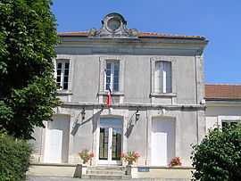
Town hall | |
 Courbillac | |
|
Location within Poitou-Charentes region 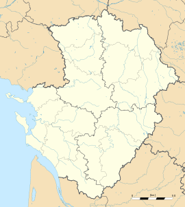 Courbillac | |
| Coordinates: 45°46′07″N 0°10′46″W / 45.7686°N 0.1794°WCoordinates: 45°46′07″N 0°10′46″W / 45.7686°N 0.1794°W | |
| Country | France |
| Region | Poitou-Charentes |
| Department | Charente |
| Arrondissement | Cognac |
| Canton | Rouillac |
| Intercommunality | Rouillacais |
| Government | |
| • Mayor (2008–2014) | Bernard Cote |
| Area1 | 11.83 km2 (4.57 sq mi) |
| Population (2008)2 | 600 |
| • Density | 51/km2 (130/sq mi) |
| INSEE/Postal code | 16109 / 16200 |
| Elevation |
25–70 m (82–230 ft) (avg. 38 m or 125 ft) |
|
1 French Land Register data, which excludes lakes, ponds, glaciers > 1 km² (0.386 sq mi or 247 acres) and river estuaries. 2 Population without double counting: residents of multiple communes (e.g., students and military personnel) only counted once. | |
Courbillac is a commune in the Charente department in southwestern France. In 1886, Philippe Delamain, a merchant from Jarnac, discovered by chance a cemetery from the Merovingian period in Herpes near Courbillac. He found an outstanding collection of weapons, brooches, jewellery and vases dating from the time when the Franks had settled in Herpes (5th-7th centuries AD). His collection was dispersed soon after its discovery but a significant proportion is in the British Museum, London.[1]
Population
| Historical population | ||
|---|---|---|
| Year | Pop. | ±% |
| 1793 | 535 | — |
| 1800 | 613 | +14.6% |
| 1806 | 598 | −2.4% |
| 1821 | 612 | +2.3% |
| 1831 | 680 | +11.1% |
| 1841 | 920 | +35.3% |
| 1846 | 950 | +3.3% |
| 1851 | 965 | +1.6% |
| 1856 | 990 | +2.6% |
| 1861 | 1,034 | +4.4% |
| 1866 | 961 | −7.1% |
| 1872 | 946 | −1.6% |
| 1876 | 884 | −6.6% |
| 1881 | 814 | −7.9% |
| 1886 | 761 | −6.5% |
| 1891 | 706 | −7.2% |
| 1896 | 689 | −2.4% |
| 1901 | 691 | +0.3% |
| 1906 | 653 | −5.5% |
| 1911 | 640 | −2.0% |
| 1921 | 528 | −17.5% |
| 1926 | 553 | +4.7% |
| 1931 | 518 | −6.3% |
| 1936 | 516 | −0.4% |
| 1946 | 457 | −11.4% |
| 1954 | 423 | −7.4% |
| 1962 | 411 | −2.8% |
| 1968 | 400 | −2.7% |
| 1975 | 426 | +6.5% |
| 1982 | 456 | +7.0% |
| 1990 | 473 | +3.7% |
| 1999 | 502 | +6.1% |
| 2008 | 600 | +19.5% |
See also
References
- ↑ British Museum Collection
External links
| Wikimedia Commons has media related to Courbillac. |