County of Rawbelle

Rawbelle
Queensland

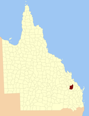
Location within Queensland
Lands administrative divisions around Rawbelle:
Pelham Pelham Clinton
Dawson Rawbelle Yarrol
Wicklow Wicklow Yarrol

The County of Rawbelle is a cadastral division in Queensland, Australia, located in the Wide Bay–Burnett region.[1][2] On 7 March 1901, the Governor issued a proclamation legally dividing Queensland into counties under the Land Act 1897.[3] Its schedule described Rawbelle thus:

Bounded on the south by the county of Wicklow; on the west by the eastern watershed of the Dawson River; on the north by the northern watersheds of Rawbelle River and Three Moon Creek; and on the east by the county of Yarrol.

Parishes

Rawbelle is divided into parishes, as listed below:

Parish LGA Coordinates Towns
Bailey North Burnett 24°54′S 151°04′E / 24.900°S 151.067°E Monto, Mulgildie
Bingmann North Burnett 24°48′S 150°53′E / 24.800°S 150.883°E
Calrossie North Burnett 25°14′S 150°35′E / 25.233°S 150.583°E
Cania North Burnett 24°32′S 151°00′E / 24.533°S 151.000°E
Clonmel North Burnett 24°43′S 151°04′E / 24.717°S 151.067°E
Coominglah North Burnett 24°55′S 150°56′E / 24.917°S 150.933°E
Coppin North Burnett 24°48′S 151°04′E / 24.800°S 151.067°E Moonford, Mungungo
Culcraigie North Burnett 25°16′S 151°01′E / 25.267°S 151.017°E
Harrami North Burnett 24°47′S 150°42′E / 24.783°S 150.700°E
Monal North Burnett 24°34′S 151°06′E / 24.567°S 151.100°E
Montour North Burnett 24°56′S 150°40′E / 24.933°S 150.667°E
Mungon North Burnett 25°07′S 150°58′E / 25.117°S 150.967°E Wuruma Dam
Rawbelle North Burnett 24°59′S 150°49′E / 24.983°S 150.817°E
Selene North Burnett 25°02′S 151°06′E / 25.033°S 151.100°E
Telemark North Burnett 25°18′S 150°50′E / 25.300°S 150.833°E
Tireen North Burnett 25°10′S 150°41′E / 25.167°S 150.683°E
Trevethan North Burnett 25°05′S 150°39′E / 25.083°S 150.650°E
Yule North Burnett 25°10′S 150°51′E / 25.167°S 150.850°E

References

  1. Department of Environment and Resource Management. "Place name details — Rawbelle". Retrieved 4 June 2013.
  2. Wide Bay/Burnett Districts, County of Rawbelle Maps – E1 Series at Queensland Archives.
  3. "A Proclamation". Queensland Government Gazette 75. 8 March 1901. pp. 967–980.

Coordinates: 25°02′S 150°51′E / 25.033°S 150.850°E