Council, Idaho
| Council, Idaho | |
|---|---|
| City | |
|
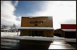
People's Theater in Council, Idaho | |
 Location in Adams County and the state of Idaho | |
| Coordinates: 44°43′48″N 116°26′10″W / 44.73000°N 116.43611°WCoordinates: 44°43′48″N 116°26′10″W / 44.73000°N 116.43611°W | |
| Country | United States |
| State | Idaho |
| County | Adams |
| Area[1] | |
| • Total | 1.03 sq mi (2.67 km2) |
| • Land | 1.00 sq mi (2.59 km2) |
| • Water | 0.03 sq mi (0.08 km2) |
| Elevation | 2,927 ft (892 m) |
| Population (2010)[2] | |
| • Total | 839 |
| • Estimate (2012[3]) | 819 |
| • Density | 839.0/sq mi (323.9/km2) |
| Time zone | Mountain (MST) (UTC-7) |
| • Summer (DST) | MDT (UTC-6) |
| ZIP code | 83612 |
| Area code(s) | 208 |
| FIPS code | 16-18820 |
| GNIS feature ID | 0396336 |
Council is a city in and the county seat of Adams County, Idaho, United States.[4] The population was 839 at the 2010 census.[5]
Geography and climate
Council is located at 44°43′48″N 116°26′10″W / 44.73000°N 116.43611°W (44.730083, -116.436213).[6]
According to the United States Census Bureau, the city has a total area of 1.03 square miles (2.67 km2), of which, 1.00 square mile (2.59 km2) is land and 0.03 square miles (0.08 km2) is water.[1]
Council experiences the typical continental Mediterranean climate (Köppen Dsa) of northern Idaho, with cold, snowy winters and hot, dry summers. It differs from cities like Moscow and Bonners Ferry in having substantially hotter summers, with average maxima as much as 7°F or 4°C higher and absolute maxima among the highest in the northwestern United States.
| Climate data for Council, Idaho (1971–2000) | |||||||||||||
|---|---|---|---|---|---|---|---|---|---|---|---|---|---|
| Month | Jan | Feb | Mar | Apr | May | Jun | Jul | Aug | Sep | Oct | Nov | Dec | Year |
| Record high °F (°C) | 54 (12) |
62 (17) |
77 (25) |
90 (32) |
98 (37) |
104 (40) |
107 (42) |
109 (43) |
102 (39) |
93 (34) |
73 (23) |
59 (15) |
109 (43) |
| Average high °F (°C) | 33.7 (0.9) |
40.1 (4.5) |
51.1 (10.6) |
62.0 (16.7) |
71.5 (21.9) |
80.7 (27.1) |
90.9 (32.7) |
90.8 (32.7) |
80.3 (26.8) |
65.9 (18.8) |
47.0 (8.3) |
35.2 (1.8) |
62.43 (16.9) |
| Average low °F (°C) | 16.8 (−8.4) |
20.9 (−6.2) |
29.1 (−1.6) |
35.1 (1.7) |
41.9 (5.5) |
48.6 (9.2) |
55.1 (12.8) |
54.3 (12.4) |
44.8 (7.1) |
34.9 (1.6) |
26.7 (−2.9) |
18.3 (−7.6) |
35.54 (1.97) |
| Record low °F (°C) | −26 (−32) |
−27 (−33) |
−12 (−24) |
15 (−9) |
21 (−6) |
30 (−1) |
35 (2) |
30 (−1) |
21 (−6) |
15 (−9) |
−20 (−29) |
−38 (−39) |
−38 (−39) |
| Average precipitation inches (mm) | 3.03 (77) |
2.88 (73.2) |
2.56 (65) |
1.95 (49.5) |
2.05 (52.1) |
1.49 (37.8) |
0.67 (17) |
0.58 (14.7) |
1.11 (28.2) |
1.57 (39.9) |
3.28 (83.3) |
3.19 (81) |
24.36 (618.7) |
| Average snowfall inches (cm) | 19.1 (48.5) |
8.2 (20.8) |
2.1 (5.3) |
0.1 (0.3) |
trace | 0.0 (0) |
0.0 (0) |
0.0 (0) |
0.0 (0) |
0.1 (0.3) |
6.8 (17.3) |
10.8 (27.4) |
47.2 (119.9) |
| Avg. precipitation days (≥ 0.01 inch) | 10.7 | 8.0 | 9.4 | 7.9 | 8.1 | 6.9 | 3.3 | 3.8 | 4.6 | 5.9 | 11.0 | 9.2 | 88.8 |
| Avg. snowy days (≥ 0.1 inch) | 6.0 | 3.6 | 0.8 | 0.1 | 0.0 | 0.0 | 0.0 | 0.0 | 0.0 | 0.1 | 1.3 | 4.1 | 16 |
| Source: NOAA (normals, 1971–2000)[7] | |||||||||||||
Demographics
| Historical population | |||
|---|---|---|---|
| Census | Pop. | %± | |
| 1880 | 60 | — | |
| 1890 | 77 | 28.3% | |
| 1900 | 277 | 259.7% | |
| 1910 | 312 | 12.6% | |
| 1920 | 388 | 24.4% | |
| 1930 | 355 | −8.5% | |
| 1940 | 692 | 94.9% | |
| 1950 | 748 | 8.1% | |
| 1960 | 827 | 10.6% | |
| 1970 | 899 | 8.7% | |
| 1980 | 917 | 2.0% | |
| 1990 | 831 | −9.4% | |
| 2000 | 816 | −1.8% | |
| 2010 | 839 | 2.8% | |
| sources:[5][8] | |||
2010 census
As of the census[2] of 2010, there were 839 people, 360 households, and 224 families residing in the city. The population density was 839.0 inhabitants per square mile (323.9/km2). There were 476 housing units at an average density of 476.0 per square mile (183.8/km2). The racial makeup of the city was 96.5% White, 0.1% African American, 0.7% Native American, 0.2% Asian, 0.1% Pacific Islander, 0.2% from other races, and 2.0% from two or more races. Hispanic or Latino of any race were 3.0% of the population.
There were 360 households of which 25.0% had children under the age of 18 living with them, 49.4% were married couples living together, 9.7% had a female householder with no husband present, 3.1% had a male householder with no wife present, and 37.8% were non-families. 33.9% of all households were made up of individuals and 15.6% had someone living alone who was 65 years of age or older. The average household size was 2.28 and the average family size was 2.87.
The median age in the city was 44.4 years. 21.1% of residents were under the age of 18; 8.7% were between the ages of 18 and 24; 21.1% were from 25 to 44; 28.9% were from 45 to 64; and 20.3% were 65 years of age or older. The gender makeup of the city was 48.7% male and 51.3% female.
2000 census
As of the census[9] of 2000, there were 816 people, 339 households, and 223 families residing in the city. The population density was 1,121.5 people per square mile (431.6/km²). There were 425 housing units at an average density of 584.1 per square mile (224.8/km²). The racial makeup of the city was 96.57% White, 1.72% Native American, 0.12% Asian, 0.12% Pacific Islander, 0.12% from other races, and 1.35% from two or more races. Hispanic or Latino of any race were 1.59% of the population.
There were 339 households out of which 27.4% had children under the age of 18 living with them, 55.5% were married couples living together, 7.7% had a female householder with no husband present, and 34.2% were non-families. 30.1% of all households were made up of individuals and 14.5% had someone living alone who was 65 years of age or older. The average household size was 2.29 and the average family size was 2.87.
In the city the population was spread out with 23.5% under the age of 18, 5.1% from 18 to 24, 24.8% from 25 to 44, 27.9% from 45 to 64, and 18.6% who were 65 years of age or older. The median age was 43 years. For every 100 females there were 103.5 males. For every 100 females age 18 and over, there were 103.3 males.
The median income for a household in the city was $24,375, and the median income for a family was $30,000. Males had a median income of $26,667 versus $11,691 for females. The per capita income for the city was $15,170. About 11.7% of families and 15.2% of the population were below the poverty line, including 16.1% of those under age 18 and 19.0% of those age 65 or over.
Notable natives
- Daniel James Burt, poet
- Harriet Miller, American politician
- James Rainwater, physicist, Nobel laureate
- Matt Paradis, Boise State and NFL Football Player
- Calvin Miller, former world record holder,
Transportation
The city is served by U.S. Route 95, connecting it to New Meadows to the north and Cambridge and Weiser to the south.
References
- ↑ 1.0 1.1 "US Gazetteer files 2010". United States Census Bureau. Retrieved 2012-12-18.
- ↑ 2.0 2.1 "American FactFinder". United States Census Bureau. Retrieved 2012-12-18.
- ↑ "Population Estimates". United States Census Bureau. Retrieved 2013-06-03.
- ↑ "Find a County". National Association of Counties. Retrieved 2011-06-07.
- ↑ 5.0 5.1 "Race, Hispanic or Latino, Age, and Housing Occupancy: 2010 Census Redistricting Data (Public Law 94-171) Summary File (QT-PL), Council city, Idaho". U.S. Census Bureau, American FactFinder 2. Retrieved October 27, 2011.
- ↑ "US Gazetteer files: 2010, 2000, and 1990". United States Census Bureau. 2011-02-12. Retrieved 2011-04-23.
- ↑ "Climatography of the United States NO.81" (PDF). National Oceanic and Atmospheric Administration. Retrieved January 13, 2011.
- ↑ Moffatt, Riley. Population History of Western U.S. Cities & Towns, 1850-1990. Lanham: Scarecrow, 1996, 91.
- ↑ "American FactFinder". United States Census Bureau. Retrieved 2008-01-31.
External links
| |||||||||||||||||