Cotabato City
| Cotabato Kutabato | ||
|---|---|---|
| Independent Component City | ||
| City of Cotabato | ||
|
Cotabato City Hall | ||
| ||
| Nickname(s): Stone Fortress of Mindanao | ||
 Map of Maguindanao highlighting Cotabato City | ||
.svg.png) Cotabato Location within the Philippines | ||
| Coordinates: 07°13′N 124°15′E / 7.217°N 124.250°ECoordinates: 07°13′N 124°15′E / 7.217°N 124.250°E | ||
| Country | Philippines | |
| Region | SOCCSKSARGEN | |
| Province |
Maguindanao (geographical) Cotabato (statistical) | |
| District | 1st district of Maguindanao | |
| During Manobo Period | 13th Century | |
| Founded as capital of Maguindanao Sultanate | 1520 | |
| Founding of Pueblo de Cotabato | 1862 | |
| Cityhood | June 20, 1959 | |
| Founded by | Apo Mamalu and Apo Tabunaway | |
| Barangays | 37 | |
| Government | ||
| • Mayor | Japal "JoJo" Guiani | |
| • Vice-Mayor | Abdullah Andang | |
| Area[1] | ||
| • Total | 176.00 km2 (67.95 sq mi) | |
| Population (2010)[2] | ||
| • Total | 271,786 | |
| • Density | 1,500/km2 (4,000/sq mi) | |
| Time zone | PHT (UTC+8) | |
| ZIP code | 9600 | |
| Dialing code | +63 (0)64 | |
| Income class | 3rd class[1] | |


Cotabato City, officially the City of Cotabato (Malay: Kota Batu; Cebuano: Dakbayan sa Cotabato; Filipino: Lungsod ng Cotabato) is one of the independent component cities located in Mindanao Island Philippines. According to the 2010 census, it has a population of 271,786.[2]
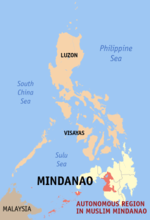
Cotabato City is the regional center of the Autonomous Region in Muslim Mindanao (ARMM) but the city is administratively part of the SOCCSKSARGEN region, which is composed of provinces of South Cotabato, North Cotabato (Cotabato Province), Sultan Kudarat, and Saranggani, as well as the highly urbanized city of General Santos. For geographical purposes, it is grouped with Maguindanao, or for statistical reasons sometimes grouped with the Cotabato province,[3] and does not belong to the ARMM. Cotabato City is distinct from and should not be confused with the province of Cotabato.
History
The name Cotabato was derived from Maguindanao word kuta wato and the Malay Bruneian word of Kota Batu, or City of Stone; kota mean city or fortress, and batu mean rock or stone.
Cotabato City had witnessed more history than any other place in Mindanao. Its history dates back to the 15th century when Shariff Kabunsuan, an Arab missionary, landed along the banks of the Rio Grande de Mindanao and introduced Islam to the natives. Islam was the faith that moved the early settlers to communal life, and to establish the Sultanate of Maguindanao with its golden age ushered in by Sultan Dipatuan Qudarat during the 17th century the time when Cotabato City developed as the capital town of Maguindanao.
In the nineteenth century, when Sultan Makakua ruled, roads and wharfs were constructed which gave rise to the birth of modern-day Cotabato. However, the then Municipality of Cotabato was first organized at the later part of the 19th century when the Spaniards established a military post at what is now Barangay Tamontaka, one of the earliest Christian settlements founded south of the Philippines. Spaniards already took with them Chabacanos and Chabacano-speaking Muslims from Zamboanga and Basilan and Cebuanos. Chabacanos being brought by Spaniards are the reason of existing Chabacano dialect in Cotabato City called Cotabateño, evolved from Zamboangueño. Cotabato was then officially founded in 1862 when the Pueblo de Cotabato was established; Christianity was introduced in the area in around the year 1870.

Following the Spanish evacuation in Jan. 1899, Datu Piang led the Moro's in a massacre of the remaining Christian community, enslaving those they did not kill.[4]:529–530 Americans arrived in Mindanao in 1900 after the Spanish–American War ended in 1898. Cotabato town was part of Moro Province and of Department of Mindanao and Sulu from 1903 to 1920, when the Empire Province of Cotabato, referred to as "Moroland" by the Americans, was founded with the town as the capital, with Datu Piang, known as the Grand Old Man of Cotabato, as its first governor.
Several towns were carved off from Cotabato town beginning in the year 1936, with Dulawan (now Datu Piang, Maguindanao) and Midsayap being the first ones which were incorporated as regular municipalities.
In 1942, at the beginning of the Pacific Front of World War II, the Japanese Imperial forces entered what is now Maguindanao province. In 1945, Maguindanao was liberated by allied Philippine Commonwealth troops and Muslim Maguindanaoan guerrilla units after defeating the Japanese Imperial forces in the Battle of Maguindanao during the Second World War.
Several towns were carved off from Cotabato town since the year 1913, with Pikit being the first one founded by Cebuano Christian colonists. Dulawan (now Datu Piang, Maguindanao) and Midsayap were incorporated as towns in 1936. In August 18, 1947, just two years after the Second World War and a year after the official inauguration of Philippine independence, the number of towns in the gigantic Cotabato province were multiplied by Executive Order No. 82 signed by President Manuel Roxas, namely: Kidapawan, Pagalungan, Buayan, Marbel, Parang, Nuling, Dinaig, Salaman, Buluan, Kiamba, and Cabacan, a total of eleven (11) towns added to the previous four towns; the newly founded towns of Kabuntalan, Pikit (conversion as regular municipality), and Glan added up in September 30, 1949. More and more newly created towns added up in the province's number of towns as the province entered the second half of the 20th century.
On July 1, 1950, the then Municipality of Cotabato was made first class municipality under Executive Order No. 466. Nine years later, it became a city on July 10, 1959, and on June 20, 1959 it was officially created into a chartered city by virtue of Republic Act No. 2364.
During the beginning of the 1950s up to the mid-1970s, Cotabato City was by far the second largest and most progressive city in Mindanao, after Davao City, with its population of more than 200,000 people residing in the city that time. However, mass insurgencies and much disorder between Christians and local Muslims in the region, began in the mid-1960 during the Marcos administration, capitulated into the city's economic decline, so the provincial government moved its provisional capital to Pagalungan in 1967 to avoid internal strife in the city. This made the city mostly isolated to other important economic centers in Mindanao.
When the original Province of Cotabato was dissolved 1967, the city used to be part of the newly founded North Cotabato province until 1973; since then the city was the administrative center of the ARMM. However, the city broke off administratively from Maguindanao as it rejoined SOCCSKSARGEN in the 1990s. Now many sources consider the city as part of the present North Cotabato Province, although geographically it is still considered part of Maguindanao.
Geography
Cotabato is approximately 698.9 nautical miles (1294 km) from Manila, the country's capital, and is bounded by the municipalities of Sultan Kudarat to the north—with Rio Grande de Mindanao separating the two—Kabuntalan to the east, and Datu Odin Sinsuat to the south. The city faces Illana Bay, part of the Moro Gulf, to the west.
Cotabato City has a total land area of 176.0 square kilometers, located at the mouth of the Rio Grande de Mindanao and Pulangi River.[5]
Barangays
Cotabato City is politically subdivided into 37 barangays.
- Bagua Proper
- Bagua I
- Bagua II
- Bagua III
- Kalanganan
- Kalanganan I
- Kalanganan II
- Poblacion Proper
- Poblacion I
- Poblacion II
- Poblacion III
- Poblacion IV
- Poblacion V
- Poblacion VI
- Poblacion VII
- Poblacion VIII
- Poblacion IX
- Rosary Heights Proper
- Rosary Heights I
- Rosary Heights II
- Rosary Heights III
- Rosary Heights IV
- Rosary Heights V
- Rosary Heights VI
- Rosary Heights VII
- Rosary Heights VIII
- Rosary Heights IX
- Rosary Heights X
- Rosary Heights XI
- Rosary Heights XII
- Rosary Heights XIII
- Tamontaka Proper
- Tamontaka I
- Tamontaka II
- Tamontaka III
- Tamontaka IV
- Tamontaka V
Climate
Under the Köppen climate classification system, Cotabato City features a tropical rainforest climate (Af), falling just short of a tropical monsoon climate (Am).
| Climate data for Cotabato City | |||||||||||||
|---|---|---|---|---|---|---|---|---|---|---|---|---|---|
| Month | Jan | Feb | Mar | Apr | May | Jun | Jul | Aug | Sep | Oct | Nov | Dec | Year |
| Average high °C (°F) | 32 (90) |
32 (90) |
33 (91) |
33 (91) |
33 (91) |
32 (90) |
32 (90) |
31 (88) |
32 (90) |
32 (90) |
32 (90) |
32 (90) |
32 (90) |
| Average low °C (°F) | 21 (70) |
21 (70) |
21 (70) |
22 (72) |
22 (72) |
22 (72) |
22 (72) |
22 (72) |
22 (72) |
22 (72) |
22 (72) |
21 (70) |
22 (72) |
| Average precipitation mm (inches) | 60 (2.36) |
80 (3.15) |
90 (3.54) |
120 (4.72) |
230 (9.06) |
220 (8.66) |
220 (8.66) |
320 (12.6) |
240 (9.45) |
250 (9.84) |
170 (6.69) |
90 (3.54) |
2,160 (85.04) |
| Source: Weatherbase.com[6] | |||||||||||||
Demographics

| Population census of Cotabato City | ||
|---|---|---|
| Year | Pop. | ±% p.a. |
| 1990 | 127,065 | — |
| 1995 | 146,779 | +2.74% |
| 2000 | 163,849 | +2.39% |
| 2007 | 259,153 | +6.53% |
| 2010 | 271,786 | +1.75% |
| Source: National Statistics Office[2] | ||
Majority are Maguindanaoan which comprises the city's population about 61%. There are some sizable ethnicity of Maranaos (8%), Tagalog (9%),Cebuano (8%) and Ilonggo (6%). The rest of the population belongs to the other ethnicity ( e.g.Iranon,Binisaya,Tausug, Chabacano).
The main languages are Maguindanao and Cebuano. Other language spoken is Chabacano, spoken by both Christians and Muslims. Also spoken are Tagalog, as well as English and Arabic. The dialect of Chabacano native in Cotabato City is called Cotabateño, evolved from Zamboangueño dialect.
Religion
Cotabato City is houses of Muslims, as well as Christians. Today majority of the city's population are Muslims, which comprises about 70% of their population, majority of them are Sunnites. Majority of Christian are Roman Catholics and most of them are Cebuanos and Chabacanos.
Economy
Cotabato City, historically, during its heyday as the capital of the Maguindanao Sultanate, has been the most economically prosperous city in the island of Mindanao. Its prosperity has been taken away by civil internal strife beginning in the 1970s. However, once it became part of SOCCSKSARGEN region in the 1990s, its economy began a radical economic recovery.
As of now, the city currently serves as the center for economic support activities, trade and finance, education and other support services such as social, physical, cultural and other basic services of Central Mindanao. It is now struggling to gain its lost glory.
Tourism
Landmark and parks
.jpg)
- Rio Grande de Mindanao: The second largest river in the Philippines and the longest in Mindanao crisscrossing, with its tributary, the city's vast area. Estimated to be 182 kilometers long and 96 meters wide. Water sports and boat racing are the popular attractions of the river, usually held to coincide with the Shariff Kabunsuan Festival and the Feast of Hariraya Puasa.
- Sultan Haji Hassanal Bolkiah Masjid: The grandeur of the Sultan Hassanal Bolkiah Masjid (Muslim center of worship), which reportedly costs $48 million, dominates the landscape of Barangay Kalanganan. Its minarets measure 43 meters high (141 feet) on top of which are pilot's lights to avoid aerial accidents at night. The height is equivalent to a 15-storey building. Crescent moons adorn the domes painted in gold. The mosque can accommodate 800 male and 400 female worshippers, A fountain will be among the main features of the courtyard.
- Church of the Immaculate Conception of Tamontaka: The oldest church, of Spanish architecture and design, was built by the Jesuits. This is where the old settlement was built in 1872. During the 1976 earthquake, a portion of the church collapsed but the Oblate Fathers restored the ruin parts following the original design.
- Immaculada Concepcion Cathedral: It is the Central Mindanao center of Catholic Preaching. With the Huge Bell Tower and state of the art Building houses the Archdioces of Cotabato.
- Lourdes Grotto: A replica of Our Lady of Lourdes Grotto in France. The compound is equipped with a retreat house for recollection and seminars, a mini zoo and a children's park which opens only every Sunday.
- Kutawato Caves: The only caves in the country that is right in the heart of the city are the Kutawato Caves. Its various entrances; all within traffic is a rarity that can only be had in the "Heart of Mindanao – Cotabato City". These caves were also the source of the city's present name for "kuta" means fort and "wato" means stone, hence the name fort of stone, which later became cotabato. Kutawato caves with its walls of white, beige and brownish shade glitters in the dark and echoes a colorful past dating back to the days when no foreign foot yet trampled upon this island. This caves had given sanctuary to the natives when the Spaniards tried to convert them into the castillan faith and has thus served the purposed when Filipino guerillas fought the invading force of the Japanese Imperial Army during the Second World War. When the Japanese firepower proved superior to that of the natives, the caves then used as an armory and even as a garrison. Within its confines, tortured and oppressed souls that thirst for freedom and democracy echoed their faint moans and cries that were buried in its bosoms, muted for over half a century. Formally re-opened and blessed on September 19, 1996, the outwait caves of cotabato city has once again reverberated the voices of the cotabateños; this time however, in a peacefully happy tone. Located at the foot of the "Tantawan" or P.C. hill, the cave is reputed to be seven kilometers long and of formidable, solid rock. Having four major entrances, each gaping mouth offers unique experience to its visitors.
- Old Cotabato City Hall: A century old structure which houses Marines Camp but soon to be a City Museum. It showcases the architectural design of the Maguindanaon Art.
- Old Provincial Capitol: An early American architecture, it was the seat of then Empire Province of Cotabato. It houses now by the reserved Military Soldiers.
- People's Palace: A majestic structure located at Malagapas, Barangay Rosary Heights 10, combining ethno-modern architectural with Muslim-inspired roof symbolizing its royalty and Roman art symbolizing the existence of Christianity in the City. The entire bureaucracy of the Executive Department are now housed under one roof.

- ORC Complex: The regional seat of the Autonomous Region in Muslim Mindanao which composed of different government offices of the entire region of ARMM and some offices of the SOCCSARGEN. Most buildings are built with state-of-the-art Islamic architecture.
- Takumi Butai Memorial Shrine: A monument in honor of Takumi Butai and the Japanese soldiers who died here during the Second World War. Takumi was the Provincial Commander of the Japanese forces assigned in Cotabato City. Before he died, he requested that some of his ashes be buried in Cotabato City. This shrine was put up by the Lion's Club of Kyoto, Japan in cooperation with the City Government of Cotabato.
- Tantawan Park: This park is build at the foot of Pedro Colina Hill which stand the huge golden statue of Sultan Kudarat.
- Pedro Colina (PC Hill): A stone fort towering over the city with a height of 90 feet, now houses the Cotabato city Internal Defense Command. This is Cotabato City's famous landmark, this historic hill served as a watch tower for the natives in their defense drive to detect and repel assaults by enemies. From this hill, one can have a panoramic view of the city, its surrounding areas, and the Rio Grande de Mindanao.
- Timaco Hill: Overlooking the Illana Bay, it is protected by Bongo Island. The place is a good resort with bluegreen waters, sandy white beach, lake and cave, wooded park and a river, is ideal for camping, skin diving, snorkeling, boating, fishing and other water sports. It likewise offer nature lovers and ideal place for trekking, bird and white monkey watching and other lesure activities. The cultural village which will be set at the foot of the hill is a typical Maguindanao village where people practice the traditional crafts such as brassmaking, malong weaving, mat and basket weaving, boat building and bamboo crafts. It is also a sanctuary for oral and written traditions of the people including lores, legends, dances, songs, rituals and other metaphysical culture of the tribe.
- Metal and Brass Warehouse: Take a look at Brgy. MB Kalanganan, Cotabato City to have a glimpse of how a brassware like gongs, traditional Muslim jars, etc. are being crafted using traditional methods (meaning manually) by the oldest and the only remaining brassware makers in Cotabato City—the Mang Family. According to them, a single brass jar as big as this can take up to 3 months to complete.
- Inaul Weaving Center: It is based just outside Cotabato City in Shariff Kabunsuan Province. Set up by H. Bai Aleizzah Albaya B Wampa, the centre concentrates on weaving and has rescued a number of old wooden weaving frames from the local area. The workshop is festooned with many examples of local weaving and embroidery, including a number of old silk pieces. At present, most of the weavers—all women— use synthetic threads, because the local market will not support silk weavings, but they hope to expand and once again begin weaving in silk.
- Barter Trade Center: It is a one stop shop to buy different native goods, accessories and souvenir items.
Events
- Araw ng Kutabato (June 12–25): It is the biggest celebration in all of the city’s festivals. It commemorates the city’s charter anniversary. Officially commencing on Independence Day (June 12), the two weeks of merry making is dotted with events like agri-aqua product showcase, exhibits of photographs and artworks, sports and traditional games and other modern day athletics. Capping the celebration is the selection of the city’s fairest maiden in the Search for the Mutya ng Kutabato and the mammoth civic/military and cultural dance parade dubbed as the Lilang-lilang Festival".
- Our Lady of Peñafrancia Fiesta (3rd Sunday of September): Celebrated in honor of Our Lady of Peñafrancia, it is preceded with a Holy mass and procession from the Immaculate Conception Cathedral to a waiting landing craft (barge) decked with colorful buntings, banana trunks, flowers and a brass band for its traditional fluvial procession at the Rio Grande to watch or join the procession in fulfillment of a vow, hosted by the Bicolano Association of Cotabato City. This annual event is a replica of the same event in Naga City.
- Immaculate Conception Fiesta (December 8): The patroness of Cotabato City, the feast of the Immaculate Conception is held from the first day of December and it is marked by a trade fair, musical presentations, cultural presentations, drums and bugle corps contest and the nightly novena mass in honor of the patroness.* Shariff Kabunsuan Festival (December 15–19): Celebrated in honor of Shariff Mohammad Kabunsuan, an Arab missionary from Johore who planted the seed of Islam in Central Mindanao. With his arrival came the Sultanate form of government and Royal houses, the Madrasa system of education, trade, commerce, to name a few. On this event, dances, traditional games and sports are the regular activities. Highlights include a Dance Parade, Banca Race and the re-enactment of his arrival.
Transportation
|
Air, via Awang Airport in neighboring Datu Odin Sinsuat, Maguindanao:
|
Land
|
Business
- Shopping center
- S-Mart
- Superama Main
- Sugni Superstore
- Puregold Price Club Cotabato – Quezon Avenue, Cotabato City (U/C, Open 2nd Quarter 2015)
- Cotabato Barter Center – Gov. Gutierrez Blvd, Cotabato City (Proposed, Lot Acquired)
- Mall
- Southseas Complex
- Alnor Commercial Complex
- Fiesta Shopping Mall – Sinsuat Ave, Cotabato City (U/C, Open 2nd Quarter 2015)
- Mall of Alnor – Sinsuat Ave, Cotabato City (U/C, Open 1st Quarter 2015)
- Superama Mall – Sinsuat Ave, Cotabato City (U/C, Open 2015)
- City Mall Cotabato – Gov. Gutierrez Blvd, Cotabato City (U/C, Open 4th Quarter 2015)
- Robinsons Place Cotabato – Quezon Ave, Cotabato City (Proposed, Lot Under Negotiation)
- Gaisano Cotabato (proposed)
- KCC Mall of Cotabato – Jose Lim St, Cotabato City (Lot Acquired Only)
Health
- Medical clinics and hospitals
- Cotabato United Hospital – Notre Dame Ave, Cotabato City (U/C)
- Cotabato Doctors Hospital – Sinsuat Avenue, Cotabato City (Proposed)
- Cotabato Regional and Medical Center – Sinsuat Avenue, Cotabato City
- Cotabato Medical Specialist – Quezon Ave, Cotabato City
- Cotabato Periculuture & Maternity Hospital – City Plaza Cotabato City
- Dr. P. Ocampo Hospital – Demazenod Ave, Cotabato City
- Notre Dame Hospital – Sinsuat Avenue, Cotabato City
- Cotabato Polymedic Clinic – Gov. Gutierrez Blvd, Cotabato City
- Cotabato Medical Plaza – Quezon Ave, Cotabato City
- Ocampo Clinic – Mabini St, Cotabato City
Every barangay has a Barangay Health Center to provide medical support. Vaccination and check-ups are the main services at these health centers.
Education
- Albert Einstein School
- Agape School (City Alliance Evangelical Church) – Guiani St, Cotabato City
- Aviation Technical School of Cotabato – Mabini St, Cotabato City
- AMA Computer College Cotabato Campus – SK Pendatun Ave Cotabato City
- Antonio R. Pacheco College – TV Juliano St, Cotabato City
- Laboratory High School – Sinsuat Ave, Cotabato City
- Computer Aided Technological Institute – Quezon Ave, Cotabato City
- Cotabato City Institute (Chinese School) – Quezon Ave, Cotabato City
- Coland Systems Technology Institute Inc. – Sinsuat Ave, Cotabato City
- Cotabato City state Polytechnic College. – Cotabato City
- Dr. P. Ocampo Colleges, Inc. – Demazenod, Cotabato City
- Headstart College of Cotabato – Tamontaka Mother, Cotabato City
- Islamic University – Kalanganan Mother, Cotabato City (Proposed)
- Innovative Systems Institute, Inc.
- JCOURSE Design Technology Institute, Inc. – Don Rufino Alonzo, Cotabato City
- Kutawato Institute of Technology and Foundation Incorporated
- Kutawato Darrusalam College
- Microspan Technological Institute – Don Rufino Alonzo St, Cotabato City
- Mindanao Capitol College
- Notre Dame University – Notre Dame Avenue, Cotabato City
- Notre Dame-RVM College of Cotabato City – Sinsuat Ave, Cotabato City
- Notre Dame School Academic of Cathedral – Quezon Ave, Cotabato City
- Notre Dame of Cotabato, Inc. – Sinsuat Ave, Cotabato City
- Notre Dame School Of Midwifery – Sinsuat Ave, Cotabato City
- Nahdah College
- Sacred Heart Learning Center – Pansacala, Cotabato City
- San Vicente Academy – Governor D. Gutierrez Avenue, Cotabato City
- STI College Cotabato – Rajah Tabunaway Blvd, Cotabato City
- St. Benedict College – Bishop Mongeau St, Cotabato City
- St. Peter and St. Paul Episcopal institute – Sinsuat Ave, Cotabato City
- Sultan Kudarat Islamic Academy Annex
Media
Television
- IBC Channel 2
- ABS-CBN Channel 5
- 9TV Channel 7
- TV5 Channel 8
- GMA Channel 12
- ABS-CBN Sports+Action Channel 25
- GMA News TV Channel 27
- SMNI Channel 29
- City TV Channel 31
- ETC Channel 35
- MYX Channel 66
Radio
FM radio stations:
- 93.7 Star FM Cotabato
- 90.9 iFM Cotabato
- 92.7 Happy FM Cotabato
- 95.9 Radyo Natin
- 95.1 MOR
- 102.7 Love Radio Cotabato
- 89.3 Brigada News FM
AM radio stations:
- DZRH Nationwide 567 kHz
- Radyo Bida 882 kHz
- Radyo Mo Nationwide 729 kHz
- Sonshine Radio 945 kHz
- Super Radyo 990 kHz
Newspaper and magazine publications:
- The Mindanao Cross
- Mindanao Examiner
- Kutawato Express
- Bandingan Magazine
News programs
Sister cities
 Ozamiz City, Philippines
- Iligan City, Philippines
- Dipolog City, Philippines
- Davao City, Philippines
References
- ↑ 1.0 1.1 "List of Cities". PSGC Interactive. Makati City, Philippines: National Statistical Coordination Board. Retrieved 2 June 2014.
- ↑ 2.0 2.1 2.2 "Population and Annual Growth Rates for The Philippines and Its Regions, Provinces, and Highly Urbanized Cities" (PDF). 2010 Census and Housing Population. National Statistics Office. Retrieved 2 June 2014.
- ↑ Local Governance Performance Management System
- ↑ Foreman, J., 1906, The Philippine Islands: A Political, Geographical, Ethnographical, Social and Commercial History of the Philippine Archipelago, New York: Charles Scribner's Sons
- ↑ Disaster Preparedness of Schools by Abdul Raffi A. Abas
- ↑ "Historical Weather for Cotabato, Soccsksargen, Philippines". Retrieved 2011-08-15.
External links
| Wikimedia Commons has media related to Cotabato City. |
| Wikivoyage has a travel guide for Cotabato City. |
- Sangguniang Panlungsod of Cotabato City Website
- Official Cotabato City Website
- NSCB details for cotabato city geographic code
- Philippine Census Information
- Department of Tourism
 |
Sultan Kudarat | | ||
| Illana Bay | |
Kabuntalan | ||
| ||||
| | ||||
| Datu Odin Sinsuat |