Corserine
| Corserine | |
|---|---|
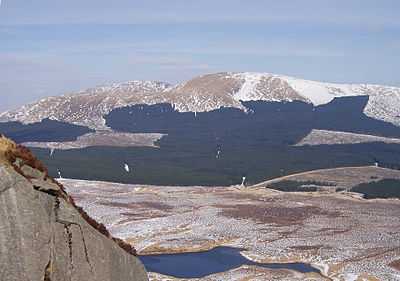 The Rhinns of Kells from Craignaw | |
| Elevation | 814 m (2,671 ft) |
| Prominence | 488 m (1,601 ft) |
| Listing | Corbett, Marilyn, Donald |
| Location | |
| Location | Dumfries and Galloway, Scotland |
| Range | Galloway Hills |
| OS grid | NX497870 |
| Topo map | OS Landranger 77 |
Corserine is the highest point of the Rhinns of Kells range in the Southern Uplands of southern Scotland. The usual route of ascent is from the car park at Forest Lodge to the east of the hill via Loch Harrow and North Gairy Top. Forest Lodge is a short drive from the village of St. John's Town of Dalry.
Walking
Corserine is an easy ascent with a very flat summit area. The full traverse of the Rhinns of Kells is a frequently undertaken long day's hillwalk.
Climbing
Because of the nature of the rock no good rock climbing has been recorded on Corserine or elsewhere on the Rhinns. However in winter after a good freeze there are a number of good ice climbs of up to 150 m on the slopes of Milldown just south of Corserine.[1]
External links
- Corserine tourist trail, map and large images
- Corserine to Meikle Millyea trail, map and large images
- Rhinns of Kells north hills from the Old Lead Mines at Casphairn, route, map and large images
References
- ↑ John Biggar. "Rhinns of Kells". Retrieved 2007-06-14.
Coordinates: 55°09′16″N 4°21′37″W / 55.15444°N 4.36036°W