Coringa-Herald National Nature Reserve

Coringa-Herald National Nature Reserve is a nature reserve in Australia’s Coral Sea Islands Territory, and an Important Bird Area (IBA). Together with the Lihou Reef National Nature Reserve, from which it is separated by about 100 km of open ocean, it forms the Coral Sea Reserves Ramsar Site, designating it under the Ramsar Convention as a wetland of international importance.
Description
The reserve lies to the east of the Great Barrier Reef and covers an area of 8,860 km2, most of which is open water. It contains three pairs of islets and cays, the Herald Cays, comprising North East and South West Cays; the Coringa Islets, comprising Chilcott and South West Islets; and the Magdelaine Cays, comprising South East Cay and North West Islet. The pairs rise steeply from separate platform reef systems, each representing a distinct stage in reef formation, varying in size from 16 to 37 ha, and making a total land area of 124 ha. Each cay has a fringing reef that is fully exposed to the influences of ocean currents and swells.[1]
The islets are formed of coral sand, rocks and coral rubble and rise no more than about five metres above sea-level. South-East Magdelaine Cay is the largest; parts of it, as well as North-East Herald Cay, have thick forests of Pisonia grandis and Cordia subcordata trees. Apart from North-West Magdelaine Islet which lacks vegetation, grasses and Heliotropium foertherianum shrubs grow on the other islets.[1]
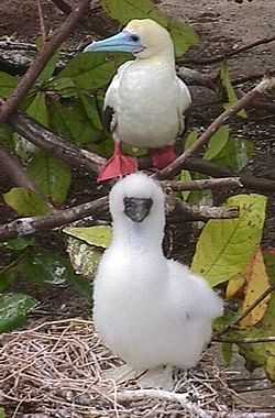
The 124 ha land area of the cays has been recognised by BirdLife International as the Coringa-Herald Reefs IBA because of its importance as a breeding site for seabirds. It supports over 1% of the world populations of wedge-tailed shearwaters, red-footed boobies, lesser frigatebirds, red-tailed tropicbirds and black noddies.[2]
References
Notes
- ↑ 1.0 1.1 Anon (2001).
- ↑ "IBA: Coringa-Herald Reefs". Birdata. Birds Australia. Retrieved 2011-06-16.
Sources
- Anon (2001). Coringa-Herald National Nature Reserve and Lihou Reef National Nature Reserve: Management Plan. Canberra: Environment Australia. ISBN 0-642-54766-1.
Coordinates: 17°04′S 150°39′E / 17.067°S 150.650°E