Cootehall
| Cootehall Uachtar Thíre | |
|---|---|
| Village | |
|
New housing in Cootehall | |
 Cootehall Location in Ireland | |
| Coordinates: 53°59′04″N 8°09′30″W / 53.984471°N 8.158262°WCoordinates: 53°59′04″N 8°09′30″W / 53.984471°N 8.158262°W | |
| Country | Ireland |
| Province | Connacht |
| County | County Roscommon |
| Elevation[1] | 52 m (171 ft) |
| Time zone | WET (UTC+0) |
| • Summer (DST) | IST (WEST) (UTC-1) |
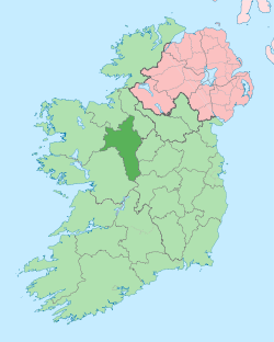
Cootehall (Irish: Uachtar Thíre, meaning "Upper Territory",[2] also Cloigne) is a village in County Roscommon, Ireland. It is located on the River Boyle, between Boyle and Carrick-on-Shannon near Lough Key Forest Park in the north of the county.
Cootehall lies 4 kilometres off the N4 road from Dublin to Sligo and between the R284 and R285 regional roads.
The Boyle River, which flows through Cootehall, connects the village with Lough Key to the west and the River Shannon to the east.
History
Cootehall was formerly called Urtaheera, or O'Mulloy's Hall, and was, early in the 17th century, together with the manor attached to it, the property of William, styled "the Great O'Mulloy ;" but in the war of 1641 it came into the possession of the English Cromwellian, Chidley Coote, nephew of the first Earl of Mountrath, and from that family took its present name.
Cootehall was a hamlet until the 2000s when it experienced rapid growth during the Irish property bubble. It is now a large village or small town in terms of the number of houses and shops existing, but many of them remain unoccupied.
It contains several ghost estates and is an archetypical example of the phenomenon.
People
- Writer John McGahern's father was based in the police station in Cootehall which inspired his novel The Barracks.
- The politician Seán Doherty was born and raised in Cootehall.
See also
References
| ||||||||||||||||||||||
