Coolgardie–Esperance Highway
| Coolgardie–Esperance Highway Western Australia | |
|---|---|
 | |
| Map of south-west Western Australia with Coolgardie–Esperance Highway highlighted in red | |
| General information | |
| Type | Highway |
| Length | 365 km (227 mi) |
| Route number(s) |
|
| Major junctions | |
| North end |
|
| |
| South end |
|
| Location(s) | |
| Major settlements | Norseman, Salmon Gums |
| Highway system | |
|
Highways in Australia National Highway • Freeways in Australia Highways in Western Australia | |
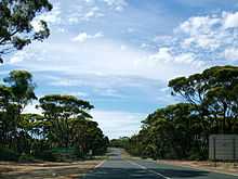
The Coolgardie–Esperance Highway is a 365 km Western Australian highway between Coolgardie and Esperance. It runs in a north-south direction linking the WA's Eastern Goldfields to the coast.[1]
The Coolgardie-Norseman stretch (National Highway 94) forms part of the Perth to Adelaide National Highway route and is the busier part of the highway with heavy interstate truck traffic. The interstate traffic continues eastwards via Eyre Highway from its junction in Norseman. From Coolgardie to Norseman it passes through arid mining country, mainly dotted with patches of gum trees, scrub and salt lakes.
The Norseman-Esperance stretch is a part of Australia's Highway 1. The scenery changes to wheatbelt with thicker stands of gum trees along the way as the climate gets wetter towards the coast.
History
The highway was unsealed until 1960, when a 3.7 metre wide (single-lane) seal was completed between Coolgardie and Esperance.[2] In 1974 the road was upgraded further and a two lane seal completed was between Coolgardie and Norseman.[2] In 1980 a two lane seal was completed between Norseman and Danielle Siding, completing the two lane seal from Coolgardie to Esperance.[2]
Major intersections
| LGA | Location | km[1] | mi | Destinations | Notes |
|---|---|---|---|---|---|
| Coolgardie | Coolgardie | 0 | 0 | National Highway 94 northern concurrency terminus: continues west | |
| Widgiemooltha | 54.5 | 33.9 | |||
| Dundas | Norseman | 165 | 103 | National Highway 94 southern concurrency terminus; National Route 1 northern concurrency terminus | |
| Esperance | Gibson | 344 | 214 | Gibson-Dalyup Road – Dalyup | |
| Monjingup, Myrup | 357 | 222 | Myrup Road – Myrup, Condingup | ||
| Chadwick, Castletown | 365 | 227 | Roundabout intersection; Highway is named Norseman Road from 1 kilometre (0.62 mi) north of the roundabout; National Route 1 southern concurrency terminus: continues west | ||
1.000 mi = 1.609 km; 1.000 km = 0.621 mi
| |||||
See also
Australian Roads portal
References
- ↑ 1.0 1.1 Google (14 March 2013). "Coolgardie–Esperance Highway". Google Maps. Google. Retrieved 14 March 2013.
- ↑ 2.0 2.1 2.2 Tricholo, P. (June 1980). Coolgardie-Esperance highway, Western Roads: official journal of the Main Roads Department, Western Australia, 5(2), p.13-16. Perth: Main Roads Department
| ||||||||||||||||||||
| |||||||||||||||||||||||||||||||