Connolly, County Clare
| Connolly Fíoch Rua | |
|---|---|
| Village | |
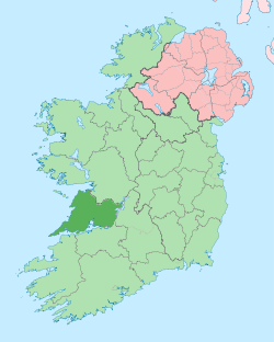
 Connolly Location in Ireland | |
| Coordinates: 52°49′48″N 9°10′47″W / 52.830014°N 9.179714°WCoordinates: 52°49′48″N 9°10′47″W / 52.830014°N 9.179714°W | |
| Country |
|
| Province | Munster |
| County | County Clare |
| Time zone | WET (UTC+0) |
| • Summer (DST) | IST (WEST) (UTC-1) |
Connolly (Irish: Fíoch Rua) is a small village located in west County Clare, Ireland.[1] It is 14 kilometres west south west of Ennis. The village is located on the R474 Ennis-Milltown Malbay road
Most important features are the Roman Catholic Church, the Post Office and the National School (founded 1905), located in the centre of the village. Other amenities are a shop/petrol station, a pub and an art gallery.
Formerly, it also had a creamery and a Garda Station.[2]
External Links
See also
References
- ↑ "Placenames Database of Ireland". Dublin City University. Retrieved 1 December 2014.
- ↑ I.T.A. Topographical and General Survey 1942/3
| ||||||||||||||||||||||||||||||