Conceição da Barra
For the municipality in Minas Gerais, see Conceição da Barra de Minas.
| Conceição da Barra | |||
|---|---|---|---|
| Municipality | |||
| The Municipality of Conceição da Barra | |||
|
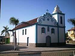
Main church of Conceição da Barra | |||
| |||
| Nickname(s): "Barra" | |||
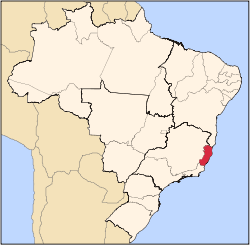
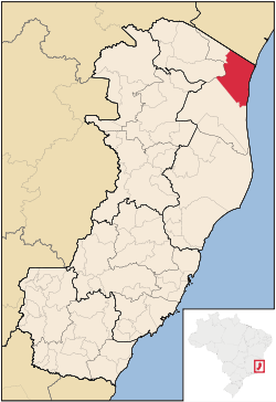 Location of Conceição da Barra in the State of Espírito Santo | |||
| Coordinates: 18°35′34″S 39°43′55″W / 18.59278°S 39.73194°W | |||
| Country |
| ||
| Region | Southeast | ||
| State |
| ||
| Founded | October 6, 1891 | ||
| Government | |||
| • Mayor | Jorge Duffles Andrade Donati (PSDB) | ||
| Area | |||
| • Total | 1,188.044 km2 (458.706 sq mi) | ||
| [1] | |||
| Elevation | 3 m (10 ft) | ||
| Population (2008) | |||
| • Total | 27,029 | ||
| • Density | 24.9/km2 (64/sq mi) | ||
| [2] | |||
| Time zone | UTC-3 (UTC-3) | ||
| HDI (2000) | 0.688 – medium[3] | ||


Coordinates: 18°35′34″S 39°43′55″W / 18.59278°S 39.73194°W Conceição da Barra is the easternmost municipality in the Brazilian state of Espírito Santo. The city is also the northernmost coastal city of the state. Its population was 27,029 (2008) and its area is 1,188.044 km².
References
- ↑ IBGE -
- ↑ IBGE 2008 statistics
- ↑ UNDP
| Wikivoyage has a travel guide for Conceição da Barra. |
| |||||||||||||||||||||||||||||||||||||||||||||||||||||||||||||||||||||