Commonwealth Avenue Historic District (Newton, Massachusetts)
|
Commonwealth Avenue Historic District | |
 | |
|
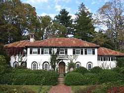
Corner of Commonwealth Avenue and Hammond Street | |
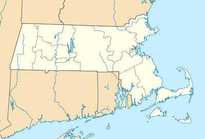 | |
| Location | Roughly Commonwealth Ave. from Walnut St. to Waban Hill Rd., Newton, Massachusetts |
|---|---|
| Coordinates | 42°20′17″N 71°11′24″W / 42.33806°N 71.19000°WCoordinates: 42°20′17″N 71°11′24″W / 42.33806°N 71.19000°W |
| Architect | Multiple |
| Architectural style | Late 19th And 20th Century Revivals, Late Victorian |
| Governing body | Private |
| MPS | Newton MRA |
| NRHP Reference # | 90000012[1] |
| Added to NRHP | February 16, 1990 |
The Commonwealth Avenue Historic District of Newton, Massachusetts, encompasses roughly the eastern half of Commonwealth Avenue, extending from Waban Hill Road, near the city line with Boston, westward to Walnut Street. The roadway was laid out in 1894 and completed in 1895. Its design was influenced in part by the local residents, who were willing to give land for some of the route, and the design of Boston portions of the road, in which Frederick Law Olmsted was involved. Construction of the roadway was followed by the construction of fashionably large residences along its route, which took place mostly between the road's construction and about 1920. The district includes 188 residential properties, which are mainly built in the revival styles popular in the early 20th century.[2]
The district was added to the National Register of Historic Places in 1990.[1]
See also
References
- ↑ 1.0 1.1 "National Register Information System". National Register of Historic Places. National Park Service. 2008-04-15.
- ↑ "NRHP nomination for Commonwealth Avenue Historic District". Commonwealth of Massachusetts. Retrieved 2014-04-10.
| |||||||||||||||||||||||||||||||||||||||||||||||||||||||
