Colombier-Saugnieu
| Colombier-Saugnieu | ||
|---|---|---|
|
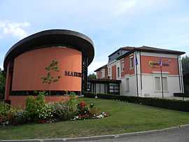
The town hall in Colombier-Saugnieu | ||
| ||
 Colombier-Saugnieu | ||
|
Location within Rhône-Alpes region  Colombier-Saugnieu | ||
| Coordinates: 45°42′44″N 5°06′46″E / 45.7122°N 5.1128°ECoordinates: 45°42′44″N 5°06′46″E / 45.7122°N 5.1128°E | ||
| Country | France | |
| Region | Rhône-Alpes | |
| Department | Rhône | |
| Arrondissement | Villefranche-sur-Saône | |
| Canton | Genas | |
| Intercommunality | Communauté de communes de l'Est Lyonnais | |
| Government | ||
| • Mayor (2014-2020) | Pierre Marmonier | |
| Area1 | 27.62 km2 (10.66 sq mi) | |
| Population (2012)2 | 2,495 | |
| • Density | 90/km2 (230/sq mi) | |
| INSEE/Postal code | 69299 / 69124 | |
| Elevation | 200–277 m (656–909 ft) | |
|
1 French Land Register data, which excludes lakes, ponds, glaciers > 1 km² (0.386 sq mi or 247 acres) and river estuaries. 2 Population without double counting: residents of multiple communes (e.g., students and military personnel) only counted once. | ||
.svg.png)
Colombier-Saugnieu is a commune in the Rhône department in eastern France.
Geography
The Bourbre forms part of the commune's eastern border.
- Zone served by Rhônexpress
See also
References
| Wikimedia Commons has media related to Colombier-Saugnieu. |