Coldspring, New York
| Coldspring, New York | |
|---|---|
| Town | |
 Coldspring | |
| Coordinates: 42°6′7″N 78°55′3″W / 42.10194°N 78.91750°WCoordinates: 42°6′7″N 78°55′3″W / 42.10194°N 78.91750°W | |
| Country | United States |
| State | New York |
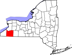
| County | Cattaraugus |
| Government | |
| • Type | Town Council |
| • Town Supervisor | Cathie H. Van Sickle (D, R) |
| • Town Council |
Members' List
|
| Area | |
| • Total | 52.0 sq mi (134.7 km2) |
| • Land | 51.5 sq mi (133.3 km2) |
| • Water | 0.5 sq mi (1.4 km2) |
| Elevation | 1,413 ft (431 m) |
| Population (2010) | |
| • Total | 663 |
| • Density | 13/sq mi (5.0/km2) |
| Time zone | Eastern (EST) |
| ZIP code | 14783 (Steamburg) |
| FIPS code | 36-009-16903 |
| Website |
cold-springny |
Coldspring is a town in Cattaraugus County, New York, United States. As of the 2010 census it had a population of 663.[1] It is located in the southwest part of the county, west of the city of Salamanca.
History
The first settler arrived around 1818. The Town of Coldspring was established in 1837 from a part of the town of Napoli. In 1847 and 1848, part of the town was added to the town of South Valley.
In 1965, the former town of Elko was flooded in the Allegheny Reservoir and dissolved; its territory was absorbed by Coldspring. Elko had been formed in 1890 from part of the town of South Valley and is now the south part of Coldspring. Elko had first been settled by Quakers, acting as missionaries to the local natives in 1798. It currently has no permanent population, as virtually all of Elko's territory is now either under the reservoir or within the bounds of Allegany State Park.
Geography
According to the United States Census Bureau, the town of Coldspring has a total area of 52.0 square miles (134.7 km2), of which 51.5 square miles (133.3 km2) is land and 0.54 square miles (1.4 km2), or 1.06%, is water.[1]
The south town line is the boundary of Pennsylvania, and the Allegheny River, impounded as the Allegheny Reservoir, divides the town into northern and southern sections.
New York State Route 394 and Interstate 86 pass through the town.
Adjacent towns and areas
To the north is the town of Napoli. Coldspring shares its western border with the towns of South Valley and Randolph. The east border is formed by the towns of Salamanca and Red House. Corydon Township in McKean County, Pennsylvania, is at the south town line.
Demographics
As of the census[2] of 2000, there were 751 people, 278 households, and 205 families residing in the town. The population density was 14.6 people per square mile (5.6/km²). There were 371 housing units at an average density of 7.2 per square mile (2.8/km²). The racial makeup of the town was 97.20% White, 0.27% African American, 1.60% Native American, and 0.93% from two or more races. Hispanic or Latino of any race were 0.40% of the population.
There were 278 households out of which 34.5% had children under the age of 18 living with them, 59.4% were married couples living together, 6.8% had a female householder with no husband present, and 25.9% were non-families. 18.0% of all households were made up of individuals and 9.0% had someone living alone who was 65 years of age or older. The average household size was 2.70 and the average family size was 3.08.
In the town the population was spread out with 27.0% under the age of 18, 6.3% from 18 to 24, 26.1% from 25 to 44, 26.0% from 45 to 64, and 14.6% who were 65 years of age or older. The median age was 39 years. For every 100 females there were 105.2 males. For every 100 females age 18 and over, there were 100.7 males.
The median income for a household in the town was $31,063, and the median income for a family was $35,938. Males had a median income of $29,479 versus $16,458 for females. The per capita income for the town was $14,568. About 10.2% of families and 15.0% of the population were below the poverty line, including 16.1% of those under age 18 and 10.8% of those age 65 or over.
Communities and locations in Coldspring
- Allegany Reservation – A reservation of the Iroquois that cuts across the center of the town, on either side of the Allegheny River.
- Allegheny Reservoir – An artificial lake created by a dam on the Allegheny River.
- Allegany State Park – A section of the park is in the southeast part of the town.
- Coldspring – A hamlet by the Allegheny Reservoir. Mostly abandoned in the construction of Kinzua Dam.
- Price Corners – A hamlet at the junction of County Road 9 and Route 394 by the western town line.
- Quaker Bridge – A hamlet at the junction of NY 280 and modern Allegany State Park Route 3. Abandoned in the construction of Kinzua Dam.
- Randolph State Fish Hatchery – A location in the northwest part of the town.
- Steamburg – A hamlet located near the center of the town on NY Route 394 and north of Interstate 86. Steamburg is the major community in the town and the seat of the town government.
- Steamburg Resettlement Area – A location south of Steamburg.
- Underwood Corners – A hamlet on County Road 39, north of Steamburg.
References
- ↑ 1.0 1.1 "Geographic Identifiers: 2010 Demographic Profile Data (G001): Coldspring town, Cattaraugus County, New York". U.S. Census Bureau, American Factfinder. Retrieved October 23, 2014.
- ↑ "American FactFinder". United States Census Bureau. Retrieved 2008-01-31.
External links
| |||||||||||||||||||||||||||||||||||||