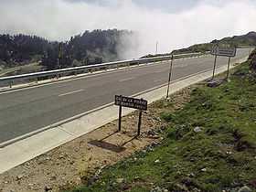
Col de la Pierre St Martin
| Col de la Pierre Saint-Martin | |
|---|---|
 | |
| Elevation | 1,766 m (5,794 ft)[1] |
| Traversed by | D132/NA1370 |
| Location |
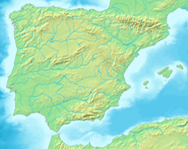
Pyrénées-Atlantiques, France Navarra, Spain |
| Range | Pyrenees |
| Coordinates | 42°58′13″N 0°45′57″W / 42.97028°N 0.76583°WCoordinates: 42°58′13″N 0°45′57″W / 42.97028°N 0.76583°W |
 Col de la Pierre Saint-Martin Location of Col de la Pierre Saint-Martin | |
Col de la Pierre Saint-Martin (elevation 1,766 m (5,794 ft)) is a mountain pass on the France-Spain border in the western Pyrenees in the department of Pyrénées-Atlantiques (France) and Navarra (Spain). The climb from the Spanish side was used in the 2007 Tour de France.
Close to the summit of the pass, there is the ski station of Arette-Pierre-Saint-Martin.
Details of the climb
The southern side of the climb, starting from Isaba (Navarra, Spain) is 27 km (17 mi) long at an average gradient of 3.6% (height gain – 966 m (3,169 ft)). The final stages of the climb start at Larra Belagua (1026m.) with 14 km (8.7 mi) at 5.2%, with a maximum of 7.4%.[2]
The pass is situated south east of Oloron-Sainte-Marie. Starting from Arette (north east), the climb is 15.3 km (9.5 mi) long gaining 1,466 m (4,810 ft) (an average gradient of 5.7%). En route, the climb passes over the Col de Labays (1,351 m (4,432 ft)), the Pas de Guilhers (1,436 m (4,711 ft)) and the Col du Soudet (1,540 m (5,050 ft)).[1]
Tour de France
The climb from the south featured in 2007 in the Tour de France for the first time on the 218.5 km (135.8 mi) stage 16 from Orthez to Gourette–Col d'Aubisque.
Appearances in Tour de France
| Year | Stage | Category | Start | Finish | Leader at the summit |
|---|---|---|---|---|---|
| 2007 | 16 | 1 | Orthez | Gourette–Col d'Aubisque |
References
- ↑ 1.0 1.1 "Col de la Pierre St.Martin - Arette". climbbybike. Retrieved 7 September 2014.
- ↑ 2.0 2.1 "Le col de la Pierre Saint-Martin dans le Tour de France" (in French). ledicodutour. Retrieved 7 September 2014.
External links
| Wikimedia Commons has media related to Col de la Pierre Saint-Martin. |