Cochranville, Pennsylvania
| Cochranville, Pennsylvania | |
|---|---|
| Census-designated place | |
|
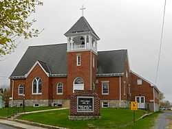
Methodist Episcopal Church | |
 Cochranville Location within the state of Pennsylvania | |
| Coordinates: 39°53′30″N 75°55′17″W / 39.89167°N 75.92139°WCoordinates: 39°53′30″N 75°55′17″W / 39.89167°N 75.92139°W | |
| Country | United States |
| State | Pennsylvania |
| County | Chester |
| Township | West Fallowfield |
| Area | |
| • Total | 1.1 sq mi (2.9 km2) |
| • Land | 1.1 sq mi (2.9 km2) |
| • Water | 0.0 sq mi (0.0 km2) |
| Elevation | 582 ft (177 m) |
| Population (2010) | |
| • Total | 668 |
| • Density | 600/sq mi (230/km2) |
| Time zone | Eastern (EST) (UTC-5) |
| • Summer (DST) | EDT (UTC-4) |
| ZIP code | 19330 |
| Area code(s) | 610 |
| FIPS code | 42-14808 |
| GNIS feature ID | 1172116 |
Cochranville is a census-designated place (CDP) in West Fallowfield Township, Chester County, Pennsylvania, United States. The population was 668 at the 2010 census.[1]
Geography
Cochranville is located at 39°53′30″N 75°55′17″W / 39.89167°N 75.92139°W[2] adjacent to the eastern border of West Fallowfield Township. Pennsylvania Routes 10 and 41 intersect in Cochranville, Route 10 heading north to Parkesburg and southwest to Oxford, while Route 41 heads northwest to Atglen and Gap and southeast to Avondale.
According to the United States Census Bureau, the CDP has a total area of 1.1 square miles (2.9 km2), all of it land.[3]
-

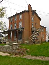
Former Presbyterian church building
-
-
References
- ↑ "Profile of General Population and Housing Characteristics: 2010 Demographic Profile Data (DP-1): Cochranville CDP, Pennsylvania". U.S. Census Bureau, American Factfinder. Retrieved August 20, 2012.
- ↑ US Geological Survey 7.5 minute topographic map series
- ↑ "Geographic Identifiers: 2010 Demographic Profile Data (G001): Caln CDP, Pennsylvania". U.S. Census Bureau, American Factfinder. Retrieved August 20, 2012.
