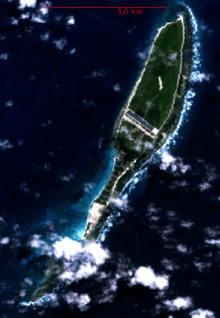
Coëtivy Island
 Coëtivy Island. NASA Image | |
 | |
| Geography | |
|---|---|
| Location | Indian Ocean |
| Archipelago | Seychelles |
| Area | 9.31 km2 (3.59 sq mi) |
| Country | |
|
Seychelles | |
| Demographics | |
| Population | 252 |
| Density | 27 /km2 (70 /sq mi) |

Coëtivy Island is a small coral island in the Seychelles 290 km (180 mi) south of Mahé, at 07°08′S 56°16′E / 7.133°S 56.267°E.
Along with Île Platte, the nearest neighbor 171 km (106 mi) northwest, it comprises the Southern Coral Group and therefore belongs to the Outer Islands.
Area and population
Its area is 9.31 km2 (3.59 sq mi) and it has a population of 252. It was named after Chevalier de Coëtivy who first sighted the island in 1771. Until 1908 it was politically part of Mauritius.
Economy
The island is privately owned by the parastatal Seychelles Marketing Board (SMB). Coëtivy has recently been known for its shrimp farms (black tiger prawn) and shrimp processing plant that began in the early 1990s; (from 1989-1992 the business was in "development phase"). There is also some vegetable farming, whose produce is sold in markets on Mahé.[1]
References
External links
| ||||||||||||||||||||||||||||||
