Cloverdale, Ohio
| Cloverdale, Ohio | |
|---|---|
| Village | |
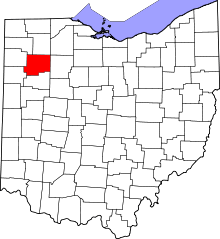
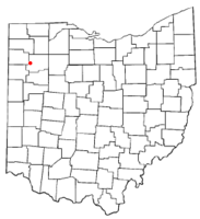 Location of Cloverdale, Ohio | |
| Coordinates: 41°1′11″N 84°18′18″W / 41.01972°N 84.30500°WCoordinates: 41°1′11″N 84°18′18″W / 41.01972°N 84.30500°W | |
| Country | United States |
| State | Ohio |
| County | Putnam |
| Area[1] | |
| • Total | 0.57 sq mi (1.48 km2) |
| • Land | 0.56 sq mi (1.45 km2) |
| • Water | 0.01 sq mi (0.03 km2) |
| Elevation[2] | 719 ft (219 m) |
| Population (2010)[3] | |
| • Total | 168 |
| • Estimate (2012[4]) | 166 |
| • Density | 300.0/sq mi (115.8/km2) |
| Time zone | Eastern (EST) (UTC-5) |
| • Summer (DST) | EDT (UTC-4) |
| ZIP code | 45827 |
| Area code(s) | 419 |
| FIPS code | 39-16266[5] |
| GNIS feature ID | 1079575[2] |
|
Early Pioneers Samuel Myers and Margaret (Hardin) Myers He was also educated in Maryland. In 1829 he came to Putnam County from Maryland after a failed family business venture in Maryland. Samuel Myers, Sr. married Margaret (Harden/Hardin/Harding) on December 25, 1833; they were the first white people to be married in Putnam Co., Ohio. Two days later on the 27th Margaret went to keeping house on the Auglaize River, at the lower end of what was then known as the Kilcannon Rapids. Samuel built them a cabin, previous to the marriage, we moved into it, and out of a walnut log near by we split, hewed and planned stuff and made corner cupboard, a table, and a bookcase, and all of which was still in our family in 1877. The floor was made of puncheon, and the door was made of plank hewed out of split logs. For a copy of this info check out the Pioneer Reminiscences story on Margaret Myers. This is where they later built a saw and grist mill, patents were later given for the style of roof he used, and a patent was also given for the buckets for the mill which were scrolled out by a millwright named Graves, and in later years a patent was issued to a man by the name of Ross for similar wheel buckets. | |
Cloverdale is a village in Putnam County, Ohio, United States. The population was 168 at the 2010 census.
History
Cloverdale was originally called Evansville, and under the latter name was platted in 1877 when the railroad was extended to that point.[6]
Geography
Cloverdale is located at 41°1′11″N 84°18′18″W / 41.01972°N 84.30500°W (41.019658, -84.304955).[7]
According to the United States Census Bureau, the village has a total area of 0.57 square miles (1.48 km2), of which 0.56 square miles (1.45 km2) is land and 0.01 square miles (0.03 km2) is water.[1]
Demographics
2010 census
As of the census[3] of 2010, there were 168 people, 69 households, and 43 families residing in the village. The population density was 300.0 inhabitants per square mile (115.8/km2). There were 77 housing units at an average density of 137.5 per square mile (53.1/km2). The racial makeup of the village was 95.8% White, 0.6% African American, 0.6% from other races, and 3.0% from two or more races. Hispanic or Latino of any race were 3.0% of the population.
There were 69 households of which 33.3% had children under the age of 18 living with them, 43.5% were married couples living together, 8.7% had a female householder with no husband present, 10.1% had a male householder with no wife present, and 37.7% were non-families. 37.7% of all households were made up of individuals and 8.6% had someone living alone who was 65 years of age or older. The average household size was 2.43 and the average family size was 3.16.
The median age in the village was 35.3 years. 29.8% of residents were under the age of 18; 7.7% were between the ages of 18 and 24; 24.4% were from 25 to 44; 29.7% were from 45 to 64; and 8.3% were 65 years of age or older. The gender makeup of the village was 49.4% male and 50.6% female.
2000 census
As of the census[5] of 2000, there were 201 people, 65 households, and 41 families residing in the village. The population density was 334.9 people per square mile (129.3/km²). There were 72 housing units at an average density of 120.0 per square mile (46.3/km²). The racial makeup of the village was 99.00% White, 0.50% Native American, and 0.50% from two or more races. Hispanic or Latino of any race were 1.00% of the population.
There were 65 households out of which 35.4% had children under the age of 18 living with them, 47.7% were married couples living together, 7.7% had a female householder with no husband present, and 36.9% were non-families. 33.8% of all households were made up of individuals and 13.8% had someone living alone who was 65 years of age or older. The average household size was 2.46 and the average family size was 3.20.
In the village the population was spread out with 23.4% under the age of 18, 6.0% from 18 to 24, 20.9% from 25 to 44, 16.9% from 45 to 64, and 32.8% who were 65 years of age or older. The median age was 45 years. For every 100 females there were 91.4 males. For every 100 females age 18 and over, there were 90.1 males.
The median income for a household in the village was $36,250, and the median income for a family was $38,438. Males had a median income of $33,125 versus $15,625 for females. The per capita income for the village was $19,333. About 15.2% of families and 19.9% of the population were below the poverty line, including 28.2% of those under the age of eighteen and 52.4% of those sixty five or over.
References
- ↑ 1.0 1.1 "US Gazetteer files 2010". United States Census Bureau. Retrieved 2013-01-06.
- ↑ 2.0 2.1 "US Board on Geographic Names". United States Geological Survey. 2007-10-25. Retrieved 2008-01-31.
- ↑ 3.0 3.1 "American FactFinder". United States Census Bureau. Retrieved 2013-01-06.
- ↑ "Population Estimates". United States Census Bureau. Retrieved 2013-06-17.
- ↑ 5.0 5.1 "American FactFinder". United States Census Bureau. Retrieved 2008-01-31.
- ↑ Warren, Robert (May 31, 1953). "Blanchard River Brought Pioneers To Putnam". Toledo Blade. p. 3. Retrieved 30 April 2015.
- ↑ "US Gazetteer files: 2010, 2000, and 1990". United States Census Bureau. 2011-02-12. Retrieved 2011-04-23.
| |||||||||||||||||||||||||