Clinton Falls, Minnesota
| Clinton Falls, Minnesota | |
|---|---|
| Unincorporated community | |
 Clinton Falls, Minnesota Location of the community of Clinton Falls | |
| Coordinates: 44°08′20″N 93°14′49″W / 44.13889°N 93.24694°WCoordinates: 44°08′20″N 93°14′49″W / 44.13889°N 93.24694°W | |
| Country | United States |
| State | Minnesota |
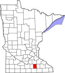
| County | Steele |
| Township | Clinton Falls Township |
| Elevation | 1,132 ft (345 m) |
| Time zone | Central (CST) (UTC-6) |
| • Summer (DST) | CDT (UTC-5) |
| ZIP code | 55049 and 55060 |
| Area code(s) | 507 |
| GNIS feature ID | 641339[1] |
Clinton Falls is an unincorporated community in Clinton Falls Township, Steele County, Minnesota, United States.
The community is located between Medford and Owatonna near Interstate 35 and Steele County Road 9. Crane Creek and the Straight River meet near Clinton Falls.
References
| |||||||||||||||||||||||||||||