Cleppé
| Cleppé | |
|---|---|
|
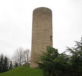
The chateau in Cleppé | |
 Cleppé | |
|
Location within Rhône-Alpes region  Cleppé | |
| Coordinates: 45°46′12″N 4°10′51″E / 45.77°N 4.1808°ECoordinates: 45°46′12″N 4°10′51″E / 45.77°N 4.1808°E | |
| Country | France |
| Region | Rhône-Alpes |
| Department | Loire |
| Arrondissement | Montbrison |
| Canton | Feurs |
| Intercommunality | Communauté de communes de Feurs en Forez |
| Government | |
| • Mayor | Philippe PIGNARD |
| Area1 | 15.48 km2 (5.98 sq mi) |
| Population (1999)2 | 454 |
| • Density | 29/km2 (76/sq mi) |
| INSEE/Postal code | 42066 / 42110 |
| Elevation |
323–394 m (1,060–1,293 ft) (avg. 350 m or 1,150 ft) |
|
1 French Land Register data, which excludes lakes, ponds, glaciers > 1 km² (0.386 sq mi or 247 acres) and river estuaries. 2 Population without double counting: residents of multiple communes (e.g., students and military personnel) only counted once. | |
Cleppé is a commune in the Loire department in central France.
Geography
The river Lignon du Forez flows through the commune.
See also
| Wikimedia Commons has media related to Cleppé. |