Ciudad Guayana
| Ciudad Guayana | ||
|---|---|---|
|
Aerial view of the modern planned part of Guayana City | ||
| ||
.svg.png) Ciudad Guayana Location in Venezuela | ||
| Coordinates: 8°22′N 62°39′W / 8.367°N 62.650°WCoordinates: 8°22′N 62°39′W / 8.367°N 62.650°W | ||
| Country |
| |
| State | Bolívar | |
| Founded | July 2, 1961 | |
| Government | ||
| • Mayor | José Ramón Lopéz | |
| Population (2001) | ||
| • Total | 1,050,283 | |
| • Demonym | guayanés | |
| Time zone | VST (UTC-4:30) | |
| • Summer (DST) | not observed (UTC-4:30) | |
| Area code(s) | 0286 | |

Ciudad Guayana (Spanish pronunciation: [sjuˈðað ɣwaˈʝana]) is a city in Bolívar State, Venezuela. It lies south of the Orinoco, where the river is joined by the Caroní River. The city, officially founded in 1961, is actually composed of the old town of San Félix at the east and the new town of Puerto Ordaz at the west, which lie on either banks of the Caroní and are connected by three bridges. The city stretches 40 kilometers along the south bank of the Orinoco. With approximately one million people, it is Venezuela's fastest-growing city, due to its important iron industry.
Guayana City is one of Venezuela's five most important ports, since most goods produced in Bolívar are shipped through it, onto the Atlantic Ocean via the Orinoco river. The city is also the location of the Second Orinoco crossing.
Guayana City is served by Manuel Carlos Piar Guayana Airport.
History
Since its foundation, it has grown from two fledgling towns into the Guayana region's most important industrial center and a hub of growth in an otherwise typically underpopulated region of Venezuela.
Much critique has been made about its design, which was created by a number of planners from MIT and Harvard in the early 1960s. Lisa Peattie's "A View From the Barrio" is a good discussion of the adverse social effects that can occur when a modernist planned city is placed without regard for context (social, economic, cultural, or climatological) in the middle of nowhere (see also the history of Brasília).
Gallery
-

Guayana City from space
-
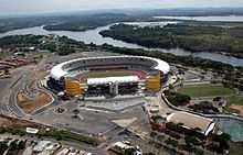
Football stadium Polideportivo Cachamay
See also
External links
| Wikimedia Commons has media related to Ciudad Guayana. |
- "Guayana City, (Puerto Ordaz & San Felix)" VenezuelaTuya, photographs of the city
- "La Guayana de Antaño", History in Pictures
- BBC article in a Puerto Ordaz aluminium plant