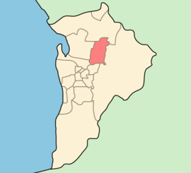
City of Tea Tree Gully
- This article is about the LGA in Adelaide. For the suburb of the same name, see Tea Tree Gully, South Australia.
| City of Tea Tree Gully South Australia | |||||||||||||
|---|---|---|---|---|---|---|---|---|---|---|---|---|---|
 | |||||||||||||
| Population | 95,467 (2011)[1] | ||||||||||||
| • Density | 1,003/km2 (2,600/sq mi) | ||||||||||||
| Established | 1858 | ||||||||||||
| Area | 95.21 km2 (36.8 sq mi) | ||||||||||||
| Mayor | Kevin Knight | ||||||||||||
| Council seat | Modbury | ||||||||||||
| Region | Metropolitan Adelaide | ||||||||||||
| State electorate(s) | Little Para, Florey, Newland, Playford, Torrens, Wright | ||||||||||||
| Federal Division(s) | Mayo, Makin, Sturt | ||||||||||||
| Website | City of Tea Tree Gully | ||||||||||||
| |||||||||||||
The City of Tea Tree Gully is in the Australian state of South Australia, in the outer north-eastern suburbs of Adelaide. The city has an estimated population of 95,467 people and is one of the most populous local government divisions in Adelaide. The major business district in the city is at Modbury, where Tea Tree Plaza, the Civic Centre and the library are located.
Howard, Lord Florey, Australian pathologist and co-discoverer of penicillin, was a resident of the City of Tea Tree Gully.
Suburbs and post codes
|
|
|
History
Tea Tree Gully was originally known as 'Steventon' as a local resident, John Stevens, was a major landowner in the area. While the area's name has changed, the name Steventon remains today as one of the electoral wards of the City of Tea Tree Gully.
The area was originally part of the Highercombe District Council, and Tea Tree Gully became the name of a smaller Council in October, 1858, when the original Highercombe District Council was split in two. When the two district councils were re-united in May, 1935, the new Council was named Tea Tree Gully and is known today as the City of Tea Tree Gully.
Geography

The gully to which the city name refers actually exists and is known to be sizable as it provided a gradient negotiable only by bullock wagons travelling through the Mt. Lofty Ranges. Additionally the gully had permanent freshwater springs which promoted the growth of tea trees in the area - thus the eventual name 'Tea Tree Gully'.
The suburbs of Vista are adjacent to the 350ha Anstey Hill Recreation Park.
A detailed history of the District of Tea Tree Gully (1836-1976) was written by Mr Ian Auhl and published by Lynton Publications (Blackwood SA) in 1976. It has since been updated to more recent times
Sister cities
The City of Tea Tree Gully, has one sister city.[2] it is the:
-
 Asakuchi, Japan (April 2006)
References
- ↑ Australian Bureau of Statistics (21 June 2012). "2011 Census QuickStats". Retrieved 24 June 2012.
- ↑ "Sister City Information". City of Tea Tree Gully. Archived from the original on 2007-08-29. Retrieved 2008-01-02.
External links
- City of Tea Tree Gully
- City of Tea Tree Gully Library
- City of Tea Tree Gully community profile
- South Australia Central (State Government portal)
- Australian Local Government Association
- City of Tea Tree Gully: Suburb Boundaries at June 2004
| ||||||||||||||||||||||||||||||