Cirières
| Cirières | |
|---|---|
|
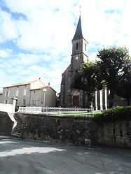
The church of Sainte-Radegonde | |
 Cirières | |
|
Location within Poitou-Charentes region  Cirières | |
| Coordinates: 46°50′16″N 0°37′11″W / 46.8378°N 0.6197°WCoordinates: 46°50′16″N 0°37′11″W / 46.8378°N 0.6197°W | |
| Country | France |
| Region | Poitou-Charentes |
| Department | Deux-Sèvres |
| Arrondissement | Bressuire |
| Canton | Cerizay |
| Intercommunality | Delta-Sèvre-Argent |
| Government | |
| • Mayor (2008–2014) | Louis Énond |
| Area1 | 16.83 km2 (6.50 sq mi) |
| Population (2006)2 | 987 |
| • Density | 59/km2 (150/sq mi) |
| INSEE/Postal code | 79091 / 79140 |
| Elevation | 162–234 m (531–768 ft) |
|
1 French Land Register data, which excludes lakes, ponds, glaciers > 1 km² (0.386 sq mi or 247 acres) and river estuaries. 2 Population without double counting: residents of multiple communes (e.g., students and military personnel) only counted once. | |
Cirières is a commune in the Deux-Sèvres department in the Poitou-Charentes region in western France.
See also
References
| Wikimedia Commons has media related to Cirières. |