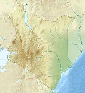
Chyulu Hills
| Chyulu Hills National Park | |
|---|---|
|
IUCN category II (national park) | |
 | |
| Nearest city | Tsavo |
| Coordinates | 2°36′S 37°51′E / 2.600°S 37.850°ECoordinates: 2°36′S 37°51′E / 2.600°S 37.850°E |
| Area | 120 km² |
| Governing body | Kenya Wildlife Service |
The Chyulu Hills is a mountain range in eastern Kenya. It forms a 100 kilometre long volcanic field in elongated NW-SE direction. Its highest peak is 2188 metres high.[1]
Geography
The Chyulu Hills are located about 150 km east of the Kenya Rift. The hills consists of several hundred small flows and cones. Volcanism in the area started about 1.4 million years ago in the northern parts of the hills, and over time the volcanism propagated towards the southeast. These volcanoes are still considered active, since their last two eruptions (Shaitani and Chainu) occurred in 1856.[1] Within the hills is the Leviathan cave, one of the longest lava tubes in the world.[2]
Kibwezi town is located 30 km northeast of the Chyulu Hills.[3]
The Chyulu Hills do not have any permanent rivers, but rainfall on hills feeds the Tsavo and Galana rivers and Mzima Springs on the surrounding plains.[3]
Chyulu hills divide the Tsavo and Amboseli plains. The area is inhabited by Maasai and Kamba people.[4]
Ecology
Lower parts of the hills are composed of grassland and thicket, while above roughly 1800 metres is dominated by montane forest. The forest contains Neoboutonia macrocalyx, Tabernaemontana stapfinaa, Prunus africana, Strombosia scheffleri, Cassipourea malonsana, Olea capensis and Ilex mitis. Some isolated parts are dominated by Erythrina abyssinica. Lower parts of the forest are dominated either by Juniperus procera or Commiphora baluensi.[3]
Mammals found in the hills include. black rhino (subspecies Diceros bicornis michaeli),[5] buffalo, bushbuck, eland, elephant, bushpig, giraffe, leopard, lion, mountain reedbuck, steinbok, wildebeest and zebra. Various snakes inhabit the hills, like black mamba, puff adder and rock python.[2][3]
There are various bird species on the hills, with some endemic races. Bird species include: Francolinus shelleyi, Pogonocichla stellata, Zoothera gurneyi, Bradypterus cinnamomeus, Hieraaetus ayresii, Stephanoaetus coronatus, Polemaetus bellicosus and Cinnyricinclus femoralis.[6]
There is wild khat growing on the hills, which is picked by local people. There is also some cultivation of khat around the hills. Khat from Chuylu hills is known as Chuylu, as opposed to Miraa, which is cultivated in the Meru County.[7]
Conservation
The Chyulu Hills National Park comprises the eastern flank of the hills and is operated by the Kenya Wildlife Service.[3] The park was formed in 1983. It forms a northwestern continuation of Tsavo West National Park.[2] The western flank of the hills is covered by the West Chyulu Game Conservation owned by Maasai group ranches.[3]
Potential threats to the ecosystem include poaching, overgrazing by growing population of Maasai herders and scarcity of water.[5]
References
- ↑ 1.0 1.1 Global Volcanism Project – Chyulu Hills
- ↑ 2.0 2.1 2.2 Tom Parkinson, Matt Phillips, Will Gourlay: Kenya Lonely Planet, 2006. ISBN 1-74059-743-5
- ↑ 3.0 3.1 3.2 3.3 3.4 3.5 Kenya Wildlife Service – Chyulu Hills National Park
- ↑ Godfrey Mwakikagile (2007): Kenya — Identity of a Nation ISBN 0-9802587-9-0
- ↑ 5.0 5.1 Chyulu Hills Rhino Programme
- ↑ Birdlife: Chyulu Hills forests
- ↑ David Anderson: The khat controversy: stimulating the debate on drugs, Berg Publishers, 2007. ISBN 1-84520-251-1
External links
| ||||||||||||||||||