Churup
| Churup | |
|---|---|
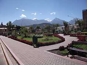 Wallunarahu and Ranrapallqa (both snow-covered), Rima Rima and Churup (on the right) as seen from Huaraz | |
| Elevation | 5,493 m (18,022 ft)[1] |
| Location | |
 Churup Peru | |
| Location | Peru, Ancash Region |
| Range | Andes, Cordillera Blanca |
| Coordinates | 9°28′09″S 77°24′57″W / 9.46917°S 77.41583°WCoordinates: 9°28′09″S 77°24′57″W / 9.46917°S 77.41583°W |
| Climbing | |
| First ascent | 1-1954 via N.W. side: S. rock face-1962: S.W. face-1972: Variant S.W. face direct-1982: S.W. face (new route)-1983[1] |
Churup (Quechua, in Ancash Quechua spelled Tsurup) is a mountain in the Cordillera Blanca in the Andes of Peru, about 5,493 metres (18,022 ft) high. It is situated in the Ancash Region, Huaraz Province, Independencia District, north-east of Huaraz.[2][3][4] Churup is situated south of the mountain Ranrapallqa, between the Rima Rima in the north-west and Qullapaqu and Wamashrahu in the south-east, at the entrance to the Qillqaywank'a valley. Churup Lake lies at the foot of the mountain.
Gallery
-
Ranrapallqa (in the distance), Rima Rima, Churup (middle, left), Qullapaqu and Wamashrahu as seen from Huaraz
-
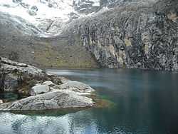
Churup Lake at the foot of the mountain
-
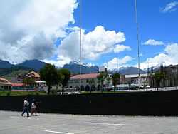
The mountains Rima Rima and Churup as seen from Huaraz
References
- ↑ 1.0 1.1 Taken from Mountaineering in the Andes by Jill Neate Peru RGS-IBG Expedition Advisory Centre, 2nd edition, May 1994
- ↑ "Nevado Churup". mincetur. Retrieved August 21, 2014.
- ↑ andix.com/huaraz_maps/huaraz2.html a Map of a part of the Cordillera Blanca (inactive website)
- ↑ escale.minedu.gob.pe - UGEL map of the Huaraz Province (Ancash Region) showing Churup labelled "Nevado Huamanrripa"